|
View an Innovation Spotlight video on weather-savvy roads.
Contact Paul Pisano of the Federal Highway Administration Office of Operations or Ray Murphy of the FHWA Resource Center for information, technical assistance, and training.
 Personnel Changes
Lynda Ogilvie started with the T2 Center on November 26th. She came to Salem, via San Jose, California, arriving here this past August. She moved here to be closer to family.
Lynda has worked in Corporate Training in the high tech sector for almost 20 years. She has been an administrator, coordinator and Program Manager. She is the second “Linda” we have had in this role. Lynda, the 2nd, will be responsible for assisting with the administrative and operational tasks, as well as any special projects.
Please join us in welcoming Lynda to the T2 team!
|
The Federal Highway Administration (FHWA) announced a funding opportunity through its Nationally Significant Federal Lands and Tribal Projects (NSFLTP) program. The program is accepting applications for $300 million in grant funding to build and repair a public highway, road, bridge, trail, or transit system that serves tribal or Federal lands. Applications will be accepted on a rolling basis, with the first deadline being December 17, 2018. Interested agencies may contact Jeffrey Mann, FHWA Office of Program Development, for additional information.
Center for Transportation Studies Releases Report on Tribal Transportation Safety
The University of Minnesota Center for Transportation Studies has released a research report on technologies that may improve traffic safety on tribal reservations. “Using GIS to Improve Tribal Safety: Applications, Trends, and Implementation Dimensions” explores the application of geographic information systems (GIS) to transportation safety on tribal lands. Motor vehicle crashes are the main cause of death for Native Americans between the ages of five and 34, and as such, improved traffic safety can reduce this major public health risk to Native populations. GIS technology may enhance the collection and use of transportation safety information to reduce risks on tribal lands.
Community Connections Innovations Handbook
The Federal Highway Administration's (FHWA's) Community Connections initiative is about using transportation innovations, partnerships, and technologies to bring communities together and connect people to services and opportunities. FHWA produced the Community Connections Innovations Handbook to help practitioners understand and apply Community Connections Innovations in their work and to inspire greater collaboration for project success. The Handbook provides a wealth of information including more detailed information and examples on the benefits of Community Connections projects; a Toolbox of techniques, strategies, and approaches; and the first steps of applying Community Connections. The tools and resources cover a wide range of contexts, scales, project sizes and types, modes, and applications - illustrating the different ways these tools can be leveraged for outcomes that engage communities more effectively, improve multimodal access, and streamline project delivery.
Guide to Improve Pedestrian Safety at Uncontrolled Crossings
As part of the Every Day Counts program on safe transportation for every pedestrian, FHWA published an updated “Guide for Improving Pedestrian Safety at Uncontrolled Crossing Locations” to help agencies choose countermeasures based on roadway characteristics and pedestrian safety issues. The guide includes information on the rectangular rapid-flashing beacon (RRFB) countermeasure. RRFBs are active (user-actuated) or passive (automated detection) amber light-emitting diodes that use an irregular flash pattern at midblock or uncontrolled crossing locations, significantly increasing driver yielding behavior. The guide is supported by an updated “Field Guide for Selecting Countermeasures at Uncontrolled Pedestrian Crossing Locations” that helps practitioners document relevant roadway conditions, traffic information, and safety data. For information, contact Becky Crowe of the FHWA Office of Safety.
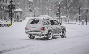 Preparing for the Winter Driving Season
By Tony Jobanek
The summer comes to a
close and we move away from those dry sunny days that have lulled us into
believing that all our driving will continue to be on dry, clear pavement. But wait, although we have experienced one
of the driest summer periods in history, soon the weather will change to those
dark rainy and sometimes frozen commutes of the late fall and winter.
In order to make
certain you are ready for the coming weather related driving challenges there
are several things you can do to ensure you and your vehicle are prepared for
adverse driving conditions. First ask
yourself, are you ready and is your vehicle ready? Where did I put that ice scraper? Have I made sure my vehicle is winter ready? What exactly does that mean?
Items you need to check on your
vehicle before the Winter driving season are:
- Tire condition and
air pressure- 2 to 3 psi outside of the manufacturers
recommended tire pressure can affect not only tire wear and traction, it can
cost you to up to 10 cents per gallon at the fuel pump due to increased
friction with the roadway.
- Leaking fluids- Inspect around and under your vehicle for leaks
or drips
- Vehicle damage-make sure nothing on your vehicle is broken or
damaged
- Mirrors-clean and adjust your side and rearview mirrors
to maximize your visibility around your vehicle.
- Head lights and tail
lights-check all lights to ensure they are clean and
working properly so other vehicles can see you from all directions.
- Oil level-ensure your oil
is changed according to the manufacturers schedule and keep it at appropriate
levels.
- Radiator Fluid level-keep your
antifreeze at the proper level and have its effective temperature checked
annually.
- Windshield wipers during inclement weather-Replace your
wipers annually to ensure maximum visibility through the windshield in rainy
conditions.
-
Windshield wiper fluid-check the level
in the reservoir.
You should carry an ice scraper with a squeegee
so you can scrape ice or snow from your vehicle windows when needed. Don’t forget to clear your headlights and
taillights of snow or ice so other drivers can see you.
It is also a good idea to carry an emergency
kit in your vehicle. Consider having the
following items in your vehicle emergency kit:
- High visibility vest
- Flashlight
- Flares, cones or triangles
- Fire extinguisher
- Rain gear and cold weather clothing
- Blankets
- Food and water
- Cell phone or 2-way radio
Finally what about
you? Make sure you are well rested and be
sure to pay attention to the changing weather forecasts so you can give
yourself the extra time necessary to drive to your destination safely. If we take the time to ensure our vehicles
are ready and we are prepared, the winter driving season will be a safer and
more enjoyable driving experience for you and….. it will be Spring before you
know it!
|
FHWA is offering opportunities to
host and/or participate in field demonstrations regarding Smarter
Work Zones (SWZ) Technology Application deployments across the country.
➜ For
more information, please contact Jawad Paracha.
A new video for local agencies on Concrete Pavement Preservation explains a long-term strategy of applying timely and appropriate preventive treatments to maintain good pavement condition and extend pavement life. The video reviews five preservation techniques—joint resealing and crack sealing, diamond grinding, grooving, load-transfer restoration and cross-stitching, and partial and full-depth repairs—and explains how a county applied the treatments on a maintenance project. The video is part of the Federal-Aid Essentials collection of informational videos for local agencies. An asphalt pavement preservation video will be available in January 2019.
The following free publications are available from the T2 Center. You may order as many copies as you wish. Available while supplies last. To request your copies, call us at 503-986-2855 or send an email to T2Center@odot.state.or.us.
 Accessible Shared Streets: Notable Practices and Considerations for Accommodating Pedestrians with Vision Disabilities
This document reviews notable practices and considerations for accommodating pedestrians with vision disabilities on shared streets. It focuses on streets where pedestrians, bicyclists, and motor vehicles are intended to mix in the same space.
The guide includes a description of shared streets, an overview of vision disabilities and the strategies people with vision disabilities use to navigate in the public right-of-way. It discusses the specific challenges pedestrians with vision disabilities face when navigating shared streets. It provides an overview of relevant U.S. guidance, a toolbox of strategies for designing shared streets that improve accessibility for pedestrians with vision disabilities, and ideas on how accessibility for pedestrians with vision disabilities can be addressed in the planning and design process.
It provides information from case studies of completed shared streets in the United States that highlight accessibility features and lessons learned, as well as a bibliography that includes sources specifically referenced in the body of the guide and other sources that inspired the guide content and may be useful for shared street designers.
|
 Nature‐Based Solutions for Coastal Highway Resilience White Paper
This white paper serves as input to an upcoming round of regional peer exchanges on nature‐based solutions, and constitutes an incremental step toward developing an implementation guide for using nature‐based solutions to improve the resilience of coastal highways to extreme events and sea level rise. Nature‐based solutions include a spectrum of natural and nature‐based features that serve as alternatives to, or ecological enhancements of, traditional shoreline stabilization and infrastructure protection techniques. In this case, the ability of nature‐based solutions to mitigate storm surge flooding, wave‐related damage, erosion, shoreline retreat, and the potential impacts of sea level rise is of interest. While nature‐based solutions have been used extensively across a diverse array of coastal settings, they are not commonly deployed within the transportation sector. In some cases, understanding of the engineering tools and methods for designing nature‐based solutions to achieve a specific outcome is lacking. This white paper addresses these issues by providing examples of nature‐based solutions and highlighting the best available science that describes their performance as solutions for coastal highways’ resilience. The implementation guide will be informed by the peer exchanges and will address the issues outlined here for the use of nature‐based solutions.
|
 Safety Evaluation
of Turning Movement Restrictions at Stop-Controlled Intersections
The Development of Crash Modification Factors program
conducted a safety evaluation of turning movement restrictions at
stop-controlled intersections for the Evaluation of Low Cost Safety
Improvements Pooled Fund Study. This study evaluated the safety effects of
converting full movement, stop-controlled intersections to right-in-right-out (RIRO)
operation using physical barriers, as measured by the change in crash
frequency. The project team obtained geometric, traffic, and crash data for
urban, three-legged, full movement and RIRO stop-controlled intersections, as
well as the downstream four-legged, stop-controlled or signalized intersection
with full movement in California. The team used a cross-sectional analysis to
estimate the effects of turning movement restrictions while controlling for other
differences between sites with RIRO and full movement. Aggregate results
indicated reductions for all crash types analyzed (i.e., total, all
intersection-related, and fatal and injury intersection-related) for
stop-controlled intersections with RIRO compared to full movement. Reductions
were statistically significant at the 95-percent confidence level for all crash
types. Crash modification factors for total, all intersection-related, and
fatal and injury intersection-related crashes were 0.55, 0.32, and 0.20,
respectively. Based on the disaggregate results, RIRO intersections do not
appear to have differing effects for different levels of traffic, design speed,
or number of lanes. Potential for crash migration in determining net benefits
needs to be considered. Results indicated potential increases at downstream
intersections, but many increases are not statistically significant even at the
90-percent confidence level. While the economic analysis suggests the strategy
can be cost-effective in reducing crashes at a hypothetical stop-controlled
intersection, potential costs and benefits with site-specific values need to be
analyzed on a case-by-case basis.
|
|