Post Flood Resources
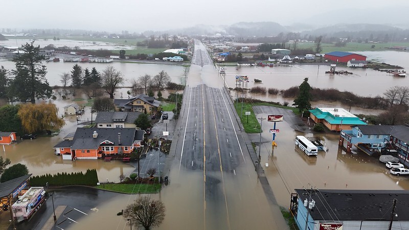
Last week, much of northwest Oregon was under a flood watch due to back-to-back atmospheric rivers in the Pacific Northwest. Many rivers experienced major flooding, and landslides affected much of the state.
We want to help reduce the stress of floods and support our local floodplain administrators in Oregon. Below are several resources for staff to help prepare for and recover from flooding.
Contact State Staff:
Additional State Resources:
- The Oregon Silver Jackets serves as a group of local, state, and federal partners focused on flood risk reduction including flood response, recovery, preparedness and mitigation. See our Flood Prep Season Storymap tool for floodplain administrators.
- DLCD can assist with post flooding guidance for substantial damage determinations or floodplain management / permitting. Contact Oregon’s NFIP Coordinator, Deanna Wright, CFM | (971) 718-7473 or deanna.wright@DLCD.oregon.gov
- Oregon Department of Emergency Management (OEM) can assist with response and recovery. Please direct time-sensitive communications and resource requests to the OERS Notification Center at (800) 452-0311.
- Reach out to your Local and Tribal Emergency Managers to coordinate substantial damage assessments and help determine floodplain risk areas.
Track local river gages, forecasts, and travel hazards:
Additional Resources:
Contact Region 10 FEMA staff:
River Estimates
How high did some rivers get during last week’s atmospheric river? Below are some of the river data estimates captured from United States Geological Survey (USGS) gages. More information is available through NOAA’s National Water Prediction Service.
|