 November 11, 2021
|
|
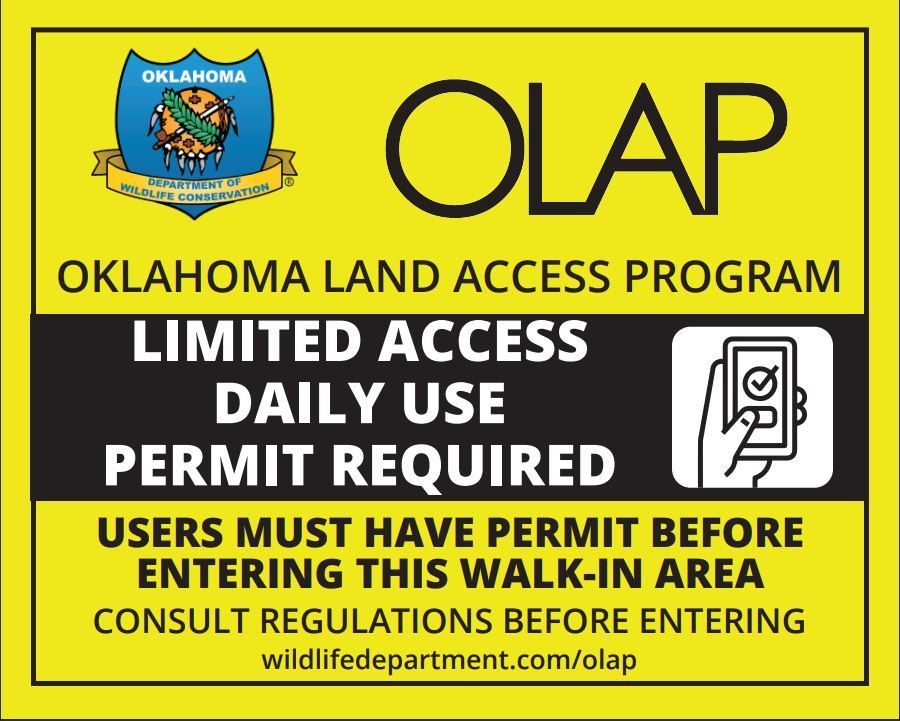 OLAP Limited Access boundary sign.
What is OLAP Limited Access?
- This new category limits the amount of hunters present on specific OLAP Walk-in Hunting Areas.
- Hunters apply to reserve from the following time blocks:
- Mon - Thu (drawing/selection on preceding Friday)
- Fri - Sun (drawing/selection on preceding Tuesday)
What are the rules?
- The rules are the same as the public "white sign" OLAP Walk-in Archery/Shotgun Only areas, with the exception that access is limited.
- For the 2021-2022 season, all Limited Access areas are archery/shotgun only.
- Click here to review OLAP regulations.
- Hunters may legally harvest any desired game (waterfowl, deer, squirrels, etc.) with the legal means of take:
- Archery
- Shotgun (no shot size larger than T shot, no slugs)
- The only exception is that elk harvest is prohibited on all OLAP.
How do I apply?
- Go to "Intro" tab on the OLAP webpage (LINK)
- Scroll down to "OLAP Limited Access Registration"
- If you can't see this option, you may need to clear your browser's cache/cookies to refresh to the updated webpage.
- You can also scroll down to quick links on this email for application forms.
- Click on the particular walk-in area's OLAP ID to open the form.
- Each form has a direct link to the map zoomed to that particular Walk-in Area.
- Fill out the form and submit your application.
Can I bring a guest?
- Drawn hunters can bring 1 guest.
- During the application process, fill in the guest's name and customer ID.
- Due to limited parking, the guest must arrive in the applicant's vehicle. Parking may be very limited at these walk-in hunting areas and may not be able to accommodate two vehicles.
What is the draw and notification process?
- All applicants are assigned a number. A random number generator selects the successful applicant.
- For the Mon - Thu reservations, the drawing will occur at noon on the preceding Friday.
- For the Fri - Sun reservations, the drawing will occur at noon on the preceding Tuesday.
-
Selected applicants will be notified via email. The Game Warden for the county will also be CC'ed.
- The drawing for the Nov 12 - Nov 14 time block will occur on Friday, Nov 12 at noon due to short notice. All subsequent drawings will follow the aforementioned schedule.
When you arrive at the walk-in hunting area:
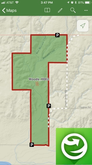
- All Limited Access tracts have specific parking areas (check the map).
- These parking areas have check-in boxes.
- In these check-in boxes are perforated cards.
- Fill out the card and deposit the top half into the check-in box.
- Place the bottom half on your vehicle's dash.
- Fill out a new card for each day you visit within your reserved time block.
Enjoy and good luck!
No check-out process or survey is currently required.
Cotton_LA001
Cotton_LA002
Grant_LA001
Seminole_LA001
Please note that the colors for the walk-in area boundaries have changed. Public archery/shotgun walk-in areas are now gray rather than red. The new Limited Access tracts are yellow. Other boundary colors remain similar/unchanged.
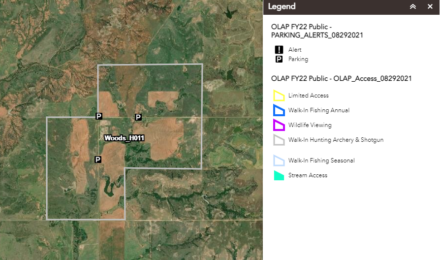
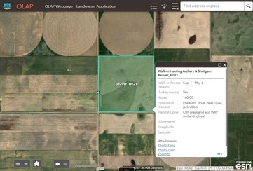
Remember to click on walk-in areas to bring up more information, including access types, dates, habitat information, specific comments/instructions, and photos. This function is available when accessing maps on a computer or via the mobile app (Explorer for ArcGIS). |
|
 |
|
Reminder: Review the maps before entering the walk-in area. Get a good feel for the property boundaries, topography, changes in land use (farming or ranching), etc.
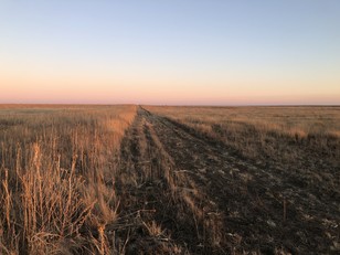
Boundaries may consist of a change from grassland to agriculture, a mowed strip (example pictured), etc. Some walk-in areas may not have fences for OLAP boundary signs, and it's the responsibility of hunters to know their location and the walk-in area's boundaries.
|
|
 |
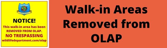
No recent closings.
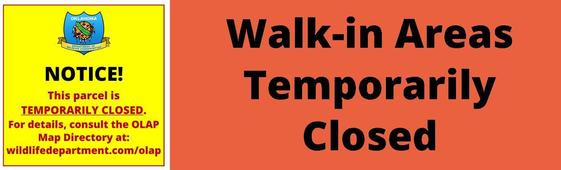
No temporary closings.
 |
|
Use the free ArcGIS Explorer App to bring the OLAP Walk-in Areas to your mobile device (data signal required). Once the app is installed on your device, search the Maps for "OLAP" and select the ODWC OLAP Web Map".
Click below to download the ArcGIS Explorer App on your Apple or Android mobile device.
CLICK HERE FOR APPLE DEVICES
CLICK HERE FOR ANDROID DEVICES
Digital maps can be accessed via browser and/or the Explorer mobile app. Direct link to online maps.
|
|
|
 |
|
Administered by the Oklahoma Department of Wildlife Conservation, The Oklahoma Land Access Program (OLAP) provides financial incentives to landowners who allow public access for hunting, fishing, stream access, and wildlife viewing opportunities on private lands. No additional permit is required by sportspersons to access OLAP walk-in areas, however hunting and fishing licenses are required, respectively, unless a person is exempt.
Consult regulations before entering OLAP Walk-in Areas. Visit the OLAP webpage to learn more.
|
|
|