OLAP Update 4/2/2020

Having trouble viewing this email? View it as a Web pageBookmark and Share

OLAP

April 2, 2021

Turkey Season Opens Soon

wild turkey

Oklahoma’s spring turkey season opens soon, please visit the below links for more information. Regional reports for WMAs reflect turkey population trends for OLAP Walk-in Areas in those respective regions. 


OLAP Prescribed Burning

RxBurn OLAP

Photo: Tanner Swank, Quail Forever Farm Bill Biologist

Pheasant Forever / Quail Forever (PFQF) biologists are working with private landowners throughout the state to improve upland bird habitat. Some of this work takes place on OLAP Walk-in areas; please note that OLAP Walk-in Areas may have been recently burned. This habitat management practice reduces Eastern red cedar encroachment, thereby improving habitat for turkey, deer, and upland birds.

Thank you to our conservation partners at PFQF!


pfqf_logo

Want to help improve quail and pheasant habitat?

Click here to visit the PFQF Oklahoma page to get involved with your local chapter.

Upcoming PFQF Events


New Walk-in Hunting Area

Sequoyah_H002
Sequoyah_H002_Map

Sequoyah_H002: Archery/Shotgun Only

485 acres of deciduous forest and shrubland. 

Link to map zoomed to walk-in hunting area.


gargraeerttrew
McIntosh_H004_removed

McIntosh_H004 is removed from the OLAP, effectively immediately.


Temporarily Closed
Dewey_H001_closed

Dewey_H001 is temporarily closed for the 2021 spring turkey season.


Interactive OLAP Tour

Want to learn more about the Oklahoma Land Access Program? Click here to take the Interactive OLAP Tour.


Explorer App

Use the free ArcGIS Explorer App to bring the OLAP Walk-in Areas to your mobile device (data signal required). Once the app is installed on your device, search the Maps for "OLAP" and select the ODWC OLAP Web Map".

Click below to download the ArcGIS Explorer App on your Apple or Android mobile device.

CLICK HERE FOR APPLE DEVICES

CLICK HERE FOR ANDROID DEVICES

Digital maps can be accessed via browser and/or the Explorer mobile app. Direct link to online maps.

You can also visit the OLAP webpage to downloaded updated PDF maps. The link to the PDFs is under the "maps" tab (scroll down). Direct link to PDF maps.


OLAP LOGO

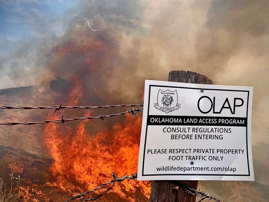
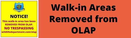
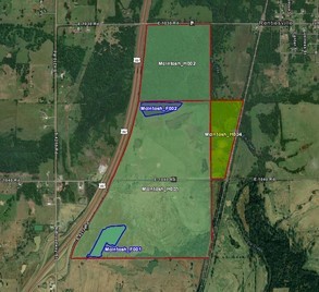
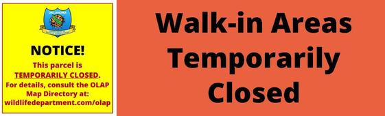
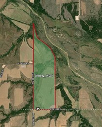
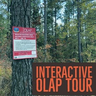
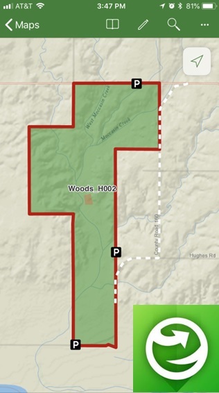
Administered by the Oklahoma Department of Wildlife Conservation, The Oklahoma Land Access Program (OLAP) provides financial incentives to landowners who allow public access for hunting, fishing, stream access, and wildlife viewing opportunities on private lands. No additional permit is required by sportspersons to access OLAP walk-in areas, however hunting and fishing licenses are required, respectively, unless a person is exempt.

Consult regulations before entering OLAP Walk-in Areas. Visit the OLAP webpage to learn more.