OLAP Update 12/23/2020

Having trouble viewing this email? View it as a Web pageBookmark and Share

OLAP

December 23, 2020

5,050 ac added in Beaver and Texas Counties

Beaver

The OLAP added 5,050 total acres, consisting of 1,680 ac of CRP grassland and 3,370 ac of native prairie rangeland. 


New Walk-in Hunting Areas: Archery/Shotgun Only

Beaver_H030

Beaver_H030: Archery/Shotgun Only

160 acres of native shortgrass prairie rangeland added to the existing walk-in area, new total of 640 ac.

Link to map zoomed to walk-in hunting area.


Beaver_H060a

Harper_H060: Archery/Shotgun Only

1,130 acres of native shortgrass prairie with topographical variation and creek. Uplands are native shortgrasses with forbs; bottoms are native tallgrasses with forbs.


Link to map zoomed to walk-in hunting area.


Beaver_H061

Beaver_H061: Archery/Shotgun Only

800 acres of native shortgrass prairie grassland. Parking area adjacent to Beaver WMA.

Beaver_H062: Archery/Shotgun Only

160 ac of CRP grassland.

Beaver_H063: Archery/Shotgun Only

160 ac of CRP grassland.

Link to map zoomed to walk-in hunting area.


Texas_H022

Texas_H022: Archery/Shotgun Only

320 acres of CRP grassland with old railroad right of way (railroad is not active).

Link to map zoomed to walk-in hunting area.


Beaver_H057

Beaver_H057: Archery/Shotgun Only

1,280 acres of native short and mixed grass prairie with topographical variation and Willow Creek. Plum mottes present in bottoms and draws.

Link to map zoomed to walk-in hunting area.


Beaver_H070

Beaver_H070: Archery/Shotgun Only

240 ac of CRP grassland.


Link to map zoomed to walk-in hunting area.


Beaver_H053

Beaver_H053: Archery/Shotgun Only

640 ac of native rangeland.

Beaver_H054: Archery/Shotgun Only

160 ac of native rangeland.


Link to map zoomed to walk-in hunting area.


Map Tips

Remember to click on walk-in areas to bring up more information, including access types, dates, habitat information, specific comments/instructions, and photos. This function is available when accessing maps on a computer or via the mobile app (Explorer for ArcGIS).

ScreenCap

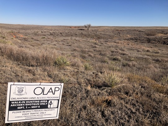
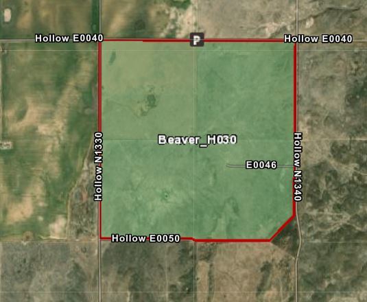
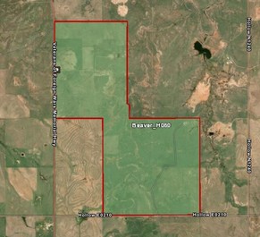
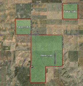
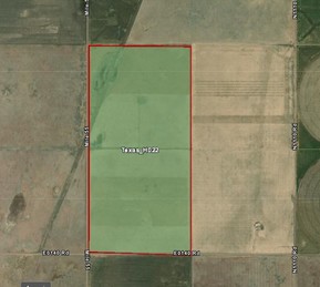
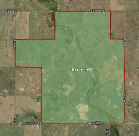
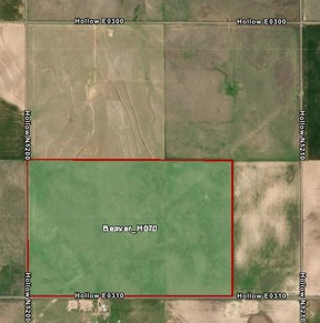
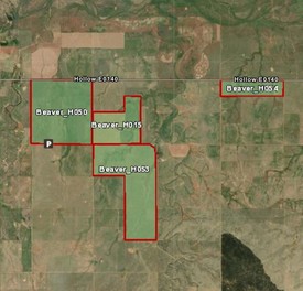
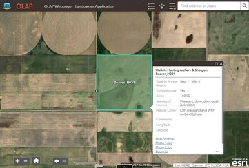
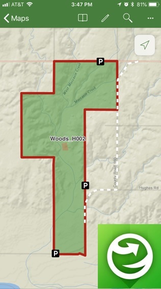
Reminder: Review the maps before entering the walk-in area. Get a good feel for the property boundaries, topography, changes in land use (farming or ranching), etc. 

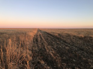
Boundaries may consist of a change from grassland to agriculture, a mowed strip (example pictured), etc. Some walk-in areas may not have fences for OLAP boundary signs, and it's the responsibility of hunters to know their location and the walk-in area's boundaries.

FieldBreak

gargraeerttrew


No recent removals.


Temporarily Closed


Logan_H002 will be temporarily closed on Saturday, December 26.


Interactive OLAP Tour

Want to learn more about the Oklahoma Land Access Program? Click here to take the Interactive OLAP Tour.


Explorer App

Use the free ArcGIS Explorer App to bring the OLAP Walk-in Areas to your mobile device (data signal required). Once the app is installed on your device, search the Maps for "OLAP" and select the ODWC OLAP Web Map".

Click below to download the ArcGIS Explorer App on your Apple or Android mobile device.

CLICK HERE FOR APPLE DEVICES

CLICK HERE FOR ANDROID DEVICES

Digital maps can be accessed via browser and/or the Explorer mobile app. Direct link to online maps.

You can also visit the OLAP webpage to downloaded updated PDF maps. The link to the PDFs is under the "maps" tab (scroll down). Direct link to PDF maps.


OLAP LOGO

Administered by the Oklahoma Department of Wildlife Conservation, The Oklahoma Land Access Program (OLAP) provides financial incentives to landowners who allow public access for hunting, fishing, stream access, and wildlife viewing opportunities on private lands. No additional permit is required by sportspersons to access OLAP walk-in areas, however hunting and fishing licenses are required, respectively, unless a person is exempt.

Consult regulations before entering OLAP Walk-in Areas. Visit the OLAP webpage to learn more.