Photo of snow geese courtesy of Matt Zeitler
In this issue:
Seasonal cycles, nature’s turnover, from the spring migrations of snow geese to the seemingly magical emergence of amphibians, offers an opportunity to reflect on the timelessness of these life giving processes. This week we journey into the deep-time of the Hudson Valley to visit those who incorporated these seasonal cycles into their culture.
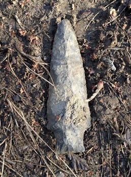
3/8 – Westchester County: While birding a local upland trail, which I've walked a hundred times, I came upon what appeared to be a prehistoric stone projectile point. I wondered if it had eroded from the verge of an old game trail during the heavy rain, coupled with the freeze and thaw of the past winter. It gave me pause to stand and reflect on our relationship to the environment and how it sustained humans long ago.
- Jeff Weber
[Jeff’s find was of a type called the Lamoka-stemmed point (114 x 38 millimeters), truly an echo from the Hudson Valley’s deep past. The spear point dates to at least 4,000 years ago during a period that archaeologists have defined as the Late Archaic. The point was not an “arrowhead.” It was fashioned and used 2,500 years before the advent of bow and arrow technology (dates are the product of radiocarbon dating of organics found in direct association with stone artifacts.)
Who were the Lamoka people? They had no written language; theirs was an oral tradition of stories told and remembered by generations. They were likely ancestral to much later Hudson Valley Algonquian-speakers such as the Leni-Lenape, Munsee, and Mohican. The Lamoka Type Site is Lamoka Lake in Schuyler County, New York, where Jeff’s point was first described by New York State Archaeologist William Ritchie.
The Late Archaic is a 2,000 year span of time that is characterized by changes in native American lifeways. Such divisions are not easy to establish. Ninety-five percent of all prehistoric material culture (artifacts) were perishable requiring that we make our assumptions based upon the five percent that remains (Lewis Binford).
Culturally, new settlement patterns were evolving including adaptations to ecological changes. The estuary had reached our present sea-level following a rebound of the land from the weight of melting glaciers. This, in turn, created optimum mesohaline (salinity) conditions in the estuary for oysters growth. Tributaries flowed more evenly as the land gave up its moisture in a more regular manner, unencumbered by the effects of dams and deforestation.
Late Archaic people lived in pre-horticultural and pre-ceramic times (before pottery). They were mobile, broad-spectrum hunters, gatherers, fishers, and foragers. They made seasonal rounds from white-tailed deer in the forest to migratory fishes and summer shellfish in the river. They organized in family and extended-family clans that provided personal identity to supplement their lineage (kinship was paramount). They traveled to Hudson Valley chert quarries, essentially ancient “cathedrals,” to extract the coin-of-the-realm, the material they fashioned into their stone tools.
They were able fishers utilizing dugout canoes often made from tulip trees (Liriodendron tulipifera) and other soft hardwoods. They knitted gillnets and seines using natural cordage such as twisted fibers of dogbane (e.g., spreading dogbane), Indian hemp (dogbane), milkweed, cattail, nettle, roots from black walnut, cedar, hemlock, fibers from the inner bark of basswood, cedar, and ash, to create their gear. Being descendants of indigenous cultures that had already been here for 8,000 years, Late Archaic people knew their home, the forests, fields, and river, very well. Tom Lake]
[Note: One-inch equals 25.4 millimeters (mm). Tom Lake]
Photo of Lamoka Spear Point courtesy of Jeff Weber
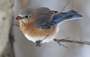
3/7 – Hudson River Watershed: Even though we are aware of the northern expansion of birds due to milder temperatures, coming upon one or more eastern bluebirds in a winter landscape can still surprise us. Crickets, grasshoppers, caterpillars, spiders and beetles are the predominant invertebrates bluebirds eat in the summer, but their food supply all but disappears come fall. How do bluebirds survive all winter in the Northeast when insects and spiders aren’t available?
Like white-tailed deer and beavers, eastern bluebirds adapt as winter approaches by changing their diet to accommodate the food that is available. In winter a bluebird’s diet consists primarily of small fleshy fruits such as sumac, winterberry, and cedar berries. Come spring, when invertebrates are once again plentiful, bluebirds will revert to a meatier diet.
- Mary Holland
Photo of Eastern bluebird courtesy of Mary Holland
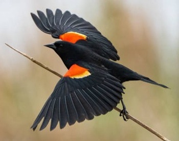
3/7 – Millbrook, HRM 82: Hundreds, probably a thousand black birds were foraging in the newly exposed grassy fields now that the snow had melted. It was their spring surge. In addition to red-winged blackbirds and common grackles, the flocks included brown-headed cowbirds and starlings — “blackbirds” all. We could also hear the constant chatter of recently returned red-winged blackbirds (Kon-ker-ree) in nearby wetlands. It was full-on spring.
- Tom Lake
Photo of red-winged blackbird courtesy of Scott Canning
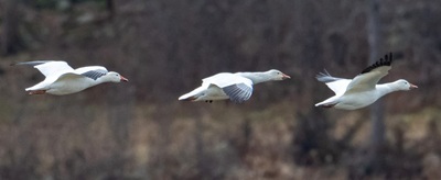
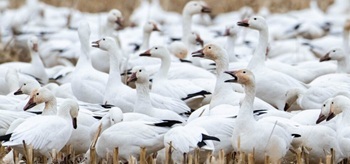
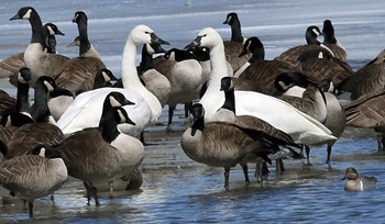
3/7 – Orange County, HRM 41-44: Right on cue, our first snow geese arrived at the Black Dirt on their journey north from their DelMarVa wintering home. By evening, Linda Scrima and Travis Rubio reported the flock had grown to 500 birds including one Ross’s goose. They also found eleven tundra swans at the Wallkill River National Wildlife Refuge’s Liberty Loop and a greater white-fronted goose at the Camel Farm.
- Matt Zeitler
[By the time I arrived the next morning (3/8), I estimated there were now more than 1,200 snow geese. Matt Zeitler]
[Tundra swans (Cygnus columbianus) are often called “America’s native swan.” Their common name refers to their summer nesting range north of Hudson Bay in the Arctic tundra. They can usually be heard calling long before they are seen, which leads to another frequently used colloquial name, “whistling swan.” David Sibley remarks that distant flocks sound like “baying hounds.” Tundra swans are occasional visitors to the Hudson Valley during late winter-spring and fall migrations. Tom Lake]
Photo of snow geese courtesy of Matt Zeitler
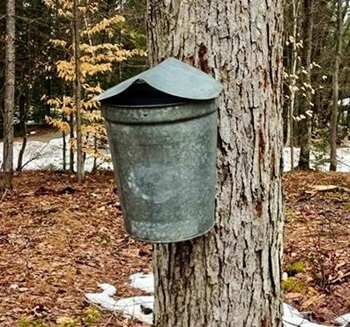
3/8 – Minerva, HRM 284: Although the lower watershed was showing signs of spring, it was still winter in the Adirondacks. I used my snowshoes to tromp through more than two feet of snow to reach my sugar maple trees. Upon arriving, I insulted them by drilling holes through their bark for the spiles. Out of the eight trees I drilled, I think five of them will be decent producers.
Walking after dark, we heard flocks of night-flyer Canada geese passing overhead. Since local waters were still locked up in ice, we suspected they were early-arrival migrants hoping to find open water in points north.
- Mike Corey, Freya Corey
Photo of maple sugaring courtesy of ADK VIC
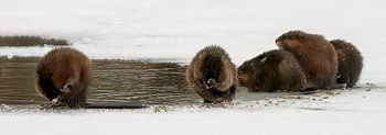
3/8 – Hudson River Watershed: Muskrats remain active all winter although they, like beavers, are restricted in their movements once the water freezes in the ponds or marshes where they reside. Winter is spent resting and grooming themselves in their lodges, swimming under the ice to procure food such as cattail roots and feeding in their roofed platforms or “push-ups.”
Once ponds and marshes begin to melt in early spring, muskrats are quick to be out on the ice or their lodge in the sunshine and fresh air. If you should happen upon a muskrat at this time of year, you are likely to see it grooming itself or its litter mates. Muskrats are fastidious groomers — they use their paws and teeth to comb through their fur, distributing water-repellent oils from scent glands.
Grooming not only makes their fur water repellent, but also functions to trap the air within it, thus providing good insulation. Clean, waterproof fur allows them to remain in cold water for up to half an hour. To stay well-groomed, they will conduct a thorough grooming before entering the water and again after they haul out. (The grooming activity also generates some body heat.)
- Mary Holland
Photo of muskrats courtesy of Mary Holland
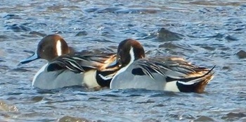
3/9 – Staatsburg, HRM 85: The winter ice that was locked in at Norrie Point finally released its hold over the weekend and was now equal parts water and ice. The waterfowl were loving it. Our usual assemblage of common mergansers was actively diving and bobbing among the ice floes and a dozen ring-necked ducks (Aythya collaris) was gathered near the edge of the cove’s ice. A hundred yards out, two northern pintails (Anas acuta) calmly rode the ebb current amid large ice floes.
--Chris Bowser
Photo of Northern pintail courtesy of Katrina VanTassell
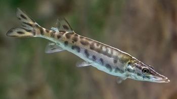
3/9 – Hudson River Watershed: Fish-of-the-Week for Week 357 is the muskellunge, Esox masquinongy (Mitchill,1824), number 88 (of 240) on our watershed list of fishes. If you would like a copy of our list, e-mail - trlake7@aol.com.
The muskellunge is new to our list of Hudson River Watershed Fishes. Muskellunge is a species of large freshwater predatory fish native to North America and is the largest member of the pike family, Esocidae. Among the Ojibwe people, their common name comes from the Algonquian word maashkinoozhe, meaning "great fish.”
Muskellunge is one of four Esocids documented for our watershed, The other three are redfin pickerel (Esox americanus americanus), northern pike (E. lucius), and chain pickerel (E. niger). There is a hybrid as well, tiger muskellunge, a cross between a male norther pike and a female muskellunge.
Muskellunge average 28–48 inches-long and15–36 lbs. The New York State angling record is a legendary 69 lbs. 15 oz fish caught from the Saint Lawrence River in 1957.
Muskellunge live in clear vegetated lakes, quiet pools and backwaters of creeks and small to large rivers (Broder & Grossman, 1966).
In nearby waters, muskellunge are found in the Great Lakes (Erie, Ontario), the Saint Lawrence River, southern Canada, and Lake Champlain. The muskellunge’s Type Site is Lake Erie, where naturalist Samuel Latham Mitchill first described Esox masquinongy to science in 1824.
But no records, as far as we could tell, from the Hudson River Watershed.
Photo of muskellunge courtesy of USF&W Service
Then, Bob Schmidt went on a mission. Dr. Schmidt frequently works at the New York State Museum with their Collection of Fishes which includes extensive archives and voucher specimens. On February 18, he examined the Museum’s records and discovered a lot of two small muskellunge (75-79 millimeters) from Hinkley Reservoir in Herkimer County, collected 21 July 1982 (NYSM 49906).The reservoir provides water that drains into the Mohawk River, thus our watershed. There were no additional comments as to whether the muskellunge had been stocked or they occurred naturally.
When the Hudson-Champlain Canal opened in 1823, connecting the Saint Lawrence River with (LaChute River) to Lake Champlain and then the Hudson River at Fort Edward, the Hudson River Watershed gained another potential access point for new fish species.
After some lengthy consideration, we decided that the muskellunge qualifies as a non-native species that nonetheless is, or has been, found in the watershed. This criteria had already been applied to such well-known non-native species as rainbow trout, brown trout, chinook salmon, smallmouth bass, northern snakehead, and a single Atlantic cod from river mile 35 at Croton Point (Lake 1982).
- Tom Lake
3/3 – Hudson River Estuary: James Boyle of the Atlantic States Marine Fisheries Commission (ASMFC) issued their first weekly report of the season for East Coast River Herring (blueback herring and alewives). These are river herring, primarily adults, returning, heading up the coast from their wintering waters.
The first report (48 blueback herring) comes from the St. Stephen fish lift in the Santee River at St. Stephen, South Carolina. As they move north, some will pare off into the Chesapeake Bay, Delaware River, the Hudson River, and then on north into New England and coastal Canada.
- Tom Lake
3/9 – Orange County, HRM 41-47: The Black Dirt Region appeared as full-on spring from songbirds to raptors. A large kettle of returning turkey vultures spiraled overhead at the Wallkill River National Wildlife Refuge’s Liberty Loop and a half-dozen flocks of Canada geese passed over, spread across like check marks in the sky.
Further along at the Camel Farm wetland in Wurtsboro, hundreds of Canada geese were wedged into too-small open water — revolving vacancies — some leaving, others arriving. On the periphery were several dozen snow geese and two brilliant white and stately Tundra swans. A short drive to the Town of Wawayanda is Pierce Circle with its mile-long string of cornfields. There are a brief few days in the fall and spring when 10,000 snow geese in migration will fill the fields. Today, having missed the crowd, I counted just fifty.
- Tom Lake
[If you choose to visit the Black Dirt, from Interstate 84 (Middletown) take Route 17 East, then take exit 124 off Route 17. Follow 17A south for a few miles to a right turn onto the Pulaski Highway. The next eight miles takes you through the heart of the Black Dirt to Pine Island.
Throughout you will see black-capped agricultural fields and tall hills, conspicuous among the flat farmland. They are called “islands” by geologists. When a post-glacial lake covered the Black Dirt, 15,000 years ago, they were islands. Set your imagination free and you may see mastodons, mammoths, elk, caribou, flat-headed peccary, perhaps even a bone-eating dog (Borophagus diversidens), whose bones are part of the Black Dirt compost. Tom Lake]
Photo of tundra swan courtesy of Deborah Tracy Kral
3/10 – Waterford, HRM 158: Nest monitor Howard Stoner reports that the adults in bald eagle nest NY485 have begun incubation. Last year they began on March 6. If the start date is accurate, we might expect a hatch around April 10-13 (32-35 days). NY485, located on Peebles Island State Park at the junction of the Mohawk and Hudson rivers, is now in its ninth season. The first eight have been successful by any measure averaging two nestlings each season.
- Tom Lake
3/10 – Ulster County, HRM 82: It was a great day to be walking the Mohonk Foothill trails without slipping and sliding as more than two-feet of snow melted away in the 70 degree air.
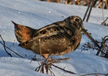
While walking the River to Ridge Trail paralleling Butterville Road in the Mohonk Foothills, a very bold woodcock fluttered down about 10 yards in front of me just off the shoulder of the trail. Standing very still I was able to get a few photos as the woodcock stood looking toward me. When I finally took a step forward the bird took flight into a nearby brushy area.
- Bob Ottens
Photo of American Woodcock courtesy of Bob Ottens
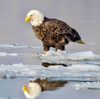
3/10 – Ulster County: I am pretty sure we had a hatch at bald eagle nest NY142 either yesterday or this morning. Yesterday, both eagles were in the nest checking things out. This morning, we saw an eagle fly from the nest and land on a fence post around the orchard. I told my daughter and her friends (home on spring break) that the eagle will likely drop down, gather some grass, and take it back to nest. Right on cue, the male eagle did that. We will keep an eye out for food coming to the nest signaling another mouth to feed.
- Bill Bollinger
Photo of bald eagle courtesy of John Badura
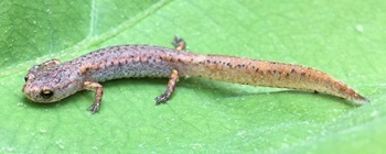
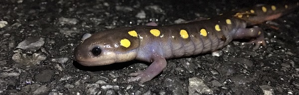
3/11 – Ulster County, HRM 100: On the night of March 11, the conditions aligned for the first warm, wet night of the year, and we witnessed the wonderful seasonal ecological phenomenon of the annual emergence of the amphibians across the landscape. Eight of us, all fellow nature enthusiasts, organized by world class nature illustrator Zoe Keller, were gathered to patrol a stretch of road in the Zena Woods area for an hour after dark.
We documented more than 150 individuals of at least eight species. This included wood and green frogs, spring peepers, American toads, spotted, and red-backed salamanders, eastern newts/red efts, and, at the very end, a single four-toed salamander. The large numbers of car-killed casualties was very sad, but seeing such an abundance and diversity of hoppers and crawlers was an inspiring harbinger of spring. We submitted our findings to Laura Heady’s Region 3 DEC Amphibian Migration Road Crossing Project.
- Laurel Sutherlin
Photo of four-toed salamander courtesy of Matt Neff
3/12 – Hudson River Watershed: The first sign of spring can often be heard or seen at the beginning of March in most of the Northeast. Each year it’s always fun to see what you hear or see first that tells you that winter is in the rear-view mirror.
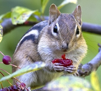
A striped rodent that has spent the winter in an intermittent state of torpor is likely to appear any day. Eastern chipmunks (Tamias striatus) somehow detect that days are lengthening, and temperatures are rising from their subterranean tunnels and soon scamper above ground. One of their two annual breeding seasons occurs in early spring, and there is no time to lose—females mate usually within a week of emerging above ground and will give birth in about a month.
- Mary Holland
Photo of Eastern chipmunk courtesy of Mary Holland
3/13 – Yonkers, HRM 18: We began our second week of late-winter surveying of the Beczak Tidemarsh for fishes migrating in from the sea, as well as any locals that may be about.
They was a significant drop in salinity from a high of 15 parts-per-thousand (ppt) last week (45% seawater) to virtually freshwater (1.0 ppt, background noise) this week. The drop was the result of heavy rainfall and rapid snow melt in the uplands of the watershed. For the four days we sampled, the water temperature averaged just under 40 degrees Fahrenheit, and the dissolved oxygen (DO) hung right around 14 parts-per-million (ppm). The meager catch from our fyke net of five glass eels (American eels) and two mummichogs was not unexpected.
- Jason Muller, Hamima Hossain, Daniel Basso, Sophie Loring, The EELS Team of Yonkers High School
[Our glass eel research net is called a fyke. The name is derived from the Colonial
Dutch word for a fishnet — fuyckorfuik — that forms the shape of a truncated cone. The name was first used on the river to describe a neighborhood of the early Dutch settlement at Fort Orange (17th century Albany). Two diverging roads that emanated from the fort, one along the shoreline and the other leading inland, viewed from the north wall of Fort Orange, would have resembled the basic shape of a fyke net. Tom Lake]
Science Saturday at Norrie Pint Environmental Center
Join us for our monthly Science Saturday programs and explore Norrie Point. Check out our series by visiting the Hudson River website. Events are free and open to the public. Registration is not required. All programs meet at the Norrie Point Environmental Center, 256 Norrie Point Way, Staatsburg NY 12580. Dress for the weather and being outside! Otherwise, no special equipment is needed.
The upcoming Science Saturday programs are:
- Rebecca Houser, Education and Outreach Specialist, HREP and NEIWPCC
Amphibian Migrations & Road Crossings Program – 2026 Volunteer Trainings
Join the DEC’s Hudson River Estuary Program and Cornell University to learn how to volunteer with the Amphibian Migrations & Road Crossings Project. Volunteers find locations where migrating salamanders and frogs cross roads on their way to vernal pools for breeding in late winter and early spring. They document weather, traffic, and species, and assist amphibians across the road safely. Trainings will be offered on the following dates:
In-person trainings are filling up, but interested volunteers can attend a program offered by an AM&RC Project Partner. Full details are available: 2026 Volunteer Trainings for the Amphibian Migrations & Road Crossings Project | Conservation Planning in the Hudson River Estuary Watershed.
Snapshot NY
The NYSDEC, in collaboration with the New York Cooperative Fish and Wildlife Research Unit at Cornell University, has launched Snapshot NY, a citizen science program that allows the public to participate in wildlife monitoring through the deployment of trail cameras. The project will help improve the way DEC monitors and manages more than a dozen wildlife species. For more information on Snapshot NY and how to participate, visit the Snapshot NY website.
Hudson River Lesson Plans
Explore our collection of Hudson River lesson plans, videos and online activities to support hand on investigations of the Hudson River in your classroom.
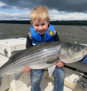
Hudson River: Striped Bass Cooperative Angler Program
You can share your fishing trip information and help biologists understand and manage our Hudson River striped bass fishery.
Here’s how it works: Fill out a logbook provided by us whenever you fish on the Hudson River (by boat or from shore). You can also use our survey123 app and record your trips using a smart phone or computer.
Record general location, time, gear used, what you caught (or if you didn’t catch anything) and return the logbook when you are done fishing for the season. You’ll receive an annual newsletter summarizing the information in addition to the latest news regarding regulations and the river. Whether you catch-and-release or take home a keeper, you can be part of the Cooperative Angler Program. Online logbook instructions (PDF)
Join today by contacting: hudsonangler@dec.ny.gov
- Jessica Best
Photo of DEC Angler Program courtesy of Jess Best
Hudson River Miles
The Hudson is measured north from Hudson River Mile 0 at the Battery at the southern tip of Manhattan. The George Washington Bridge is at HRM 12, the Tappan Zee 28, Bear Mountain 47, Beacon-Newburgh 62, Mid-Hudson 75, Kingston-Rhinecliff 95, Rip Van Winkle 114, and the Federal Dam at Troy, the head of tidewater, at 153. The tidal section of the Hudson constitutes a bit less than half the total distance—315 miles—from Lake Tear of the Clouds to the Battery. Entries from points east and west in the watershed reference the corresponding river mile on the mainstem.
To Contribute Your Observations
The Hudson River Almanac is compiled and edited by Tom Lake and emailed weekly by DEC's Hudson River Estuary Program. Share your observations by e-mailing them to trlake7@aol.com.
Was this Newsletter Forwarded to You?
Subscribe today to DEC Delivers Hudson River Almanac topic for weekly natural history journal that covers the Hudson from the High Peaks of the Adirondacks to New York Harbor.
Helpful Resources
National Oceanic and Atmospheric Administration online tide and tidal current predictions are invaluable when planning Hudson River field trips. For real-time information on Hudson River tides, weather, and water conditions from sixteen monitoring stations, visit the Hudson River Environmental Conditions Observing System website.
DEC's Smartphone app for iPhone and Android is now available at New York Fishing, Hunting, and Wildlife App.
|