
Conserving Natural Areas in the Hudson River Valley
The New York State Department of Environmental Conservation sent this bulletin on 11/07/2023 03:00 PM EST |
| DEC Delivers - Information to keep you connected and informed from the NYS Department of Environmental Conservation |
| View in browser |
Hudson RiverNet
|
In This Issue
Conserving Natural Areas in the Hudson Valley
From the shorelines of the tidal river to the distant ridges and mountains that define its drainage, the Hudson River estuary watershed is celebrated for its remarkable biological diversity. Forests, streams, fields, and wetlands weave a living fabric through our communities, sustaining an ecosystem that provides clean water, climate resilience, and outdoor enjoyment to residents. New Guidebook: Best Practices for Adopting Conservation Inventories and Plans
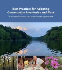
To further our support of local conservation planning, this year we completed a new publication to provide legal guidance and best practices for adopting and implementing natural resources inventories, open space inventories and plans, and critical environmental areas. Best Practices for Adopting Conservation Inventories and Plans (PDF) was developed in collaboration with Pace Land Use Law Center and will guide municipalities interested in taking “next steps’ to ensure their conservation inventories and actions have meaningful and intended outcomes. Along with procedural guidance, the publication includes many examples of policy language and local laws from Hudson Valley communities. View the recorded webinar with the lead author of Best Practices. Putting Natural Areas and Habitat on the Map
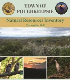
In 2023, the number of municipalities creating and using natural resources inventories (NRIs) continued to grow. By mapping and describing a community’s resources—such as forests, wildlife habitat, soil types, and aquifers—NRIs provide a comprehensive and useful reference for anyone involved in making decisions about land use and land conservation. With support from the Estuary Program and partners like Cornell Cooperative Extension of Dutchess County, the Town of Clinton, Town of Washington and Village of Millbrook, Town of Mount Pleasant, and City of Peekskill developed NRIs this year. How are NRIs used by municipalities? In addition to helping landowners, developers, and local officials with site planning, NRIs provide an important foundation for identifying priorities and crafting municipal plans and policies to proactively protect what the community cares about. This year, the Town of Poughkeepsie adopted a joint Natural Resources Inventory and Open Space Plan with funding from an Estuary Grant. The project included a map-based conservation analysis tool and identified key opportunity areas for land acquisition and trail connections. The Town of New Paltz used its NRI and Estuary Program assistance to draft a conservation overlay zone to increase protection of an area of high biodiversity value. These projects contribute to our target of 25 new or updated conservation practices, plans, or policies completed by 2025, and our target to have 40% of municipalities use their NRIs for a conservation plan or policy. Since 2015, we’ve assisted 47 communities with creating NRIs and 34% percent have used these to implement plans or policies. Local Financing for Future ConservationFor some municipalities, securing funds to protect priority lands and waters is a next step in their conservation planning process. This year, with Estuary Program assistance, the towns of Chatham in Columbia County and Philipstown in Putnam County adopted community preservation plans, providing a required step toward establishing community preservation funds. The City of Kingston in Ulster County completed a similar planning effort. These initiatives contribute to our 2030 target to help five watershed municipalities establish local land acquisition programs to advance their conservation priorities.
Return to In-person Trainings
This year, we were delighted to bring back a full schedule of in-person training programs with attendance by more than 200 municipal officials, land trust staff, and environmental professionals, and hundreds more joined us for our Conservation and Land Use webinars (recordings are available on DEC's website).
The year is not over yet. We hope you will join us on November 14 for Municipal Options for Financing Open Space Protection, when leaders from Bethlehem, Kingston, New Paltz, and Red Hook will share their experience with local open space funding. Learn more about this program, and how to register, on the Events page of the Cornell University website - Conservation Planning in the Hudson River Estuary Watershed. Helping Amphibians with Safe Passage
This year marked the 15th year of the Amphibian Migrations and Road Crossings Project (AM&RC). Since the project started in 2009, more than 1,000 community volunteers have conducted surveys on rainy nights in early spring to document where migrating amphibians encounter roads on their breeding journey from forests to vernal pools. They observed 20 different species and tallied more than 65,000 amphibians and assisted more than 40,000 across roads. As the AM&RC project continues to grow, we’re working to engage more implementation partners, improve the volunteer experience, and apply the project data to achieve conservation outcomes. This year, we:
|


|
The New York State Department of Environmental Conservation respects your right to privacy and welcomes your feedback | Update preferences or unsubscribe | Learn more about DEC Delivers |
|
| Connect with DEC: |
|
| Basil Seggos, Commissioner | |