|
Have a safe and enjoyable outdoor recreational experience on the lands and waters of the Adirondacks. Properly plan and prepare for your outdoor adventure. Minimize the impact on the mountains and forests, rivers and brooks, ponds and lakes, and the wildlife of the Adirondacks.
Check the Backcountry Information for the Adirondacks web pages for more detailed information on access, outdoor recreation infrastructure, and conditions for those planning to recreate in the Adirondacks. This bulletin provides only the most recent notices.
Emergency Situations: If you get lost or injured, keep calm and stay put. If you have cell service, call the DEC Forest Ranger Emergency Dispatch, 518-891-0235.
Check snow amounts and mountain weather conditions before heading out this weekend.
Packing the proper gear for a winter hike is very important, and you should be prepared to encounter all conditions. See our recommended packing list and winter safety tips.
Watch a video about winter hiking safety tips.
View a video about snowmobile safety.
Plan Ahead and Prepare
Weather forecasts and conditions can and do change quickly. Check the current National Weather Service Forecast, and be prepared for the forecasted conditions, or change your plans.
-
Snow on trails. Trails will have significant snow covering with the winter storm coming 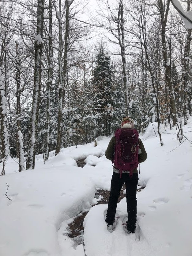 in at the end of this week. Ice will still be prevalent underneath the fresh snow on exposed summits and bedrock. Wear snowshoes. Pack or carry crampons. Snow shoes are required wherever snow depths exceed 8” in the High Peaks Wilderness. in at the end of this week. Ice will still be prevalent underneath the fresh snow on exposed summits and bedrock. Wear snowshoes. Pack or carry crampons. Snow shoes are required wherever snow depths exceed 8” in the High Peaks Wilderness.
-
Breaking trail. Heavy snow will cover even well-traveled trails. Plan for more time during your trip. Breaking trail can exhaust more energy than regular hiking. Gaiters can protect your lower legs from the wet, cold elements of deep snow.
-
Blow down on trails. Strong winds associated with the upcoming storm will create blow down. Plan to encounter fallen trees and low hanging branches along trails.
Practice Leave No Trace
Follow proper trail etiquette to maintain minimal impact on the  environment and the natural resources of the Adirondacks, as well as ensure an enjoyable outdoor experience for all visitors by following the Seven Principles of Leave No Trace. environment and the natural resources of the Adirondacks, as well as ensure an enjoyable outdoor experience for all visitors by following the Seven Principles of Leave No Trace.
General Conditions/Notices
Learn the conditions you will encounter from Adirondack Backcountry Information.
All
-
WINTER STORM WATCH: The National Weather Service has issued Winter Storm
Watches for the Adirondacks and surrounding areas effective late Thursday night through Saturday morning.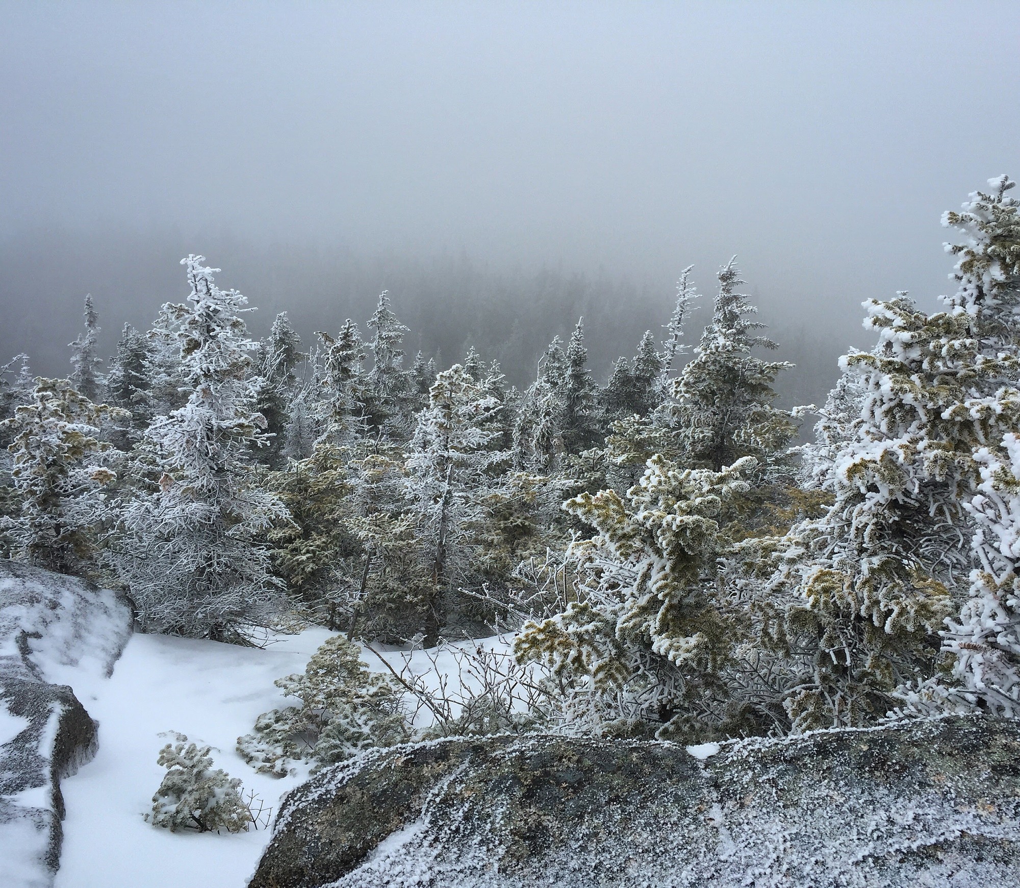
- Significant accumulation of heavy, wet snow is possible.
- Total snow accumulations range from 5 to 15 inches throughout the watch areas with locally higher amounts possible.
- Strong winds associated with the storm could gust as high as 35 to 40 mph on Friday night
- High winds may lead to scattered tree damage and isolated power outages.
- Travel could be very difficult to hazardous and may impact the morning and evening commutes on Friday.
- Check the current National Weather Service Forecast for the current conditions, forecasts, and the specific Winter Storm Watch information for the location where you live, plan to travel, and plan to recreate.
-
Travel: Check NY511 for road closures and conditions.
-
Snow Cover: Snow depths range from 12 to 30 inches across most of the Adirondacks.
- There is little to no snow in the in the northwestern and northeastern corners of the Adirondacks.
- Most of the Adirondacks is forecast to receive 6 to 12 inches of new snow through Saturday morning.
- The very eastern Adirondacks are forecast to receive 2-4 inches of snow with more in the higher elevations.
- Snow is deeper in the higher elevations; snow is 7 to 8 feet deep above 3,000 feet in the High Peaks region.
- The National Weather Service NERFC Snow Page provides maps depicting current snow depths and forecasts.
-
Ice on Waterbodies: Ice has formed on most waters.
- Always check the thickness of ice before traveling across it.
- Avoid ice over running water, near inlets & outlets and near boathouses & docks - especially those with "bubblers" or other ice prevention devices.
- Remember, ice that holds snow may not hold the weight of a person.
-
Be safe on the ice, especially when ice fishing.
Hikers/Skiers/Snowshoers
-
General Information
- Trail Conditions:
- Fresh snow will be present on all trails. Most trails will have deep snow.
- In the lower elevations of the eastern portion of the Adirondacks, shallow snow may cover ice on trails.
- You should use snowshoes on all hikes except in the very eastern Adirondacks where you may need trail crampons.
- Carry snowshoes, trail crampons, and steel-tipped hiking poles on all hikes, and use whichever is warranted for conditions.
- Traveling through snow takes more time and energy than hiking on bare ground – especially when breaking trail through deep, freshly fallen snow.
-
Designated Snowmobile Trails:
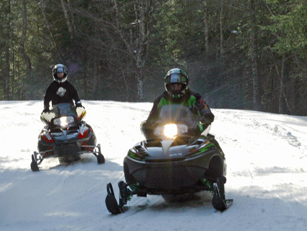
- Watch and listen for snowmobiles when skiing or snowshoeing on designated snowmobile trails.
- Move off the trail to allow snowmobiles to safely pass.
-
Mountain Summits: Temperatures will be much colder, winds will be stronger, ice will be present, and snow will be deeper. Check the National Weather Service Mountain Point Forecasts for selected summits.
Snowmobilers
-
General Information: Snowmobiling
-
Trails: Fresh snow will be present on all trails – most trails will have deep snow.
-
Safety:
- Watch for skiers and snowshoers using snowmobile trails - slow down to safely pass.
Ice Anglers
-
General Information: Ice Fishing
-
Ice Shanties: You can take Ice fishing shanties on and off the ice when in use, but you cannot leave them empty on the ice.
-
Safety: Be safe on ice.
Recent Notices
Notices below reflect recent changes in conditions and recreation infrastructure work that DEC and its partners completed. Check the Backcountry Information for the Adirondacks for ongoing issues and more detailed information.
-
Kings Bay Wildlife Management Area: The gates for the road to Catfish Bay are closed due to muddy conditions. This WMA sets on the shores of Lake Champlain north of the Adirondacks.
-
Ausable Marsh Wildlife Management Area: The gate has been closed due to flooding on the road. This WMA sets on the shores of Lake Champlain in northeast corner of the Adirondacks.
-
Lake George Wild Forest: The Town of Fort Ann has closed Shelving Rock Road for mud season. Parking along Shelving Rock Road and at the gate is prohibited. Sleeping Beauty, Shelving Rock, and the Buck Mountain East Trailhead are not accessible while the road is closed.
-
High Peaks Wilderness:
- Lake Colden Caretaker Report
- 61 inches (155 cm) of snow at the stake at 2,750 feet (838 m) elevation.
- 7 to 8 feet (215 to 245 cm) of snow above 3,000 feet (914 m) elevation.
- The use of snowshoes or skis is required on all trails.
- South Meadow Lane, Marcy Truck Trail, and the ski trails are in good condition for skiing despite the loss of some snow depth prior to the weekend.
- Snow cover on foot bridges may be above the handrails. Use caution when crossing.
- Snow Bulletin:
- Snow depths in the High Peaks Region range from 10 inches to more than 85 inches, depending on location and elevation.
- The winter storm forecast to begin late Thursday night is expected to bring an additional 12-23 inches of snow.
- High winds are forecast to be associated with the storm.
- Expect wind slabs to have formed on leeward slopes and significantly more amounts in deposit zones, such as gullies.
- The current snow conditions have created a great bed surface for snow to slide on.
- Backcountry downhill skiers, snowboarders, and others who may traverse slides and other steep open terrain should be aware of avalanche risks on what to do to avoid triggering avalanches.
- Climbers should also be aware of potential avalanche risks in gullies used to access some climbs.
- Pay attention to red flags:
- High winds;
- More than 12 inches of snow in a 24-hour period;
- Any amount of snow that falls at a rate of more than an inch per hour; and,
- Avalanche activity
- There have been four skier triggered avalanches reported this winter in the High Peaks region – two included partial burial of skiers. All four occurred during or within a few days of a winter storm.
- Before you go out:
- Put new batteries in your transceiver and practice with them.
- Bring your shovel, probe, have a pack, with adequate equipment to handle whatever conditions you may encounter
- Carry a good first aid kit.
- Look at the forecasted weather, dig your own pits, and make your decisions based on your observations.
- Practice safe-travel techniques.
- Just because a slope has been skied, doesn’t mean that it can’t slide!
- Have a rescue plan and know how to self-rescue.
Highlighted XC Ski - Black Bear Mountain Ski Trails, Inlet, NY
Black Bear Mountain Ski trails are part of the Moose River Plains Complex.
Black Bear Mountain Lower Ski Trail extends 3 miles from private land along State Route 28 to the Bug Lake Trail. The trail follows for 0.4 miles along an easement over private land and continues easterly for 2.6 miles. Wet areas make portions of the trail unsuitable for use during non-winter seasons.
A 5.8-mile loop using both trails is possible but it requires skiing the 0.6 miles between the two trailheads on a busy snowmobile trail along State Route 28 or walking on the shoulder of State Route 28.
Bug Lake Trail extends 3.2 miles from Uncas Road to Eighth Lake Campground. The trail connects with the Black Bear Mountain Uncas Trail at mile 0.9, the Mike Norris Trail at 2.0 miles, and the Seventh Lake Trail at 2.5 miles. The trail passes Bug Lake and Eagles Nest Lake, between intersections with the Mike Norris Trail and the Seventh Lake Trail.
Mike Norris Trail extends 2.5 miles between the Bug Lake Trail and the Brown Tract Canoe Carry Trail. A 0.75-mile spur trail, which leaves the trail 0.8 miles from the intersection with the canoe carry, provides access to a lean-to on the western shore of Eighth Lake. Another lean-to on the shore of the lake is located near the intersection of this trail and the canoe carry.
Black Bear Mountain Trailhead Parking is located off State Route 28 (43.7645°N, 74.7938°W)
|

