|
Have a safe and enjoyable outdoor recreational experience on the lands and waters of the Adirondacks. Properly plan and prepare for your outdoor adventure. Minimize the impact on the mountains and forests, rivers and brooks, ponds and lakes, and the wildlife of the Adirondacks.
Check the Backcountry Information for the Adirondacks web pages for more detailed information on access, outdoor recreation infrastructure, and conditions for those planning to recreate in the Adirondacks. This bulletin provides only the most recent notices.
Emergency Situations: If you get lost or injured; keep calm and stay put. If you have cell service, call the DEC Forest Ranger Emergency Dispatch; 518-891-0235.
More information on hiking safety and what to pack.
Bear Activity: A nuisance bear with an ear tag has been active in the Eastern High Peaks recently. The bear is approaching hikers and campers in an attempt to obtain food. Bear canisters are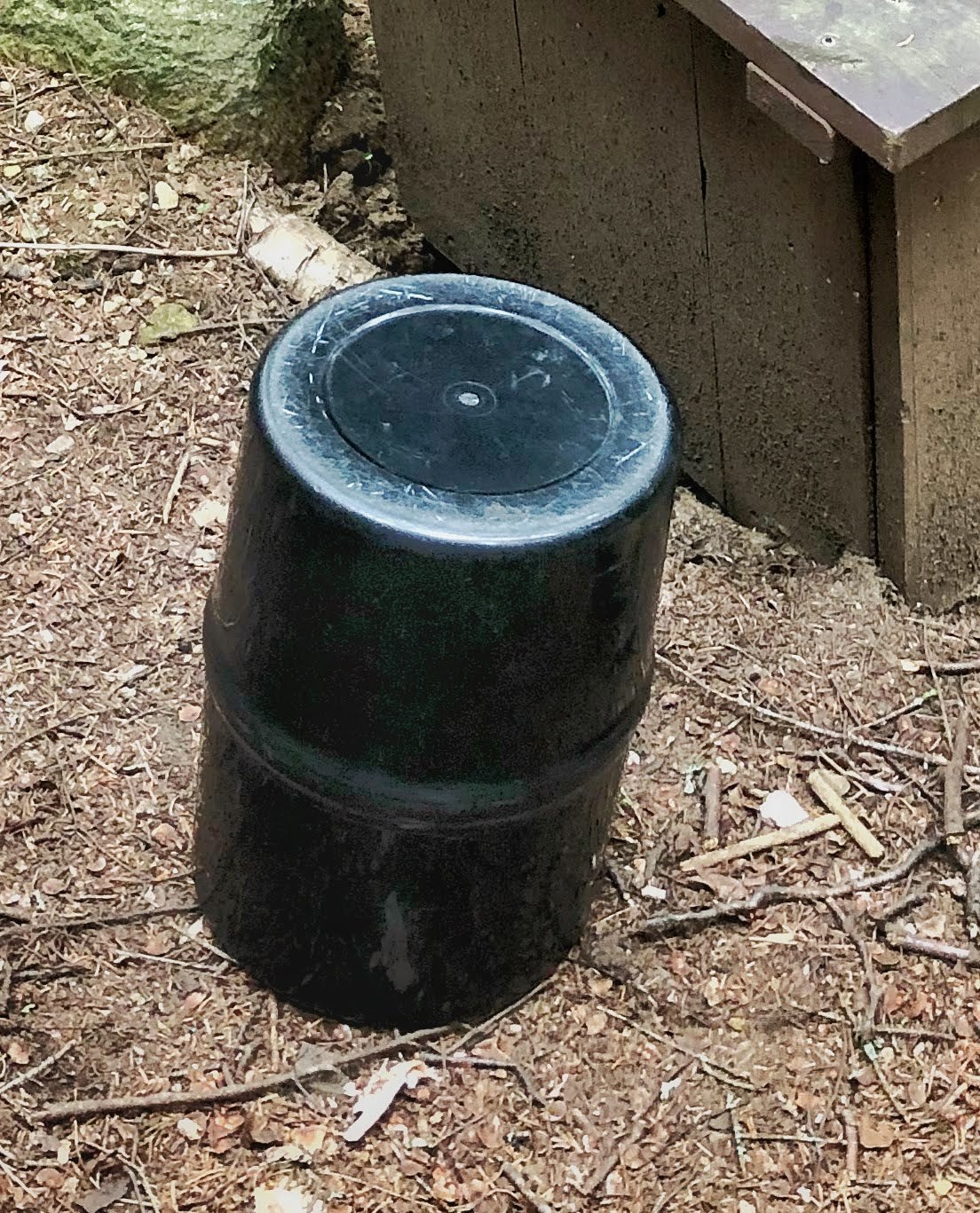 currently required in the High Peaks Wilderness and strongly recommended throughout the rest of the park. Be sure all of your food and waste will fit securely within the bear canister. If you’re not sure about an item, pack it in your canister anyway. currently required in the High Peaks Wilderness and strongly recommended throughout the rest of the park. Be sure all of your food and waste will fit securely within the bear canister. If you’re not sure about an item, pack it in your canister anyway.
- Do not eat or store food where you sleep. Cook and store food 100 feet or more from lean-tos and tent sites.
- Bear hangs and the Bear Vault brand canisters are not effective. These have consistently been defeated in the Eastern High Peaks Wilderness.
- Lock all food, garbage and toiletries in bear resistant containers.
- Bear spray is an option for close encounters. Keep it on your person and easily accessible.
- Report nuisance bear incidents to DEC.
Plan
Weather forecasts and conditions can and do change quickly. Check the current National Weather Service Forecast, and be prepared for the forecasted conditions, or change your plans.
-
Plan for bathroom breaks along the trail by packing these essentials:
- Earth-friendly toilet paper
- Small shovel to dig cathole (a stick works great as well)
- Deposit and bury solid human waste and toilet paper in catholes dug 6 to 8 inches deep, at least 200 feet from water, camp and trails.
- Cover and disguise the cathole when finished.
- Ziploc bag to carry out all toilet paper when a cathole is not used. Please do not leave your toilet paper laying on the ground.
- Hand sanitizer
-
Carry out what your carry in: This includes wrappers, trash and even food scraps. Food scraps take a long time to decompose and can draw wildlife near populated trail areas and cause negative wildlife encounters. Bring an extra baggie to carry these items out with you.
Prepare
Properly prepare to better ensure a safe and enjoyable recreation experience.
-
Reusable water bottles help to minimize waste and weight during a backpacking or hiking trip. Carry a water filtration system with you to fill up at water sources along your trip.
-
Separate your trash from your recycling while at campgrounds. State campgrounds have recycling centers to make waste disposal more convenient. By keeping your trash and recycling separate, it will be more convenient for you and will help keep recyclables out of landfills.
-
Prepare for any trip by researching the trip ahead of time. This will help you with determining what to bring and what to wear.
-
Things to know before you go:
- Bring a headlamp and make sure it is fully charged.
- Pack an emergency kit to be prepared for an unexpected overnight stay.
- You will be hiking down in the dark. Be sure to know the route you are taking.
- Leave your plans/itinerary with friends or family.
- Hike with a buddy for safety and good company.
- Bring warm, wind-protectant layers. When the sun goes down, the mountain air can become very cold.
Practice Leave No Trace

Follow proper trail etiquette to maintain minimal impact on the environment and the natural resources of the Adirondacks, as well as ensure an enjoyable outdoor experience for all visitors by following the Seven Principles of Leave No Trace.
Dispose of Waste Properly:
- Pack it in, pack it out. Pack out all trash, leftover food and litter.
-
Do not leave bags of trash along roadside camping areas or dispose of trash in privies. There is no trash service in the backcountry so carry out what you carry in.
- Food scraps tossed aside can take years to decompose. In that time, it can attract wildlife like bears to populated trail areas creating negative wildlife encounters.
Alpine Vegetation: The summit of a high peak is an amazing place to be. While you're soaking in the accomplishment of your hard work and the beauty of the views, don’t forget to watch where you’re walking. The High Peaks of the Adirondacks are home to rare and endangered alpine vegetation that live and thrive on our rocky summits, and it’s up to you to help protect it.
- Keep a clean trail and summit so alpine vegetation can grow healthy and freely.
- Stay on the trail and on the rocks to avoid trampling and damaging alpine vegetation.
- Carry a rock to the summit to help summit stewards build trail cairns and rock screes that help protect the vegetation.
General Conditions/Notices
Learn the conditions you will encounter from Adirondack Backcountry Information.
All
-
Active Nuisance Bears: The warm dry weather has reduced the amount of berries and other natural foods available to bears. DEC has received reports of nuisance bears throughout the Adirondacks. Follow practices to avoid negative encounters with bears in the backcountry.
-
Bear Resistant Canisters: The use of bear-resistant
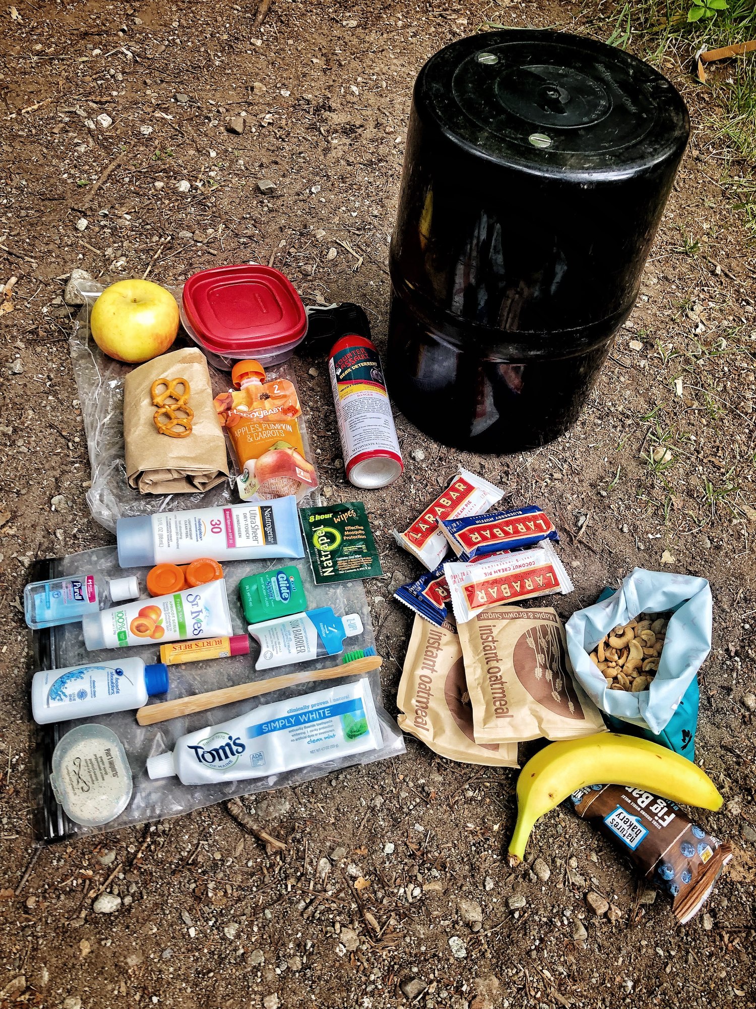 canisters is required for overnight users in the Eastern High Peaks Wilderness between April 1 and November 30. All food, toiletries and garbage must be stored in bear-resistant canisters. DEC encourages the use of bear-resistant canisters throughout the Adirondacks. canisters is required for overnight users in the Eastern High Peaks Wilderness between April 1 and November 30. All food, toiletries and garbage must be stored in bear-resistant canisters. DEC encourages the use of bear-resistant canisters throughout the Adirondacks.
-
Summer Weather: Stay cool and hydrated on hot and sunny days. Avoid heat exhaustion:
- Slow your pace, rest often, and stay in the shade as much as possible.
- Carry plenty of water and drink often – even if you don’t feel thirsty.
- Dogs, especially large dogs, are very susceptible to the heat. During hot weather:
- Do not take them on strenuous hikes up mountains that expose them to the heat and sun.
- Leave them home - not in your car.
- Take them to a lake or pond.
-
Thunderstorms: Check weather forecasts before and during all outdoor recreational activities.
- Avoid summits, water surfaces, and other open areas during thunderstorms.
- As soon as you are first aware of an approaching thunderstorm, move to lower elevations, head to shore or otherwise seek shelter.
- If caught outside in a thunderstorm, find a low spot away from tall trees, seek an area of shorter trees and crouch down away from tree trunks.
-
Biting Insects: Expect to encounter mosquitoes, deer flies, and no-see-ums (biting midges) when outdoors. Follow these steps to minimize the nuisance of biting insects:
- Wear light-colored clothing.
- Wear long sleeve shirts; tuck shirts into pants and button or rubber band sleeves at the wrist.
- Wear long pants and tuck the bottom of pant legs into your socks.
- Pack a headnet to wear when insects are thick.
- Use an insect repellant with DEET; follow label directions.
-
Fire Danger Rating: MODERATE. Check the current fire danger map.
-
Be safe with campfires.
- DEC forest rangers have responded to a number of wildland fires started by campfires that were not properly extinguished.
Hikers and Campers
-
Trail Conditions:
- Trails are mainly dry but expect to encounter wet and muddy conditions in low spots, along water bodies, and in drainages.
-
Avoid damaging hiking trails, trail side vegetation and habitats.
- Wear water-resistant hiking boots and let them get muddy.
- Stay in the center of the trail and walk through mud and water.
-
Mountain Summits: Temperatures will be cooler and winds will be stronger. Check the National Weather Service Mountain Point Forecasts for selected summits.
Boaters, Paddlers and Anglers
-
Water Levels: While areas outside the Adirondacks are getting plenty of rain, we are not receiving a lot of rain here. Water levels in most streams, rivers, lakes and ponds are low to very low. See the USGS Current Water Data for New York for stream flow of selected waters.
- Boaters and paddlers should use caution. Rocks, logs, and other obstacles normally covered in deeper water may be present just below the surface.
- Many shallow sections of rivers cannot be traversed by canoes or kayaks.
- Rains this week may bring levels up in some streams and rivers depending on the location, duration, and density of rainfall in thunderstorms.
- Use caution around steep, shallow, rocky streams and rivers. These are considered “flashy”, meaning water levels can rise quickly after a rainfall. Water levels will also drop quickly after the rains have stopped.
Mountain Bikers
-
Electric bicycles: Electric bicycles (E-bikes) of any class are not allowed on trails or roadways where public motorized access is prohibited.
Recent Notices
Notices below reflect recent changes in conditions and recreation infrastructure work completed by DEC and its partners. Check the Backcountry Information for the Adirondacks web pages for ongoing issues and more detailed information.
-
Fulton Chain Wild Forest: DEC reminds visitors to practice Leave No Trace Principles when hiking on Bald Mountain (AKA Rondaxe Fire tower).
-
Northville-Placid Trail: A logging operation is occurring on the conservation easement lands south of Tirrell Pond.
- Logging equipment will be crossing the Northville-Placid Trail at one location.
- There is a 100-foot buffer on either side of the trail outside of that crossing.
- Please be attentive for logging activity when on that section of trail.
- Logging is a normal activity on conservation easement lands.
-
Saranac Lake Wild Forest:
- Water levels are very low in the Saranac Chain of Lakes, the Saranac River, and connected waters. Numerous propellers and lower units of boat motors are being damaged when striking rocks, logs, stumps, or the bottom. Boaters should stay in the channel and clear of all hazard buoys. Travel slow and trim motors up when traveling in shallow or unknown waters.
- Due to unforeseen circumstances, DEC will only staff the Lower Lock in the Saranac Lakes Chain on Friday, Saturday and Sunday for the remainder of summer. DEC staff will operate the lock between 10 a.m. and 6 p.m.
-
Essex Chain Lakes Complex: Access to the western portion of the Complex, including the Deer Pond Parking Area, the Fifth Lake MAPPWD route, and the campsites along Cornell and Deer Pond roads, is closed.
- The closure will remain in effect until the end of August.
- DEC is replacing three motor vehicle bridges, one each on Woody’s Road, Cornell Road, and Deer Pond Road, to facilitate safe passage along these corridors for the future.
-
High Peaks Wilderness:
- The lands of the Dix Mountain Wilderness are now part of the High Peaks Wilderness. DEC will be changing signs, web pages, and regulations to eliminate the Dix Mountain Wilderness and transition to the High Peaks Wilderness.
- Group size regulations are now in effect on the lands in the former Dix Mountain Wilderness. Groups should consist of no more than 15 hikers and no more than eight campers.
- DEC is undertaking a multi-year, comprehensive effort to promote sustainable tourism, and address public safety in the Adirondacks focused on the State Route 73 Corridor between Exit 30 of the Northway (I87) and Lake Placid.
- DEC has piled materials for improving campsites along South Meadow Lane in the Mt. VanHoevenberg Trailhead Parking Area. Vehicles should park in the nearby pull offs along South Meadow Lane until the work is complete.
- A nuisance bear with an ear tag continues to be active in Eastern High Peaks. The bear has changed its pattern of behavior and is now approaching hikers and campers during the middle of day in attempt to obtain food. Pack all food, toiletries and garbage in a bear resistant canister as required by regulation. If approached by a bear:
- Do not throw your pack at it. If it is rewarded with food, it will continue this behavior.
- Raise your arms over your head to look bigger and yell loudly at the bear as you slowly back away – do not run.
- If available, bang rocks or metal objects together for noise.
- Use bear spray if it continues to approach.
- Avoid negative encounters with bears
-
Bog River Complex (Lows Lake):
- DEC is overseeing a maintenance project on the Lows Upper Dam to bring the dam into compliance with New York Dam Safety Regulations.
- Construction activities will impact recreational users of the portage from Hitchins Pond to Lows Lake, as well as private landowners and users of the Sabattis Boy Scout Camp.
- Work is scheduled to occur Monday through Friday and is expected to last through summer 2018.
- Members of the public wishing to access Hitchins Pond and Lows Lake will continue to launch at Low's Lower Dam, located near the end of State Highway 421.
- Recreational users should continue to use the existing designated portage around Low's Upper Dam.
- From Hitchins Pond, travel northwest past the old homesite.
- Stay within the designated traffic area (delineated with orange construction fence) at all times as you make your way through the work area.
- Continue to the dock on the right side of the Bog River Flow.
- If you have any questions or concerns contact Henry Dedrick, Supervising Forester at the DECs Potsdam sub-office at 315-274-3342 or e-mail.
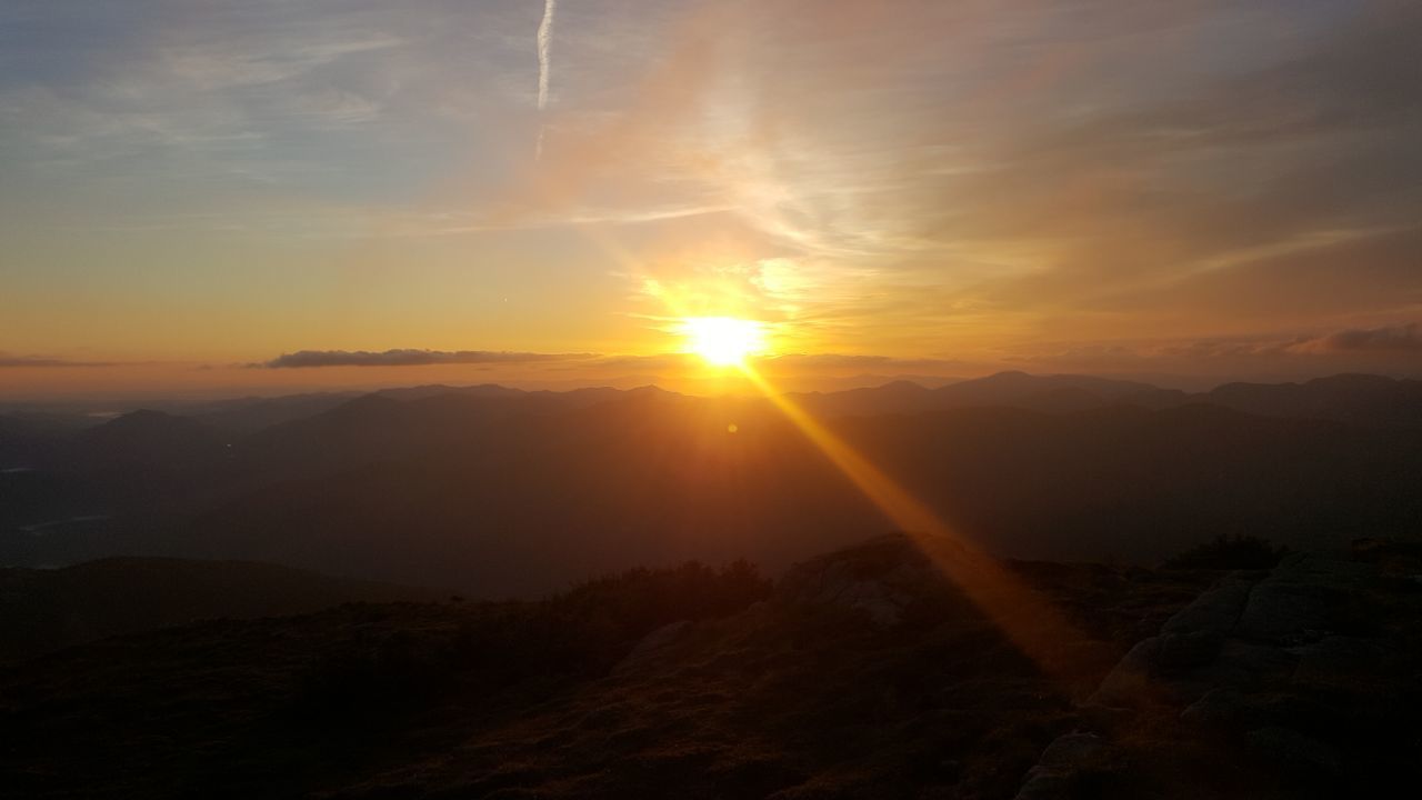
Photo Credit: Fardad Housh- High Peaks Wilderness
Highlighted Hike - Cedar Lakes Trail, Indian Lake, NY
Cedar Lakes Trail, extends 2.7 miles beyond the 1.6-mile start of the French Louie Trail making  this a 4.3-mile one-way hike to Cedar Lakes in the West Canada Lakes Wilderness. The Cedar Lake trail connects the French Louie Trail in the south and the Northville-Placid Trail in the north. It drops 80 feet in the first 0.75 mile, then climbs 305 feet in the next 1.9 miles and drops 60 feet in the last 0.6 mile to the intersection with the Northville-Placid Trail. this a 4.3-mile one-way hike to Cedar Lakes in the West Canada Lakes Wilderness. The Cedar Lake trail connects the French Louie Trail in the south and the Northville-Placid Trail in the north. It drops 80 feet in the first 0.75 mile, then climbs 305 feet in the next 1.9 miles and drops 60 feet in the last 0.6 mile to the intersection with the Northville-Placid Trail.
Camping:
Cedar Lakes Lean-to #1 is located at the end of a 0.5-mile spur trail which leaves the Northville-Placid Trail 4.5 miles north of the intersection with the French Louie Trail.
Cedar Lakes Lean-to #2 is located on the west shore of the Cedar Lakes, 1.0 mile south of the intersection with the Cedar Lakes Trail.
Cedar Lakes Lean-to #3 and designated primitive tent site are located on the northern shore of the Cedar Lakes 0.2 mile south (west) of the intersection with the Cedar Lakes Trail.
Pillsbury Mountain:
At the trail head to reach Cedar Lake is the 3,597 ft Pillsbury Mountain. It is one of the highest peaks in the Southwest Adirondacks. The short but moderate 1.6-mile trail climbs 1,500 ft before reaching the fire tower at the summit. The cab is currently closed but panoramic vistas can be offered from climbing the tower steps.
Location:
This is a much less populated area of the Adirondacks due to the remoteness of the trailhead. Pillsbury Mountain Trailhead Parking is located at the end of the Old Military Road in the Perkins Clearing Easement Tract.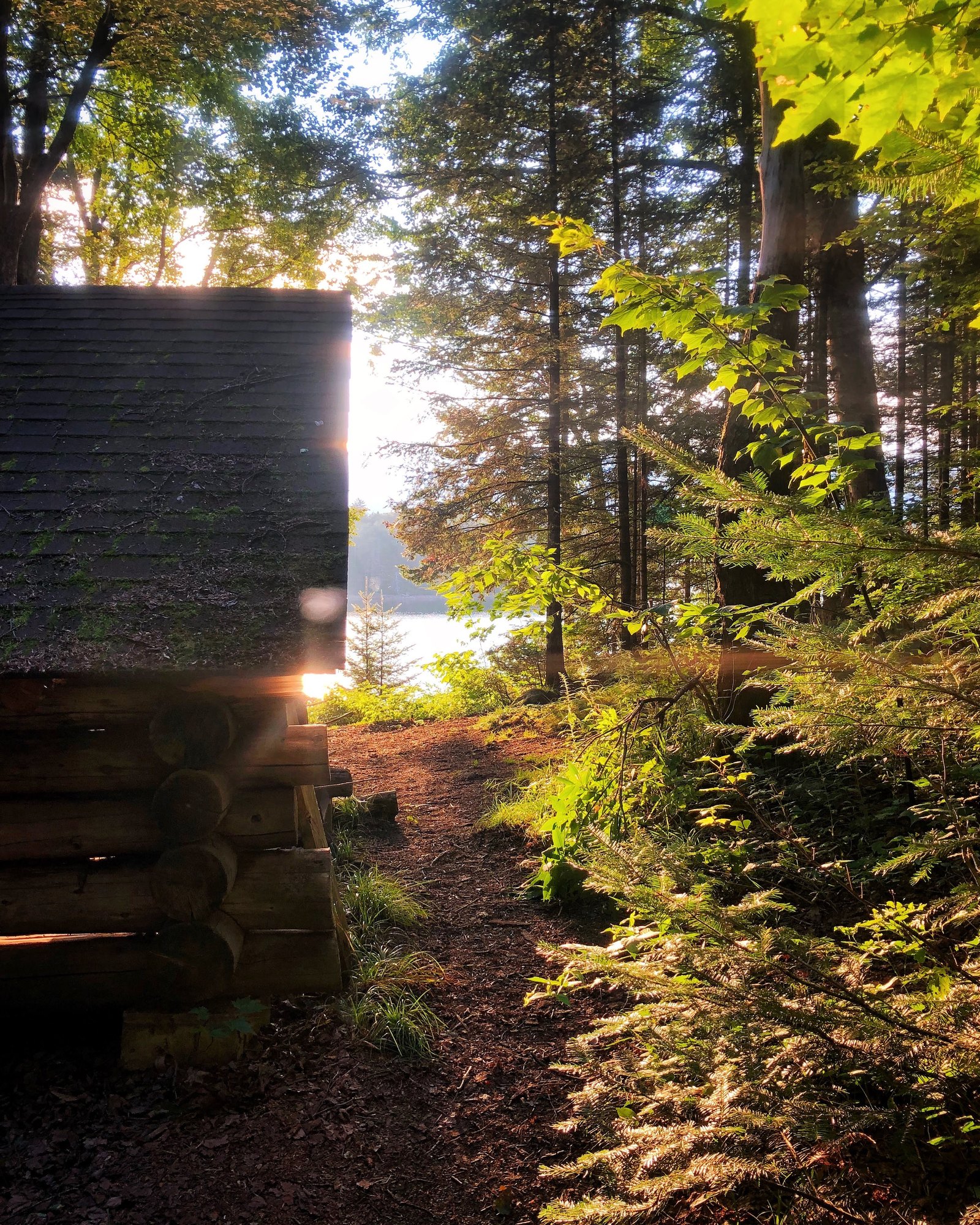
Directions:
From the junction of NY 30 and NY 8 in Speculator, drive north on NY 30 to Perkins Clearing Road and make a sharp left turn (just after passing Mason Lake). Follow this dirt road for 3.3 miles to a junction marked by a signpost and turn right.
Go 1.8 miles to another junction (just after the Sled Harbor clearing on the left) and turn right again. Drive 1.2 miles to the end of the road. There is parking for 10-15 cars at the end of the road. Because this last road is a bit rough, some people park at Sled Harbor and walk from there. However, the road can be driven by most cars with caution.
Directions courtesy of CNY Hiking
|

