Monmouth County Environmental Newsletter: August 2019
|
|
|
|
Having trouble viewing this email? View it as a Web page.
|
|
|
|
 Environmental Council Members in the All-American Selection Display Garden at Deep Cut Gardens
Monmouth County Environmental Council Visits Deep Cut Gardens
The Monmouth County Environmental Council recently had the pleasure of visiting Deep Cut Gardens in Middletown. This County Park is steeped in history and boasts a variety of attractions for the whole family to enjoy. Council members watched colorful koi fish in the ornamental lily pond, browsed the horticultural center library and strolled through the manicured grounds. Areas around the Deep Cut Gardens reflect European influences including the alpine inspired rockery garden or the rose parterre which is filled with roses, colorful annual flowers, neat boxwood hedges and flanked by the restored pergola. Members also viewed the collection of bonsai trees and tropical plants in the green house. In the front of the park, members enjoyed the All-America Selections Display Garden, one of two trial display gardens in New Jersey which showcases new award winning never before sold varieties of plants. Deep Cut Gardens is open from 8 a.m. to dusk year-round. Learn more about the County Park here, or use the interactive walking tour map.
|
|
Upcoming Environmental & Outdoor Events in Monmouth County:
Some activities require registration and/or fees:
- All-Month-Long, Mondays, Wednesdays and Fridays, 11 a.m. -12 p.m. Seining Along Sandy Hook Bay, Bayshore Waterfront Park, Port Monmouth
- Every Tuesday, Tidal Tuesdays, 11 a.m., Fisherman's Cove Conservation Area, Manasquan
-
Every Wednesday, Fishing 101, 10 a.m. -2 p.m. Manasquan Reservoir, Howell
-
Every Saturday & Sunday, Birding on the Deck, Sandy Hook Lot M Observation Deck
- Aug. 17 & 18 12 -2 p.m. Potato Harvest, Historic Longstreet Farm, Holmdel
- Aug. 24, 3 -6 p.m. Bayshore Fishing Derby, Bayshore Waterfront Park, Port Monmouth
|
|
|
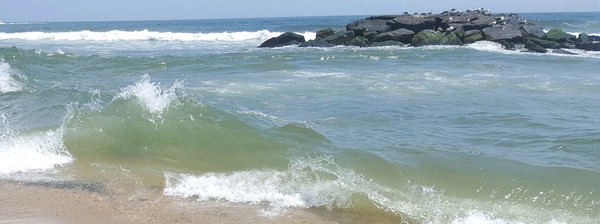
Know Your Zone This Hurricane Season
The Monmouth County Office of Emergency Management is reminding residents, businesses and visitors of Monmouth County to "Know Your Zone." This public education campaign includes an interactive Know Your Zone map, which shows the new hurricane evacuation zones and vulnerabilities to storm surge. The campaign was developed in partnership with the County's coastal municipal emergency management coordinators and is based on the threat, strength, direction and forecasted storm surge of an impending hurricane, nor’easter or other coastal flooding event. The campaign also reflects the National Hurricane Center’s (NHC) decision to separate the association of storm surge inundation from the category of storm.
Use the interactive mapper to learn in which zone you live. During hurricanes and flood events, follow instructions if your zone is issued a notice of voluntary/recommended or mandatory evacuation. For more tips on how to prepare for hazards including hurricanes, visit the Monmouth County OEM website or view the NJ Office of Emergency Management Hurricane Survival Guide for New Jersey.
|
|
|
|
|
|
 Keyport Waterfront Park provides public access to Raritan Bay. Source: Linda Brennen
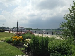
Law to Improve Public Access to Waters
Public Law 2019, chapter 81 was approved on May 3, 2019, amending the Municipal Land Use Law (P.L.1975, c.291) and instructing the New Jersey Department of Environmental Protection (NJDEP) to amend various rules for the purpose of enhancing public access to tidal waters and adjacent shorelines. Rules implementing the Coastal Area Facilities Review Act (CAFRA), Flood Hazard Area Control Act, the Wetlands Act of 1970, and the Coastal Zone Management Act were specifically noted. NJDEP recently announced that they will be holding an invitational stakeholder meeting to inform the process as they begin their review and analysis of funding and permit activities related to Coastal Zone Management and the Flood Hazard Area Control Act.
|
|
NJ FRAMES Seeking Comment by August 10
NJ FRAMES (Fostering Regional Adaptation through Municipal Economic Scenarios) is a NJDEP led regional collaborative effort seeking to understand and address future flood vulnerability in the areas surrounding the Navesink and Shrewsbury Rivers. The study uses sea level rise estimates as well as total water level estimates, which considers sea level rise, flooding caused by storms and high tide. NJ FRAMES is using these projections to examine how communities could be affected by flooding in the years 2030, 2050, and 2100. To address these future flood risks, NJDEP identified three potential scenarios for two rivers resilience: Living with the Water, Protecting our Communities from the Water and Moving Away from the Water. On July 10, NJ FRAMES hosted a public open house for stakeholders to browse maps that show potential actions for each of the scenarios. NJDEP continues to seek feedback from all stakeholders and has posted the scenario maps here. Comments are due by August 10. Stakeholder input will help the development of the future NJ FRAMES Regional Resilience and Adaptation Action Plan. Learn more about NJ FRAMES or submit a comment here.
|
|
|
Barnegat Bay Partnership Draft Revised Comprehensive Conservation Management Plan Seeks Comments
Below: Echo Lake in Howell is part of the Barnegat Bay Watershed. Source: Linda Brennen
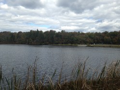
The Barnegat Bay Partnership (BBP) is a collaboration of federal, state, municipal, academic, business and private organizations dedicated to the protection and enhancement of the Barnegat Bay. Through its work, BBP considers the entirety of the Barnnegat Bay watershed, which includes the portions of Freehold, Millstone, Howell and Wall Townships that drain into the Toms River and the Metedeconk River.
As a National Estuary Program funded by the Clean Water Act, BBP is responsible for creating a Comprehensive Conservation Management Plan (CCMP) to evaluate the conditions and to establish plans to maintain and restore the estuary. In 2002, the EPA approved the BBP CCMP. In recent years, BBP has reviewed and revised its CCMP. On July 1, 2019, the Draft Revised CCMP was released to reflect the changes in the bay’s condition and emerging threats, such as climate change and sea level rise. The revised plan focuses on four priority areas: water quality, water supply, living resources and land use. For each priority, the plan specifies one or more goals, several objectives and multiple actions to achieve those objectives. To learn more about the BBP, the draft revised CCMP and how to submit comments, click here. BBP is seeking comments on the draft revised CCMP until August 31.
|
Monmouth County GIS Updates Monmouth Wastewater Management Plan Viewer
The Monmouth County Office of Geographic Information Systems (GIS) recently updated the Monmouth County Wastewater Management Plan Map Viewer to be more accessible. Upon opening, the layers list is immediately visible. Layers may also be adjusted to become transparent to easily view parcels and sewer service areas. The parcels layer was also updated to reflect current boundaries. To view parcels, the map must be zoomed. The Office of GIS also recently updated the Property Viewer Map. Use this map to search for property information on any parcel in the County.
Nominations Open for 14th Annual Women in Wildlife Awards
Conserve Wildlife Foundation (CWF) is a nonprofit organization dedicated to protecting N.J.'s endangered and threatened species through wildlife management, habitat restoration, education and citizen engagement. For 14 years, CWF has recognized women across NJ who have acted as leaders in wildlife protection through its Women in Wildlife Awards. CWS is currently accepting nominations for the 2019 awards. Nominations will be accepted in three categories: leadership, inspiration and education. If you would like to nominate a woman who has devoted her time and efforts to protecting N.J.'s wildlife, complete a nomination form by August 19, 2019. Winners will be recognized at the Women and Wildlife Awards reception on October 23, 2019.
Sustainable Jersey Offering PowerSave School Program
This school year, Sustainable Jersey is partnering with New Jersey Natural Gas (NJNG) and the Alliance to Save Energy (ASE) to offer the PowerSave Schools program. PowerSave Schools directly engages students with Science, Technology, Engineering and Mathematics (STEM) principles to promote energy literacy through lesson plans, activities and competitions. Not only does the Program offer an innovative curriculum, but it also helps schools reduce energy consumption and allows schools to gain points for certain Sustainable Jersey for Schools action items.
While 22 schools will be continuing the program this year, 13 additional schools will be admitted. Eligible schools must be registered with Sustainable Jersey and within the NJNG service area. Interested schools must submit an application by August 23. To learn about the program, access the application here.
About This Newsletter
The purpose of the newsletter is to inform Monmouth County citizens on the health of their environment and list environmental outreach events in their community. The newsletter is produced by the Monmouth County Division of Planning Section of Environmental & Sustainability Planning in coordination with the Monmouth County Environmental Council. The County of Monmouth and the Board of Chosen Freeholders do not necessarily share the viewpoints of any environmental group mentioned in this newsletter.
If you have questions, comments or wish to have an event listed in the newsletter, please contact: Amber.Mallm@co.monmouth.nj.us
|
|
|
|