Register for the 18th Annual NJAFM Annual Conference
2023 NJAFM ANNUAL CONFERENCE
OCTOBER 24th - 26th
Atlantic City, NJ
The New Jersey Association for Floodplain Management (NJAFM) 18th annual conference will focus on mitigation as the cornerstone of effective floodplain management. Mitigation takes many forms - natural resource restoration, structural elevations, floodproofing, higher regulatory standards and codes, education and training, comprehensive planning, land use management, and a host of other actions. With an increase in federal funding for hazard mitigation and infrastructure, we have a unique opportunity to work collaboratively to leverage resources and maximize investments in a broad range of actions to address chronic flood hazards now, and into the future. The conference will explore Federal and State mitigation funding programs and provide examples of how to collaborate in the funding, design and implementation of successful mitigation projects here in New Jersey.
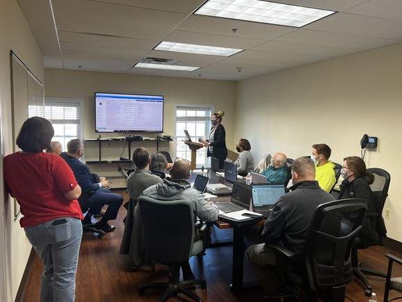
The NJAFM annual conference is the premier floodplain management conference in the Northeast. With more than 40 speakers and several hundred participants, this is the conference that regional floodplain managers from the public and private sector plan to attend. In addition, many consulting firms and product vendors associated with floodplain management attend as well.
The annual conference provides an opportunity for professionals in the fields of floodplain management, engineering, hydrology, geology, planning, code enforcement, emergency management and real estate to participate in Plenary Sessions and concurrent technical sessions on a broad range of relevant topics. The conference also includes a number of training and networking events designed to educate and inform conference attendees.
The New Jersey Association for Floodplain Management (NJAFM) 18th annual conference will be held on October 24th, 25th and 26th, 2023 at the Hard Rock in Atlantic City. The conference includes:
- A golf outing on Tuesday, October 24th.
- A series of training workshops on Tuesday, October 24th.
- A moderated Cracker Barrel session on a wide array of topics the evening of October 24th, with complimentary food and beverages.
- A full conference program on Wednesday, October 25th.
- A half-day program on Thursday, October 26th.
- A proctored Certified Floodplain Manager (CFM) exam and an ethics training session for PEs, CFMs, and PPs, both in the afternoon of the 26th.
Back to Top
In July of this year, FEMA announced the approval of revisions to the Elevation Certificate and Dry Floodproofing Certificate. The new expiration date of these forms is June 30th, 2026. These revised forms should be used moving forward and can be accessed at the FEMA website linked below:
NFIP Underwriting Forms - FEMA.gov
Highlights of the revisions to the Elevation Certificate include the following:
• A new Section H is available for use in all flood zones to determine the building's
first floor height for NFIP insurance purposes. Photos must be submitted with all
Elevation Certificates.
• Instructions for other sections have been revised and clarified, as needed, to ensure
greater consistency and accuracy in the information provided.
Highlights of the revisions to the Dry Floodproofing Certificate include the following:
• A revised format that requires separate certification of building design, elevation,
and construction.
• A new Required Documentation page.
Please note that FEMA has received inquiries requesting the usage of the expired forms and provided the following guidance:
• For NFIP insurance rating purposes, FEMA will accept a properly completed prior
Elevation Certificate or Floodproofing Certificate that is signed or certified prior to
November 1, 2023.
• For NFIP communities participating in the Community Rating System (CRS) Program,
FEMA will accept a properly completed prior Elevation Certificate or Floodproofing
Certificate that is signed or certified prior to November 1, 2023.
• In NFIP non-CRS communities, for floodplain management compliance purposes,
communities can use their discretion for certifying elevation information.
Back to top.
The Bureau of Flood Engineering and Climate Resilience has recently updated the Local Design Flood Elevation Worksheets within our model Floodplain Development Permit and Floodplain Administrator Guidebook. These updates have been made to align the worksheets with the new NJDEP Inland Flood Protection Rule flood elevation requirements. With these current updates, the Bureau continues to support our local Floodplain Administrators in their efforts on determination of accurate Local Design Flood Elevations which are fundamental to designing NFIP compliant projects.
The updated worksheets can be found either in the
The changes have been made primarily to the worksheets and involved ASCE 24-2014 “Flood Resistant Design and Construction” clarification on the classification of Classes I-IV and the difference between critical structures and noncritical structures.
The process when dealing with Critical Structures is to compare the 500-year Flood Elevation, Base Flood Elevation with additional feet added due to state standards and freeboard (Design Flood Elevation – DFE), and the 500-year flood elevation with consideration of wave height for coastal flood zones. Once these elevations have been compared, the highest elevation will be chosen and used for design in order to be conservative in the design of flooding for these Class III and Class IV critical structures.
Upon review of the process for reviewing noncritical structures, the design flood elevation is compared with the 500-year flood elevation and the lower of values governs when compared. For example, if the 500-year flood elevation is 12 feet in elevation but the design flood elevation is 11 feet, these 11 feet would govern.
The State and Bureau are hopeful that these changes will make the process of filling out the model floodplain development permit less confusing and provide a clearer way to determine the lowest design floor elevation -- regardless of if the structure is in coastal/riverine flood zones or is a noncritical or critical structure.
Back to top.
NJAFM is offering in-person and virtual self-study floodplain management training options.
NFIP Review Course (In-Person Training)
This National Flood Insurance Program Review Course is a free, no-cost training for New Jersey municipal, county, and state officials, as well as the general public, looking to expand their knowledge of floodplain management and obtain their Certified Floodplain Manager (CFM) certification. This course was developed and sponsored by the New Jersey Department of Environmental Protection (NJDEP), Bureau of Flood Engineering.
WHEN: 9:00a.m. — 4:30p.m. EDT
- Day 1: November 13, 2023
- Day 2: November 29, 2023
- Day 3: December 13, 2023
WHERE: The School of Flood, 19 Mantua Road, Mt. Royal, NJ 08061
For further details and to register for an in-person training session please visit: NFIP Review Course Details & Registration
Note: Additional dates for these training sessions will be updated at the NFIP Review Course Web Page.
Back to top.
There are many instances where a community may need to request NFIP-related data, including Repetitive Loss/Severe Repetitive Loss data, National Violation Tracker properties, policies, claims, ICC payouts, etc. To obtain this data, your community must sign an Information Sharing Access Agreement (ISAA) with FEMA. For the latest ISAA Guidance for FEMA Region 2, please use the below link:
R2_ISAA_Guidance_07122023.docx
FEMA develops the ISAA, however they require two things from the community to do so:
- A signed letter on official letterhead documenting the request, for which you may use the template language on page one of the ISAA Guidance Document. Please tailor the yellow highlighted sections, as necessary.
- The completed questionnaire on pages 4-5 of the ISAA Guidance Document. Pages 2-3 include descriptions of the potentially applicable Routine Uses. Routine Use "T" covers repetitive loss data. Other Routine Uses are: Routine Use "M" for outreach; Routine Use "R" for research; and Routine Use "O" for floodplain management (including compliance and planning).
After signing the letter and completing the questionnaire, please submit both documents to fema-r2-nfip-datarequest@fema.dhs.gov.
Questions on this process may also be submitted to fema-r2-nfip-datarequest@fema.dhs.gov.
Back to top.
Form AW-501 is the FEMA NFIP Repetitive Loss Update Form. When submitting AW-501s on mitigated properties, the form's supporting documentation must be submitted to NFIP Underwriting. Below, please find the current AW-501 Form (expires 10/31/2023), cover sheet, and the instructions which include email/mail addresses for NFIP Underwriting.
Form: 20231031_AW501_form.pdf
Cover Sheet: AW501_Transmittal_Cover_Sheet.pdf
Instructions: R2_AW501_instructions.pdf
Back to top.
The Inland Flood Protection Rule, referenced in our Summer newsletter, has been adopted, effective July 17th, 2023. A courtesy copy of the rule and additional information are available here.
The Inland Flood Protection Rule updates New Jersey’s existing flood hazard and stormwater regulations by replacing outdated precipitation estimates with modern data that account for observed and projected increases in rainfall. These changes will help reduce flooding from stormwater runoff and increase the resiliency of new developments located in flood-prone inland areas. New Jersey is the first state to use predictive precipitation modeling to implement rules to inform and protect future development and redevelopment from the impacts of climate change. Please note that the adoption of this rule will change the flood hazard area design flood elevation from being one foot above the FEMA 100-year flood elevation to now three feet above.
The Inland Flood Protection Rule establishes design elevations that are reflective of New Jersey’s changing climate and more frequent and intense rainfall, replacing standards based on outdated data and past conditions. The updated standards will apply to certain new and substantially reconstructed developments in inland riverine areas that are subject to flooding, but they do not prohibit development in these flood hazard areas. Under the two primary components of the rule:
- The elevation of habitable first floors will be two feet higher than currently indicated on DEP state flood maps and three feet higher than indicated on FEMA maps.
- Applicants for certain permits will use DEP’s New Jersey-specific precipitation data when calculating peak flow rates of streams and rivers for permits under the Flood Hazard Area Control Act Rules, N.J.A.C. 7:13, as well as when proposed development triggers compliance with DEP’s Stormwater Management rules, N.J.A.C. 7:8.
Studies commissioned by the Murphy Administration regarding increased intensity of current and projected rainfall events indicate that additional resilience actions must be taken to better protect New Jersey’s people, communities, and public and private assets. In an effort to close severe climate data gaps and provide a reliable scientific basis for regulatory adjustments, the DEP commissioned New Jersey-specific studies that confirmed precipitation has increased in the state over the past 20 years and will continue to increase through the end of this century. The peer-reviewed studies, released in November 2021, were performed by the Northeast Regional Climate Center, a partner of the National Oceanic and Atmospheric Administration.
Key findings showed that:
- Precipitation amounts that long guided state policy, planning and development criteria relied upon data obtained through 1999 and did not accurately reflect current precipitation intensity conditions. Extreme precipitation amounts are 1 percent to 15 percent higher now than the 1999 data suggests. Therefore, the 1999 data previously in use is outdated and not reflective of current precipitation.
- Precipitation during the 100-year storm is likely to increase by 23 percent to 50 percent above the 1999 baseline by 2100. These numbers represent the upper end of the likely range as defined by the Intergovernmental Panel on Climate Change (IPCC). Projected changes will be greater in the northern part of the state than in the southern and coastal areas.
The updated standards in the Inland Flood Protection Rule will apply to new or reconstructed developments and not to existing developments. Pending development applications before the DEP that are administratively complete at the time of adoption are not affected by these changes. Existing provisions of the flood hazard and stormwater rules that provide flexibility from strict compliance based on unique site-specific conditions will remain in place, along with new provisions designed to ensure that infrastructure projects already in progress can continue to move forward.
The final rule also provides clarifications for the legacy provision of the Flood Hazard Area Control Act rules at N.J.A.C. 7:13-2.1 to address projects that were wholly located outside the prior flood hazard area, and which have already received local approval under the Municipal Land Use Law. As initially proposed, this exemption from the new flood elevations would have been limited to those projects that had begun construction before the new rules were adopted. In recognition of the often-significant investments made for projects that have reached the stage of receiving municipal approval, the DEP is retaining the existing exemption for such projects.
In connection with the proposed Inland Flood Protection Rule, to aid the public to gauge flood risk and provide a visual approximation of regulatory jurisdiction on specific parcels, the DEP has launched a flood indicator tool.
While the tool does not provide a definitive demonstration of regulatory jurisdiction or calculate actual risk, it can be useful in assisting property owners or prospective property owners on potential risk and, by referencing the 500-year flood extent, approximate DEP’s regulatory jurisdiction and flood risk. Equipped with this information, property owners may then decide to take additional steps to determine actual risk, which is dependent on site-specific conditions.
Back to top.
|