 New Trail Openings!
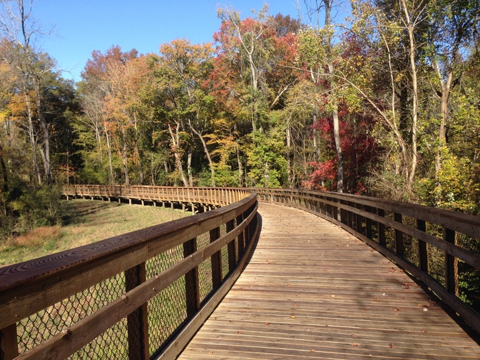
By the end of the year, the Capital Area Greenway System will add over ten additional miles to the existing 104 miles. Three projects, the Crabtree Creek Trail east extension project, the Horseshoe Bend section of the Neuse River Trail, and the Honeycutt Creek Trail will be wrapping up in the next few weeks.
The Crabtree Creek Trail extension is approximately 4.1 miles. The trail connects to the existing trail at Milburnie Road, extends along Crabtree Creek and finally joins the Neuse River Trail at Anderson Point Park. This project will be complete by the end of November.
The 0.8 mile Horseshoe Bend section of the Neuse River Trail will be complete in early December. This section is the final gap in the Neuse River Trail. When complete, it will extend over 30 miles from the Falls Lake Dam to the Sam's Branch Trail outside of Clayton.
The Honeycutt Creek Trail is expected to be complete by the end of December. The trail is over 5.6 miles long and begins at the existing East Fork Mine Creek Trail at Longstreet Drive. It continues upstream along East Fork Mine Creek ,across Strickland Road, underneath I-540 and through Honeycutt Park. At Durant and Honeycutt Roads the trail transitions to an unpaved natural surface trail that will connect to the South Shore Trail at Falls Lake Recreation Area.
|
 Capital Area Greenway Planning and Design Guide Now Ready for Review
With over 100 miles making up more than 28 different
trails, the Capital Area Greenway system is one of the jewels of the City of
Raleigh. In order to continue to serve as a highly functional,
multi-use, recreation and transportation trail network, as well as an
environmental conservation tool, City staff have developed a planning and design
guide.
The document will be presented to
the City of Raleigh Parks, Recreation and Greenway Advisory Board (PRGAB) on
Nov. 20 at 6 p.m. in the Council Chamber of the Avery Upchurch Government
Complex for review. At the meeting, there will be opportunity to comment.
To download a draft of the guide and comment online, visit YourParksYourFuture.com or visit the Greenway homepage.
For over four months, City staff worked in
conjunction with the PRGAB Greenway and Urban Trees Committee and the Bicycle
and Pedestrian Advisory Commission’s Joint Bicycle and Pedestrian Planning
Committee to review and revise the guide. Following the review and comment
period, the PRGAB will recommend sending the document to the Raleigh City Council
for review and adoption.
Once completed and implemented, the
guide will serve as a template for City staff and consultants as they develop
future greenways, trails, ancillary facilities and amenities. The guide will
offer new greenway trail classifications, design standards, and trail
management guidance. This guide will
supplement the Department’s System Plan.
|
Trail Closures and Alerts
Trail closures are listed below. Please visit the Greenway Maintenance Page for updated closures and repair projects.
Neuse River Trail
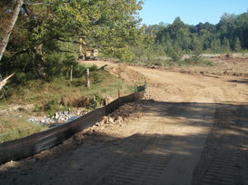
Horseshoe Farm Nature Preserve will be closed through March 2015 while Phase 1 renovations to the park and access road are being made. Neuse River Trail access to and from the park will also be closed during this time. There are several available parking lots for access to the Neuse River Trail between Horseshoe Farm Park and Buffaloe Road Athletic Park including lots at 200 Trailhead Lane, 4901 Elizabeth Drive and 5812 Buffaloe Road (Buffalo Road Athletic Park).
Wake Forest's Smith Creek Greenway, which extends from the Neuse River pedestrian bridge (near mile marker 4.75) to Burlington Mills Road will be closed until April 2015 for the work in this area. No impacts or closures to the Neuse River Trail are expected due to this work.
|