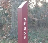
 Neuse River Trail Project Updates
Section Opens - The 3.5 mile long section of trail extending from Anderson Point Park to Skycrest is complete. This section has two bridges over the Neuse River, one south of Milburnie Dam and one north of Anderson Point Park. Paved parking lots are located off of Anderson Point Drive and at Allen Drive, off of Raleigh Beach Road.
What's Next - Depending on the weather, three more sections are expected to open in early 2013. These are the County Line to Auburn Knightdale section, the Auburn-Knightdale to Poole Road section, and the 401 to Skycrest section.
What's Left - The Poole Road to Anderson Point section, which includes the Poole Road parking lot, is expected to be completed in the spring. The Riverbend section extending from WRAL soccer complex to north of 401 should be completed early 2014.
|
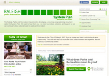 Your Parks, Your Future
Raleigh's Parks and Recreation System Plan Update
|
Public Meetings Coming Up!
The new Parks and Recreation System Plan Project is a 16-month comprehensive process that will shape the direction, development and delivery of the city's parks and recreation services over the next 20 years.
As a part of the process to update the Parks and Recreation System Plan, a series of public forums are being held in January. These meetings will focus on identifying the needs and priorities of the Parks and Recreation System. Times and locations are listed under the Events section.
Can't make the meeting or want to get involved now? Visit www.yourparksyourfuture.com a community engagement website, that allows you to submit your ideas, review documents, find meeting dates, take surveys, learn more about the process, and get involved with the System Plan update.
 Smartphone Greenway App
Now available for Android Phones
RGreenway, a smartphone application or "app" that incorporates the City's GIS greenway trail data to make exploring the trails easier, was released in September for iPhones and is now also available for Android phones.
The app, developed independently from the City, provides user location, trail connections, parking, and points of interest. Additional information, as well as a link to download the app can be found at RGreenway.com
|
Alerts
Bridge Replacement Closure
Bridge replacement and trail repairs will soon begin at several locations. Access at these locations will be restricted. 1) Fallon Park, along Oxford Road at Kenmore Drive, (2) Lions Park, along Bridges Branch , (3) Lake Johnson Park, adjacent to the Waterfront Center, and (4) Crabtree Creek Trail at Rothgeb Park off Rothgeb Drive. Please see the project page for more details.
Walnut Creek Trail Closure
The Walnut Creek Trail will be closed through December 21st between Garner Rd. and Wilmington St. for Public Utilities re-use waterline work. More>>
Centennial Bikeway Connector Closure
The Centennial Bikeway Connector will be closed from Achievement Drive to Lake Wheeler Road beginning December 15th through February 15th for Public Utilities re-use waterline work. More>>
Crabtree Creek Trail Closure
The Crabtree Creek Trail between N. Raleigh Boulevard and Atlantic Avenue will be closed from December 17th through February 15th for Public Utilities sewer line work. More>>
Buffalo Road Canoe Launch Closed
The Buffalo Road Canoe Launch is closed while the Skycrest to 401 section of the Neuse River Trail is under construction. It is expected to re-open in January. More>>
Poole Road Canoe Launch Closed
Poole Road Canoe Launch will be closed for construction of the Poole Road to Anderson Point section of the Neuse River Trail. Construction on this section of trail is expected to be complete in spring 2013. More>>
|