|
|
N.C. Highway 12 Remains Closed; NCDOT Planning Emergency Ferry Activation
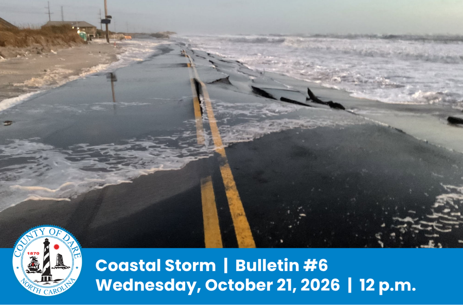
N.C. Highway 12 remains closed between the Marc Basnight Bridge and Rodanthe. The North Carolina Department of Transportation (NCDOT) reports approximately 800 feet of pavement damage near the Pea Island Visitor Center, where persistent waves have undermined the roadway. Approximately 1,800 feet of protective dunes have been lost in that area, and significant wind-blown sand has accumulated in the Canal Zone.
Additional high tide cycles and continued ocean overwash must subside before NCDOT can fully assess the damage and determine what repairs will be needed. A timeline for reopening the highway cannot be established until that assessment is complete.
Dare County is coordinating closely with NCDOT, which is in the planning stages of activating the emergency ferry route between Stumpy Point and Rodanthe. NCDOT will announce departure schedules if the route is activated.
Do not attempt to travel on the closed section of N.C. Highway 12 or drive around barricades. Conditions remain unsafe.
Coastal Flooding and Overwash Continue Through Thursday
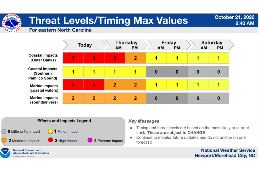
According to the National Weather Service, coastal flooding and ocean overwash will continue through Thursday, October 22. Water levels during high tides today and Thursday could be similar to or higher than those already experienced.
The next high tides are expected around 4:30 p.m. today, Wednesday, October 21, and 5 a.m. Thursday, October 22. Further flooding, erosion and overwash are possible during these periods.
Winds are expected to ease Thursday, and seas will gradually subside. However, coastal flooding will remain a concern. Minor soundside flooding also remains possible, particularly on southern Hatteras Island.
Residents should prepare for the possibility that roadway access will remain unavailable for multiple days. Dangerous ocean conditions persist. Stay out of the ocean and away from areas affected by overwash.
State of Emergency Remains in Place; No Visitor Entry
Dare County’s state of emergency and mandatory evacuation order for Hatteras Island visitors remain in effect. Visitors are not permitted to enter Hatteras Island at this time. Dare County will announce when restrictions are lifted.
The evacuation order applies only to Hatteras Island visitors. Hatteras Island residents and areas north of Oregon Inlet are not under an evacuation order.
Visitors with upcoming Hatteras Island reservations should not travel toward the island at this time. They should contact their accommodations provider directly about their reservation. Dare County cannot change lodging reservations or provide information about individual accommodations.
Updates & Road Conditions:
Continue following official updates at DareNC.gov/Storm. To receive emergency text alerts from Dare County, text DareEmergencyAlerts to 77295.
For additional information or questions, call the Dare County Emergency Management Information Line at 252-475-5655.
The next bulletin will be issued no later than 12 p.m. on Thursday, October 22.
Dare County Public Works Trash Collection:
Trash collection on Hatteras Island is suspended until N.C. Highway 12 becomes safe for travel. An updated collection schedule will be announced once conditions allow service to resume. Subscribe to receive email and/or text updates regarding trash collection schedule changes for unincorporated areas of Dare County at DareNC.gov/Trash.
National Park Service – Cape Hatteras National Seashore:
Cape Hatteras National Seashore campgrounds and lighthouse climbing operations are currently closed. The reopening of off-road vehicle ramps will be announced at http://go.nps.gov/beachaccess..
As a reminder, several privately owned oceanfront houses in Rodanthe remain structurally compromised and at risk of collapse, creating significant safety hazards because of exposed septic systems and instability during periods of high surf and strong onshore winds. If a house collapses, visitors should avoid walking, swimming or engaging in recreational activities near or downwind of the collapse site, as debris may be transported for miles along the Cape Hatteras National Seashore.
|
|
|
|