|
Hurricane Erin Bulletin #3
Tuesday, August 19, 2025 | 11 a.m.
 Life-threatening storm surge, waves up to 20 feet, and impassable road conditions expected
Dare County Emergency Management Director Drew Pearson is urging residents and visitors to take immediate precautions as Hurricane Erin approaches the North Carolina coast.
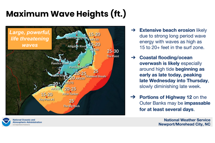
Dare County is now under a Tropical Storm Watch, a Storm Surge Watch and a High Surf Advisory. According to the National Hurricane Center, life-threatening storm surge of up to 4 feet above ground level is possible, with dangerous wave action on top of the surge.
Storm surge flooding could begin impacting vulnerable portions of N.C. Highway 12 on Hatteras Island with this afternoon’s high tide, around 5 p.m. Once inundation begins, it will persist for several days, worsening with each tide cycle. N.C. Highway 12 is expected to become impassable, making it extremely difficult—if not impossible—for emergency services to respond.
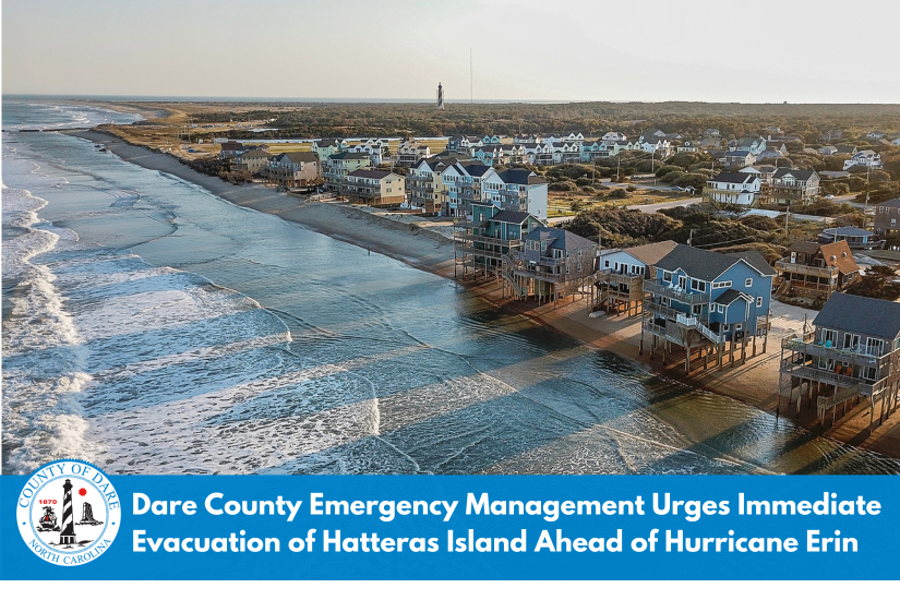
“It is imperative that any visitors on Hatteras Island who have not already evacuated do so immediately—before travel becomes unsafe and your safety is put at risk,” Pearson said.
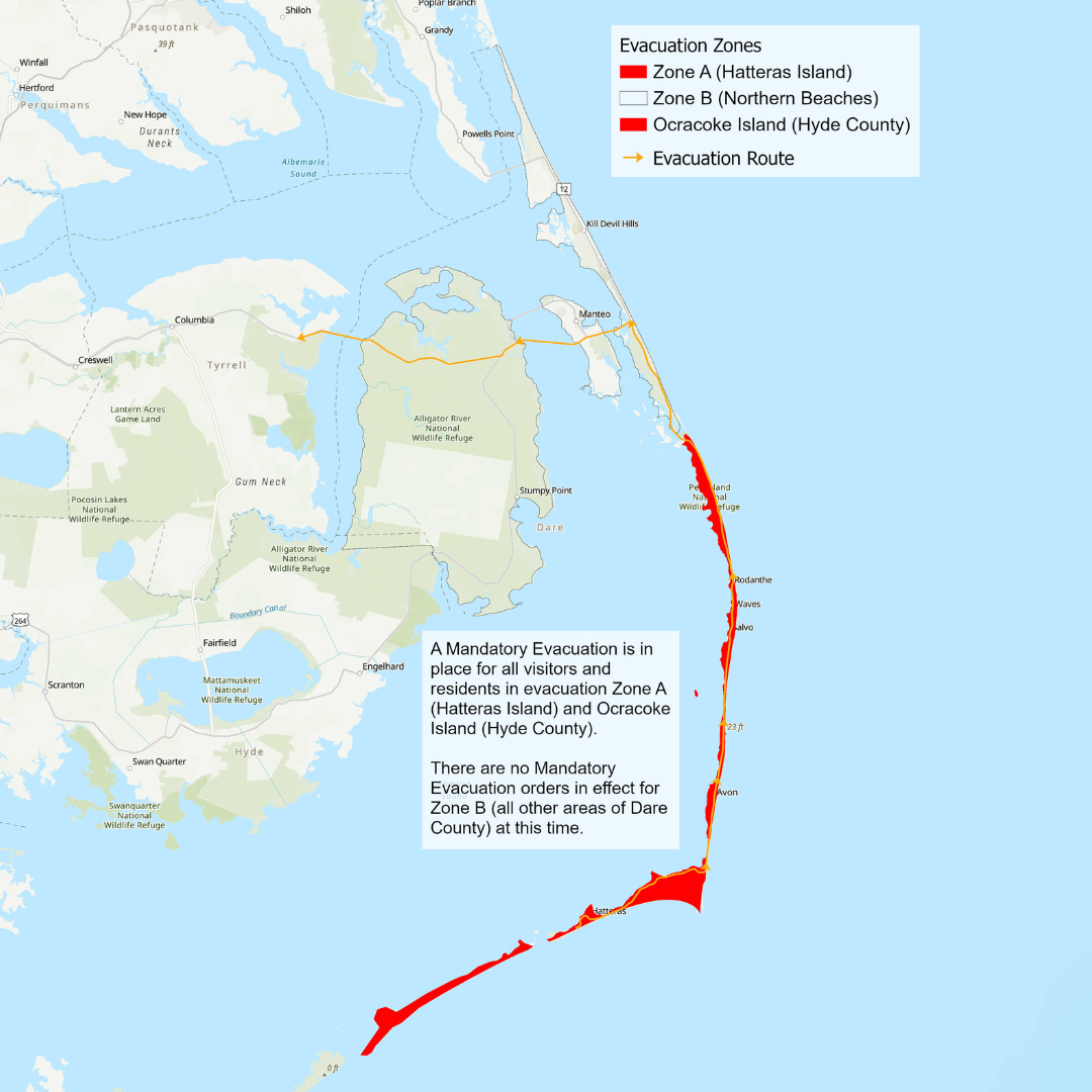 A Mandatory Evacuation order for Hatteras Island residents went into effect at 8 a.m. today. Pearson stressed the seriousness of the situation:
“I know many who live on the island feel they can ride out a storm, but Hurricane Erin is different. Extended flooding and the threat to Highway 12 will severely limit our ability to respond—and even a slight shift in Erin’s track toward our coast could bring much more dangerous conditions. Please, do not take the risk. Evacuate now, while it is still safe to do so.”
While the most extreme impacts are expected to occur on Hatteras Island, residents and visitors north of Oregon Inlet—on the northern beaches—should also remain alert. Coastal conditions will worsen as the storm passes offshore. Rising ocean waters may require moving vehicles and securing property.
Dare County Emergency Management will continue to provide updates as conditions develop. For the latest official information, visit DareNC.gov/Erin, follow Dare County Government on social media, and sign up for emergency alerts.
“Please take this storm seriously, stay safe, follow all evacuation and safety guidance, and stay out of the ocean,” Pearson said.
 To view the latest weather briefing from the National Weather Service at Newport/Morehead City, N.C., please click the button below.
Stay Informed & Prepared:
Sign Up for Local Alerts:
-
Emergency Alerts: Sign up to receive customized alerts—including severe weather watches and warnings, evacuation orders, and other time-critical notifications—at www.OBXAlerts.com
-
Beach & Ocean Conditions: Get daily beach condition updates via text by texting “OBXBeachConditions” to 77295. For rip current safety, red flag warnings, and more, visit LoveTheBeachRespectTheOcean.com.
Dare County Emergency Management will continue to issue periodic updates, with the next update scheduled no later than Tuesday, August 19, 2025 at 4 p.m.
|