NEWS RELEASE
FOR IMMEDIATE RELEASE:
June 23, 2024
MEDIA CONTACT: Dana Kazel, Communications Manager
218-725-5049 (office) • 218-591-2219 (cell)
St. Louis County provides update on flood situation and ongoing work for June 23
Flood waters have receded in Cook, allowing recovery efforts to move fully forward. Meanwhile the Biwabik community continues to deal with flooding, and sandbagging is underway in Brookston as the St. Louis River continues to rise. St. Louis County Emergency Management continues to work with local jurisdictions to coordinate resources and prepare for future flooding.
The St. Louis County Rescue Squad went door to door last night to approximately 175 residents on Bear Island Road to notify them of potential flooding from the Island Lake Reservoir in preparation of possible evacuations. Thankfully the water level has not risen further, so no evacuations have been needed.
The County has now recorded more than 1,000 damage points - including to public infrastructure and private property - as a result of the June 18 rain event.
Anyone who has sustained damage to their property is asked to complete an online damage reporting form for the County Assessor's Department, and to include descriptive photos of damage if possible. Assessor staff will be inspecting damaged property and in instances of significant damage, the property owner may be eligible for relief. A link to the damage reporting form can be found online at stlouiscountymn.gov/flood. People also can call the Assessor's Department at 218-726-2304 to request a form be sent to them. Some local jurisdictions have also requested residents file a report with them. People who have done so should still complete the county's form.
Public Works has reported one new road closure southeast of Embarrass. The complete list of closures is as follows:
District 4 (northern St. Louis County)
- NEW: CR 362 Waisanen Rd at the intersection with CR 558 Palo-Tia Rd.
-
CSAH 138 Giants Ridge Rd (CR 416 Tower/Biwabik Rd – Terminus)
-
CR 356 Range Line Rd (Fire # 9339 – CR 923)
-
CR 421 Sassas Rd (State Hwy 1 – CSAH 87 Leander Rd)
-
CR 431 Short Rd (CR 948 – CSAH 115)
-
CR 467 Heino Rd (State Hwy 53 – CR 912 Ralph Rd)
-
CR 467 Heino Rd (State Hwy 53 – CR 430 Burghardt Rd)
-
CR 481 Carpenter Rd (UT 8163 Graham Rd – UT 8157 Goodell Rd)
-
CR 481 Carpenter Rd (CR 500 – CR 958 Plum Creek Rd)
-
CR 481 Carpenter Rd (TH 1 – CR 540 Olson Rd)
-
CR 491 Roini Rd (CSAH 82 – UT 8157)
-
CR 492 E Anton Rd (CR 912 Ralph Rd – State Hwy 53)
-
CR 492 Anton Rd (west of State Hwy 73 from Fire # 11244 – Terminus)
-
CR 600 Johnson Rd (CR 948 – CSAH 115)
-
CR 620 Salo Rd (90 corner – UT 6301)
-
CR 652 Goodell Rd (State Hwy 53 – CSAH 82 Heino Rd)
-
CR 796 Kaunonen Lk Rd (Cemetery Rd – CSAH 21)
-
CR 912 Ralph Rd (CR 652 Goodell – CSAH 82 Heino Rd)
-
CR 912 Ralph Rd (CR 467 Heino Rd – CR 492 E Anton Rd)
-
CR 914 Watt Rd (CR 500 – CR 958)
-
CR 923 Leander Rd (CR 912 Ralph Rd – Terminus)
-
CR 931 Murray Rd (CSAH 22 – CR 491 Gustafson Rd at Bridge)
-
CR 936 E Hannula Rd (State Hwy 53 – Terminus)
-
CR 939 N Riddell Rd (TH 1 – North Terminus)
-
CR 958 Alango Rd (CR 914 – CR 938)
-
UT 8110 CR 361 (State Hwy 1 – CSAH 115)
-
UT 8110 CR 361(TH 1 – CSAH 115)
-
UT 8117 Jackpine Lane (TH 73 – Terminus)
-
UT 8143 North Peterson Rd (TH 1 – CR 107)
-
UT 8157 Goodell Rd (CR 491 Roini Rd – State Hwy 73)
District 5 (Duluth and surrounding townships) - all roads are now open
District 6 (Central St. Louis County including quad cities)
- Bodas Road from McKinley east to Barker Rd.
- Brimson Toimi Road between Hwy 16 and Little Creek Road
District 7 (Southwestern St. Louis County)
- South Townline Road (CR 442) from Hingeley Rd. to two miles east of Hwy 73
- Sherwood Anderson Road between Williams Road and Osborn Road
- Shaw Road between Hayes and 92
- Green Rock Road by Belchner Road
St. Louis County residents affected by last week's storm and aftermath are encouraged to visit the County's online flood resource page at stlouiscountymn.gov/flood to find a map of current road closings, a link to file damage reports online, guidance for handling flooded septic tanks and wells, and other resources.
###
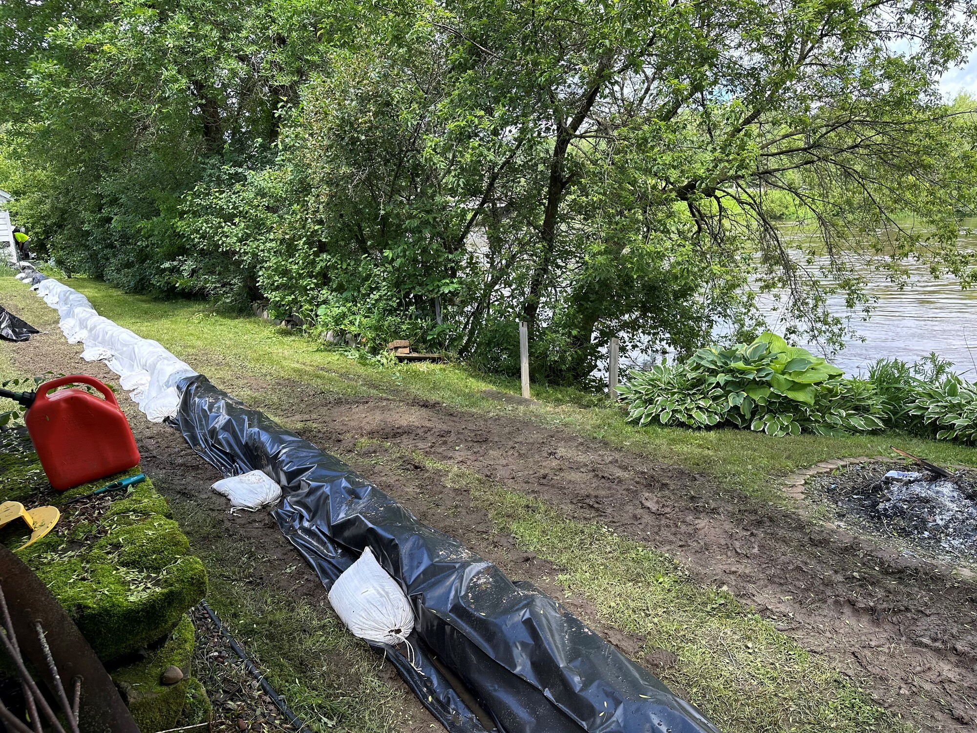
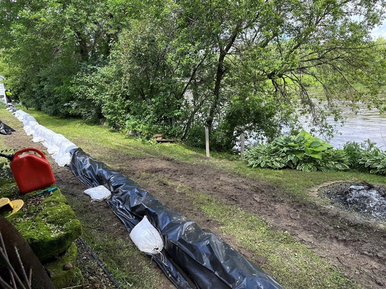 As the St. Louis River continues to rise, St. Louis County delivered sandbags to the Brookston to help residents prepare.
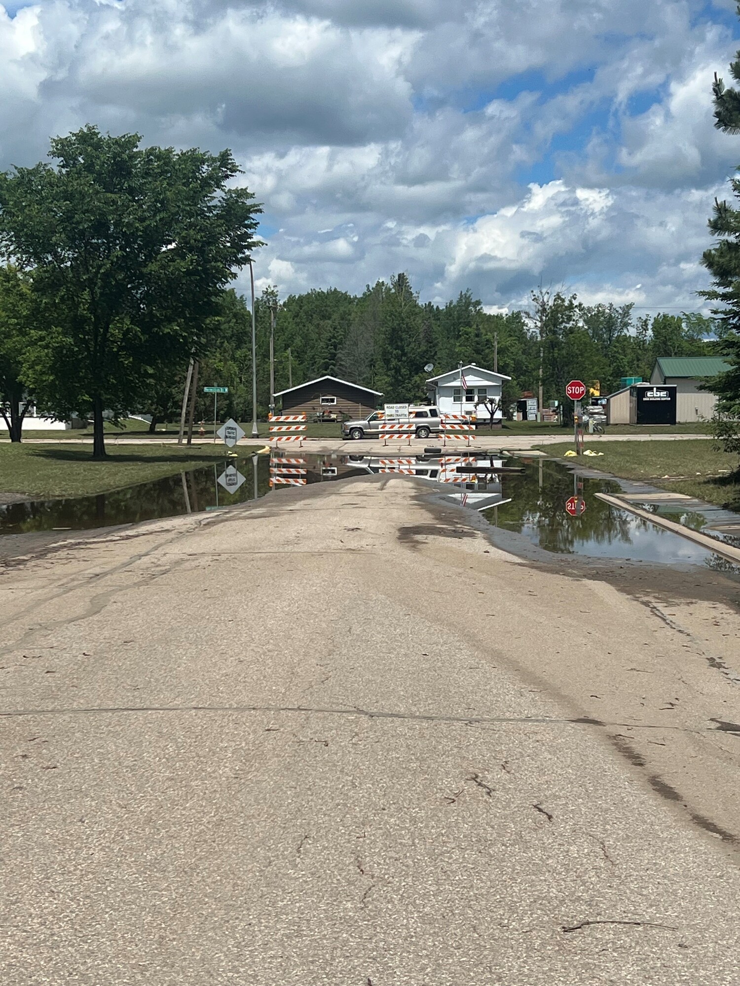
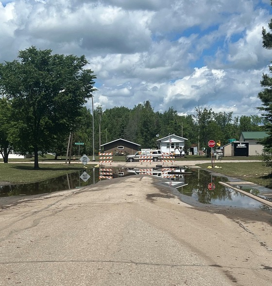 Flood waters have largely receded in Cook, allowing for clean up efforts to move forward.
 Water levels remain very high on Sabin Lake in Biwabik.
|