|
|
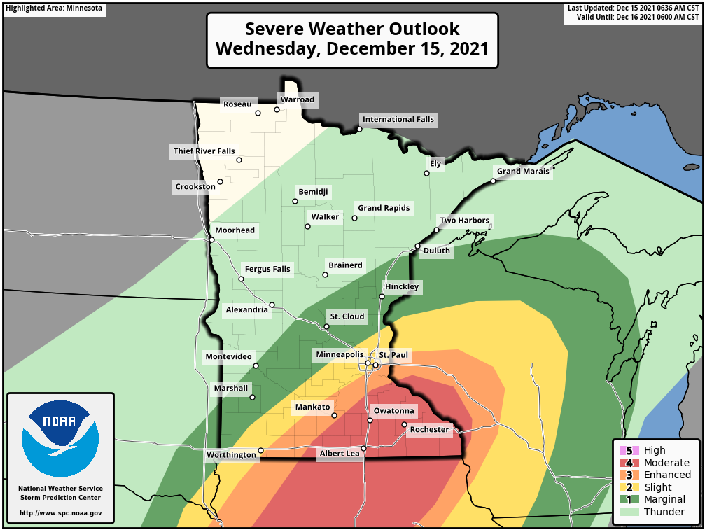
A significant low pressure system will move into the region today and track across the MN/IA border this afternoon. Despite being mid-December, enough energy will exist with this system to produce a line of severe thunderstorms across southern Minnesota capable of producing damaging straight-line winds over 75mph and tornadoes. Thunderstorms are expected to develop in the late afternoon and rapidly move northeast and exit the state by late evening. The threatened area includes Albert Lea, Mankato, Rochester, Winona, and the Twin Cities.
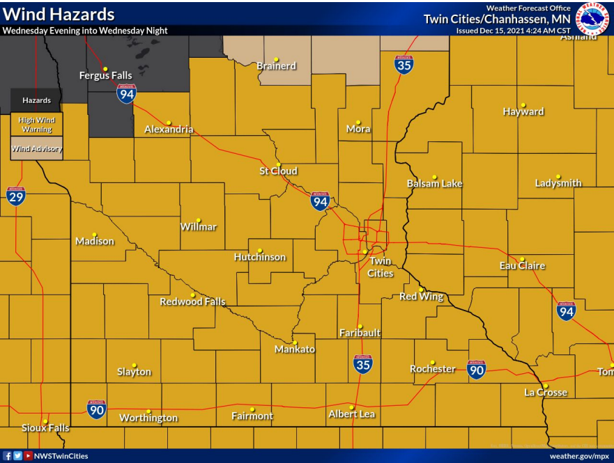
In addition to the severe weather, strong sustained winds of 30-40 mph will persist across all of southern Minnesota overnight. Peak wind gusts of 55-60 mph are likely, with some areas exceeding 65 mph.
The highest rainfall totals are expected across northeast Minnesota, where 1-1.5 inches are possible before precipitation switches to snow overnight. Locally higher amounts are possible from thunderstorms across southern MN. Temperatures will quickly drop below freezing overnight, and result in freezing of residual water from evening rainfall on roads, bridges, and overpasses. This may produce hazardous driving conditions across central and southern MN Thursday morning.
Surprisingly, snowfall amounts take a backstage for this event. Accumulating snow will be limited to the far northern part of the state. Heavy accumulations approaching 6 inches will be possible from Detroit Lakes to International Falls.
|
|
-
What: Severe weather, including damaging winds and tornadoes, strong sustained winds, heavy rain, flash freezing on roadways
-
Where: Southern Minnesota – severe threat and strong sustained winds; Southern and Northeast Minnesota – heavy rain and flash freezing; Northern Minnesota – accumulating snow
-
When: Wednesday afternoon through Thursday morning
-
Impacts: Damaging thunderstorms possible. Travel overnight will be hazardous due to high winds. Travel and commuting will be hazardous Thursday due to freezing of water on roadways.
|
|
|
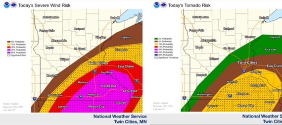
The Storm Prediction Center upgraded the severe weather risk overnight to moderate (4/5) across southern and southeast Minnesota. A line of fast moving thunderstorms is expected to develop around 6 PM across southern MN, near Mankato and Albert Lea, and rapidly move northeast. These storms are expected to reach Rochester, the Twin Cities, and Winona by 9 PM. The primary threat is damaging straight-line winds. Wind gusts of 60-90 mph are possible. There is also the potential for tornadoes across southeast MN this evening. Despite being mid-December, this is a threat that should be taken seriously. Stay aware and be prepared to seek shelter if severe weather approaches your area tonight.
A moderate risk typically occurs in Minnesota once every 1-2 years. One has never been issued in winter in Minnesota. The last December slight risk for Minnesota was December 5, 2001. The magnitude of this event is likely to be unprecedented for December in Minnesota.
|
|
|
Strong sustained winds of 30-40 mph, with 55-65 mph gusts, are expected overnight mainly across the southern half of the state. Travel overnight could be impacted.
 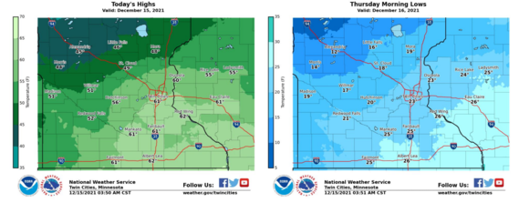 Heavy rain is expected across much of southern and northeast Minnesota this evening. One to one and a half inches of rain are possible across this area. Temperatures will then drop quickly overnight, as the low pressure system exits the region and winds switch from the south to northwest. This will result in freezing of residual water on roadways, bridges, and overpasses. Travel and commuting Thursday could become hazardous.
Finally, far northern Minnesota is expected to see accumulating snowfall overnight. Snow will develop across northwest Minnesota late this evening. Rain will change to snow overnight across the Arrowhead. The northern 1/3rd of the state can expect 2+ inches of accumulation. A narrow band of heavier snow, 6+ inches, is possible from Detroit Lakes to International Falls.
|
|
|
Thanks!
MPCA Meteorologists
|
|
|
|