|
The monitoring season is winding down and we are in our final week to take clarity readings on your lake or stream. After that, yet another Secchi season comes to a close!
2020 has turned out to be a strange year. With the delayed start of our monitoring season due to stay-at-home orders, and then needing to socially distance while monitoring, it's been a season like no other. We are so grateful for the lake and stream monitoring you did this summer in spite of it all and we hope it even brought some normalcy back into your daily life!
We look forward to receiving your 2020 Secchi data and ask that you please send it to us by October 31st, if possible. This gives us the time needed to enter it into our database and prepare it for display through our online reporting system.
As a reminder, you can submit your data to us electronically using our Microsoft Excel template. Download the file to your computer, fill it in with your data, attach it to an email addressed to us, and you're done! If you submit your data electronically, you can keep your paper datasheet for your records. Important Note: DO NOT reply to this newsletter email with your 2020 Secchi data. The CMP DOES NOT receive any replies through the newsletter delivery system. Please send a separate email to us at the following addresses with your 2020 data: clmp.pca@state.mn.us (lakes) and csmp.pca@state.mn.us (streams)
You can download both the Lake and Stream Excel Electronic Datasheets from the Resources for Volunteers page on our website.
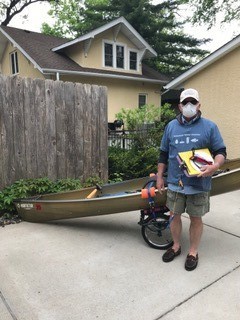
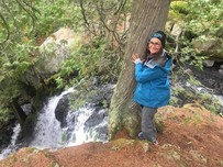
Photo Caption: CLMP volunteer Mike Brinda, heading out to monitor Lake Harriet.
Back to top
|

The MPCA is excited to announce we are partnering with U of M Extension to offer an advocacy training program for Citizen Lake and Stream Monitors this fall! Online modules will take place October 26 - November 20, with final activity: December 1, 2 and 3 from 10-noon via Zoom. Register now by following this link:https://z.umn.edu/EmpowerU2020water
Do you care about water issues in Minnesota? Have you ever wanted to talk with a resource manager, local decision maker or elected official about the health of your favorite lake or stream but don’t know how to go about it? You can learn how to influence management decisions! This program helps citizen water monitors and other water related volunteers grow their skills to meaningfully engage decision makers about Minnesota's lake and streams.
At the end of this training you will:
- Understand the roles and levels of government and who to contact regarding stream and lake management.
- Learn to use skills such as influence, power, persuasion, framing, questioning and listening in interactions with decision makers.
- Know where to find reputable information on the status of lakes and streams in your area.
- Have an engagement plan and experience practicing it in a safe, peer-learning environment.
- See yourself as a resource to decision makers on lake and stream management.
- View engagement with decision makers as a norm and encourage others to do it.
- Network with other people passionate to make a difference around lake and stream issues.
Most importantly, you will be able to apply what you have learned in this course to confidently share information with decision makers, give input on policies and plans, and be an active voice in lake and stream management.
Back to top
|

In light of the recommendation to continue social distancing guidelines into the foreseeable future, we feel it necessary to move our annual gathering, the Secchi Social, to a virtual format rather than in person. We look forward to this event every year and are disappointed we won't get a chance to see many of you in person this year, but it will make next year even sweeter! We plan to host our virtual Secchi Social at noon on Thursday, November 5th, during our regular November lunch-time webinar series. We plan to have a great speaker and spend time honoring the great work of our lake and stream monitors. We will send an email invitation with the link to join the webinar about a week before the event. We hope you will join us!
Back to top
|
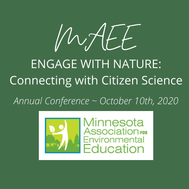
Like most meetings this year, the Minnesota Association for Environmental Education 2020 Annual Conference will be virtual! The event will be held Saturday, October 10 from 8 am to 2 pm. Conference participants are invited to do some hands-on citizen science prior to the event - MPCA Citizen Water Monitoring is one activity offered - and then join a virtual session to share their experience and learn more about the programs. Other tracks include Monarch Conservation, Carp Tracking, Pesky Plant Tracker, iNaturalist and Worm Rangers.
The Keynote speaker will be Carrol Henderson, who will give a historical perspective on local citizen science projects and share his personal experience as a renowned hero for Minnesota wildlife.
Find out more and sign up to participate at Virtual MAEE 2020 Conference
Back to top
|

During August and early September, a small group of Citizen Water Monitors helped the MPCA test a new online system for entering their data and enrolling as new participants in the Citizen Lake and Stream Monitoring Programs. The online testers found a few bugs and offered valuable feedback on their experience with the system. Over the coming weeks, IT staff at the MPCA will be refining the system based on feedback received. It is currently uncertain when the new system will be ready to use, but stay tuned for an official launch date! Back to top
|
MPCA water monitoring was limited in 2020 due to COVID social distancing protocols. Staff were unable to conduct lake monitoring or collect fish samples because both activities are conducted in teams for safety reasons. Thankfully, stream monitoring staff were able to collect water samples at sites across the state and biological monitoring staff were able to collect aquatic macroinvertebrates (bugs). So, even in these challenging times, the MPCA safely monitored as much of our precious water resources as we could! Back to top
|
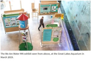
Last spring, the We Are Water MN traveling exhibit was expected to kick-off their third tour on Minnesota’s Iron Range, with school kids pouring through the exhibit and community gatherings around water. Like so many of our 2020 plans, these plans had to change.
As museums and campuses safely re-open, We Are Water MN is able to be a part of these facilities’ re-opening plans, with capacity limits, cleaning protocols, and virtual events.
This popular statewide community engagement project invites visitors to reflect on the experiences of members of the host community and come to a deeper understanding of what taking care of water means to people. Science and history are also included via a 1,000-square foot, hands-on exhibit created by the Minnesota Humanities Center, MPCA, Minnesota Historical Society, and Minnesota Departments of Health, Agriculture, and Natural Resources.
Morris will be the first stop on a tour that is visiting six Minnesota communities between August 2020 and September 2021: Morris, Mankato, St. Paul, Rochester, Chisholm, and Pipestone.
Activities in Morris will run through October 19th at the Morrison Gallery on the University of Minnesota Campus (600 E 4ht Street). For more information, check out the We Are Water website.
Back to top
|

Collecting data is an important activity for protecting or improving your favorite lake or stream - there are many more actions citizens, government entities, and other partners can take, but you need a plan. Local (counties, soil and water conservation districts, and watershed districts) governments, with state and tribal partners, are creating action plans across Minnesota. These plans lay out projects, programs, and policies for protecting and improving local streams, lakes, groundwater, habitat, recreation, and more.
Since 2015, Minnesota has been in a transition from water plans developed on county boundaries to plans based on watershed boundaries. This is happening through “One Watershed, One Plan” program at the MN Board of Water and Soil Resources (BWSR). The program brings together local officials and staff, as well as a broad array of stakeholders including lake associations, river advocacy groups, and others from an area of land that drains to a common major river. BWSR has identified 61 “planning boundaries,” based on how the water flows (hint: water flow largely ignores political lines). This model allows upstream and downstream neighbors to identify shared goals for the water resources they deem most important in their area. This also allows upstream neighbors to understand how their activities on the land impact waters downstream.
Once the planning partnership identifies priority resources, they set goals including improving or protecting surface water quality, managing flooding, enhancing habitat, protecting drinking water and groundwater, or other locally identified topics. Goals are sometimes specific to a particular lake or stream and may include a number of parameters like water clarity, sediment, or nutrients.
Finally, an implementation plan lays out the strategies and specific actions the watershed partners will do over a 10-year period. Projects, programs, and policies are all on the menu, along with things like research and monitoring programs.
Water quality data is critical for these plans. Generally speaking, lakes and streams without a data record tend to be left out of the prioritization process. For example, in the Pine River One Watershed, One Plan, the partnership used “lakes with water quality trend data” as one criterion for selecting 19 priority lakes out of over 500 lakes in the area! Also, data is used to set baseline conditions and future goals – you can’t know where you are going if you don’t know where you started.
Citizen input is also important. Local elected officials (and sometimes municipal and tribal leaders) make the final decisions in the planning, but they get a lot of help along the way from the people who care most about the area’s waters and those who will be key in implementing the plan. Citizens can participate in public input forums and may be appointed to serve on an advisory committee. The advisory committee contains agency experts and others who combine data and science with local values to recommend priorities and actions in the plan.
To see what planning efforts are happening in your area, the “participating watersheds” section of the One Watershed, One Plan website at https://bwsr.state.mn.us/one-watershed-one-plan or contact your local soil and water conservation district, county environmental services department, or watershed district.
Back to top
|
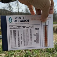
Winter is right around the corner, and there's always the potential for an early snowstorm to catch us off guard. With snowfall, salt application can be expected! Excessive salt and other de-icers applied to roads, parking lots, and sidewalks during colder months can pose a threat to aquatic life and water quality when runoff flows into streams and lakes.
In a new partnership with the Minnesota Pollution Control agency, the Izaak Walton League of America’s volunteer Salt Watchers track chloride spikes and advocate for smart road salt practices. Become a Salt Watcher today! If you haven’t ordered your FREE test kit yet, you can find out more and order online. The tests are quick, easy – and meaningful!
Register for their Salt Watch Kickoff Webinar here-- https://attendee.gotowebinar.com/register/8934308640759284747 .
Want to learn more about how YOU can be a positive influence on winter maintenance activities? Attend a free online Smart Salting for Property Management class this Fall: bit.ly/mpcasmartsalting For question email smartsalting.pca@state.mn.us
If you have any questions, email saltwatch@iwla.org
Back to top
|


Shannon's family is expanding this November! They are expecting a baby boy at the end of the month and then she will take 5 months off to care for the new addition. Shannon will be back in the office in April 2021. In the meantime, Josh will be the main contact for the CLMP. You can contact him at josh.stock@state.mn.us or 651-757-2235.
Back to top
|
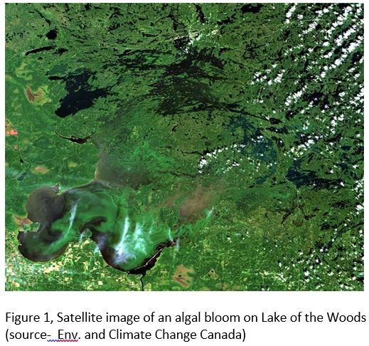
Lake of the Woods covers nearly 1 million acres on the border between the US and Canada. The lake’s massive watershed drains nearly 25,000 square miles, largely of forests, wetlands, and upstream lakes, including the BWCA and Voyageurs National Park in Minnesota, and Quetico Provincial Park in Ontario. About 1/3 of the lake is within Minnesota. The complex lake, especially the southern basins, experiences algal blooms each summer- sometimes at nuisance levels that negatively impact recreation for the public. The MPCA declared its portion of the lake impaired in 2008 and a detailed impaired waters study was recently completed after many years of study and modeling to understand and the catalog the sources of phosphorus to the lake.
|
Minnesota, Ontario, Manitoba, the US EPA, Environment and Climate Change Canada, Tribal nations, citizen volunteers, University scientists, County Soil and Water Conservation Districts, and many other partners have worked together for decades to cooperatively manage and monitor the lake. From 2016 to 2020, Environment and Climate Change Canada (ECCC) conducted a detailed study of the lake, including development of a tool to use satellite images to monitor the seasonal progression of algal blooms in the lake. For several reasons, especially the lake’s large size, it is difficult to monitor conventionally via water quality sampling. That’s where satellite images come in, as described by the scientists at ECCC:
“Remote sensing of inland water algal blooms is based on the measurement of water colour using camera-like optical sensors on board satellites. Phytoplankton (as well as other particles and dissolved materials in the water) cause changes in water colour by absorbing and scattering different wavelengths of light. Chlorophyll-a is the main pigment contained in phytoplankton that is used in photosynthesis. It is the concentration of chlorophyll-a that we derived from the remote sensing signal, as an indicator of the total amount of phytoplankton in the water.”
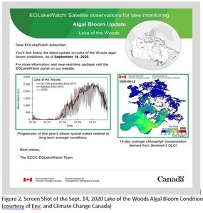
ECCC’s online Lake Watch program, led by remote sensing scientist Dr. Caren Binding, displays weekly images online (website link below) of satellite-derived chlorophyll-a concentrations and derived algal bloom extent, as well as comparisons to historical conditions. Past research has shown that in Lake of the Woods, dry and hot summers tend to produce the worst algal blooms. ECCC’s Lake Watch program provides an essential tool to track algal blooms, and will advance international efforts to monitor and protect the lake for years to come.
Online Resources
- Environment and Climate Change Canada’s EO Lake Watch website: https://www.canada.ca/en/environment-climate-change/services/water-overview/satellite-earth-observations-lake-monitoring/remote-sensing-algal-blooms.html
- EO Lake Watch Bloom monitoring tool for Lake of the Woods, Lake Winnipeg and Lake Erie, including a link to sign up for weekly updates https://www.canada.ca/en/environment-climate-change/services/water-overview/satellite-earth-observations-lake-monitoring/interactive-algal-bloom-monitoring-tool.html
- MPCA’s Lake of the Woods TMDL ; https://www.pca.state.mn.us/water/tmdl/lake-woods-excess-nutrients-tmdl-project
- University of Minnesota’s remote sensing of water resources https://water.rs.umn.edu/
Back to top
|

As my time with the MPCA and the Citizen Stream Monitoring Program comes to a close, I want to thank you all for the opportunity to work together! A lot has changed over the years - from the development of a statewide watershed approach for monitoring and assessment of our waters, to the full integration of biological and pollutant load monitoring of streams and rivers, and so much more. My view of the importance and value of citizen monitoring has changed as well.
When I was hired to help launch the CSMP back in 1998, my main goal for the new network of stream water monitors was to COLLECT MORE DATA. Thanks to all of you, we’ve reached that goal! While I will always consider data collection of utmost importance to watershed work, I have grown to appreciate the value of connecting people to their streams and rivers; the importance of stopping, observing, and getting to know our rivers, and of cultivating human relationships with flowing waters. After all, only when we know and understand something, can we truly care and work for it!
I’m not sure what my future holds, but I will undoubtedly spend more time on our amazing rivers. While it’s difficult to say farewell to something I care a lot about, it’s comforting to know that all of you and the good people at the MPCA will KEEP ON MONITORING! I wish the CSMP and all of you the best. Thanks for all you do! -- Laurie
After November 19, Josh Stock will be the primary contact for CSMP until further notice. You can reach Josh at josh.stock@state.mn.us or 651-757-2235
Back to top
|

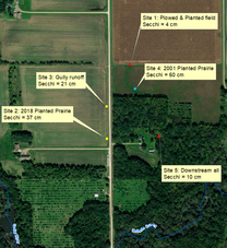
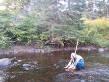
By Peter Mattson, Stream volunteer in Mower County
|
|