Watershed Connections - July 2019

Watershed Connections

July 2019

Widespread changes needed for waters in Minnesota River Basin to improve

sediment jars minnesota river

Changes in water and land management are needed across the Minnesota River Basin for the state’s namesake river to improve in water quality, as well as streams and lakes throughout the 10 million acres of the basin, according to four studies released today by the Minnesota Pollution Control Agency (MPCA) and local partners.

Learn more about the studies and overall goals for the watershed at an open house on Wednesday, July 31, from 4-7 p.m., at the Sibley Park Pavilion, 900 Park Lane, Mankato.

The studies, funded by the Legacy Amendment, determined the Total Maximum Daily Load (TMDL) or the maximum amount of a pollutant that a water body can accept and still meet water quality standards. The standards are designed to make sure waters are fishable and swimmable.

Goal: Reduce sediment in river by 50 percent by 2030

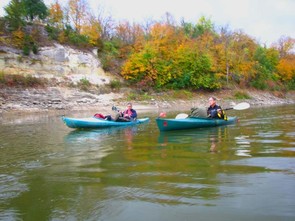
One study concerns the major portion of the Minnesota River, focusing on Total Suspended Solids or sediment and other particles that cloud the water. The study calls for decreasing sediment in the river by 50 percent. The Minnesota River basin is a naturally vulnerable system with erodible soils, but some practices such as artificial drainage worsen the situation by bringing too much water at too fast a rate into the system.

Increasing flows are a major factor in the Minnesota River basin, accelerating erosion of river banks, reducing water quality and threatening infrastructure. In the last 80 years, flows have doubled in the Minnesota River.

It isn’t just an increase in precipitation causing increased flow; the river actually carries more water now per inch of rain than historically. Increased artificial drainage, reduced storage on the land (wetlands) and lack of perennial vegetation all contribute to higher flows. The end result is erosion of fields and streambanks that send sediment into the water.

The muddy water then makes it hard for fish and other aquatic species to breathe, find food and reproduce. The sediment is also filling in the Lower Minnesota River and even Lake Pepin downstream at a much faster rate than before European settlement – and intensive farming – of the basin.

Minnesota River - Water/Ways flyer

Historical, cultural, economic asset

“The Minnesota River is a historical, cultural, economic and recreational asset for Minnesota,” said MPCA Commissioner Laura Bishop. “Improving the Minnesota River’s water quality does not start or end with one community or industry; rather it requires all of us to work together for the common good.”

In addition to the main Minnesota River, TMDL studies for the Lower Minnesota, Minnesota River-Mankato and Watonwan river watersheds will be open for comment. Altogether, these three studies look at dozens of river segments impaired by bacteria, sediment, nutrients and/or chloride as well as 50 lakes with nutrient levels high enough to cause algae. The MPCA and partners have prepared Watershed Restoration and Protection Strategies (WRAPS) for the three watersheds, also open for comment.

“These studies are all pieces of the Minnesota River basin puzzle. Now we need everyone in the basin to help put the pieces together. The good news is that many practices have multiple benefits. Enhancing soil health helps plant growth, can lead to better water quality, and even lessen the impact of climate change,” Bishop said.

minnesota river basin map

335 miles across southern Minnesota

The Minnesota River flows 335 miles from Big Stone in South Dakota to the Mississippi River near St. Paul. Its basin includes all or parts of 37 counties, draining 17,000 square miles. It provides fishing and other recreation for much of southern Minnesota.

The TMDL for sediment covers nine major watersheds from the outlet of Lac qui Parle Lake in western Minnesota to the mouth of the Minnesota River. In all, 61 sections of the main river and its tributaries carry too much sediment to meet water quality standards. Most of it comes from bluff, ravine and streambank erosion, driven by higher stream flows that result from field drainage and somewhat from increased precipitation.

The studies are part of the state’s program to monitor the health of Minnesota’s 80 major watersheds every 10 years. They follow a TMDL for the Lower Minnesota last year that recommended fixing feedlot and septic systems to reduce bacteria in the river.

Learn more and provide feedback

To learn more about the studies:

To provide feedback:

  • Comments must be in writing and are due by 4:30 p.m., Sept. 20.
  • Use the online comment form at pca.state.mn.us/help-us-help-our-water-comment.
  • Written comments must include a statement of your interest in the report and the action you wish the MPCA to take, including specific references to sections of the draft report you believe should be changed and the reasons for making those changes.