|
The Minnesota Pollution Control Agency
(MPCA) has set March 6 as the new deadline for applying for federal grants to
reduce water pollution. Funded by the Clean
Water Action Section 319 program, these grants help local partners reduce nonpoint
source pollution in lakes and streams. The
MPCA anticipates about $2.5 million will be available this year, contingent
upon Congressional appropriation. One change this year is a minimum request of
$50,000. For the application and more information, visit the MPCA
website.
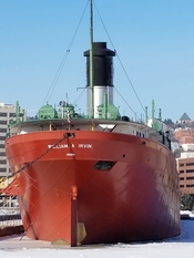
The
watery home of Duluth’s retired ore carrier William A. Irvin is one step closer
to being cleaned up: The MPCA has selected a remedy that caps the Minnesota
Slip’s contaminated sediment.
All options considered by the agency
and the public were weighed against four goals:
- Minimize exposure to sediment contaminants that contribute to fish-consumption advisories
- Minimize exposure of aquatic organisms to contaminated sediments
- Preserve water depth to enable the current use of the slip
- Enhance deep water aquatic habitat where possible
The selected remedy, with an
estimated $1.6 million cost to complete, met those goals. It was also the least
expensive because it moves 2,500 cubic yards of contaminated sediments to the
slip’s deeper areas, covers the leveled sediment with a 3-foot cap and requires
no offsite disposal.
In partnership with the U.S.
Environmental Protection Agency and U.S. Army Corps of Engineers – Detroit
district, MPCA staff has begun the design process. This effort will include a
more extensive environmental review and allow for additional public comment.
Funding for the construction portion of the cleanup depends on the Minnesota
Legislature passing the bonding bill which contains money for this and other
St. Louis River Area of Concern cleanup projects. Barring unforeseen design or
funding delays, construction could begin in 2018.
The slip’s contamination is the
result of a century of industrial and shipping activities in the
Duluth-Superior harbor that left “legacy pollutants” likely destined for
cleanup. The site is one of 10 identified in Minnesota for cleanup as part of
the St. Louis River Area of Concern Remedial Action Plan.
The Minnesota Slip is located within
the St. Louis River Area of Concern, one of 43 so-designated Great Lakes basin
locations where historic shoreline alterations and industrial contamination
caused impairments affecting its ability to support wildlife habitat and
aquatic life. Successful completion of the Minnesota Slip remediation project
would contribute to a healthier St. Louis River.
For more information, visit the
MPCA’s Minnesota
Slip cleanup webpage, or contact Project Manager Heidi Bauman at heidi.bauman@state.mn.us,
218-302-6607 or 800-657-3864.
|
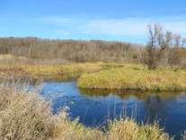
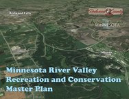 Following public meetings last fall and in Feburary, the Minnesota River Valley Recreation Area Master Plan is expected to be completed later this spring. The plan, being developed by the Minnesota Dept. of Natural Resources with Redwood and Renville counties, will leverage natural, recreational, cultural, historical and agricultural assets located within 2 miles either side of the Minnesota River in the two counties.
The plan's objectives are:
- To develop an outdoor recreational destination that would promote regional economic growth, development, and tourism while respecting private lands and the agricultural heritage of the area.
- To address the conservation of the natural and cultural resources of the Minnesota River Valley area in Redwood and Renville counties.
- To provide for the shared use, enjoyment, and understanding of these resources through a broad selection of outdoor recreational opportunities and recreational travel routes that connect units of the outdoor recreation system in the river valley.
The plan will also address the impacts to the natural and cultural resources, interpretive services, recreational opportunities, and administrative activities in the area and provide recommendations on the unit designation of the area under the Outdoor Recreation Act.
In 2013, The Minnesota River Valley Citizen Advisory Committee report formalized a number of recommendations. In 2014 legislation was enacted directing DNR to develop a master plan. Chapter 290-H.F. No.2852, Sec. 65. In 2015, DNR partnered with Renville and Redwood counties to start a coordinated master planning process.
|
The MPCA invites comments on the following draft
reports, which are on public notice through March 15. Written comments must
include a statement of your interest in the report, and the action you wish the
MPCA to take, including specific references to sections of the draft report you
believe should be changed, and the reasons for making those changes.
Leech Lake River: Healthiest watershed in
Upper Mississippi basin
The MPCA and local partners have developed
a plan, called a Watershed Restoration and Protection Strategies (WRAPS) report, to restore and protect water quality in the Leech Lake River watershed in north central Minnesota.
The Leech Lake River watershed is in the
northern part of the Upper Mississippi River Basin, and includes parts of
Beltrami, Cass and Hubbard counties. The watershed also includes the Leech Lake
Reservation (Leech Lake Band of Ojibwe).
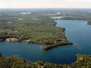
The Leech Lake River watershed is a healthy
watershed, maybe the healthiest in the upper Mississippi River basin. This is
partly because most of the very few impairments are the result of natural
background conditions. Also, the high amount of forested land plays a role in
preserving water quality throughout the watershed. Identified causes of
impairments include low dissolved oxygen, excess sediment, altered hydrology
and geomorphology, habitat loss and elevated phosphorus.
A WRAPS report summarizes:
- Physical, chemical, and biological assessments of water quality
- Identifies impairments and water bodies in need of protection
- Identifies biotic stressors and sources of pollution
- Proposes strategies and actions designed to achieve and
maintain water quality standards
Comments may be submitted to Phil Votruba,
MPCA, 7678 College Road, Baxter, MN, 56425, or by email to phil.votruba@state.mn.us. For more information, contact Votruba at 218-316-3901,
or toll-free at 800-657-3864.
|
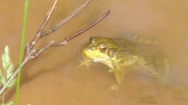
Nemadji River: Mixed results for stream and
lakes in this northern watershed
The MPCA and partners found mixed water
quality test results for 30 waterbodies in northern Minnesota’s Nemadji River watershed.
The Nemadji system is well known as the
primary source of sediment to Lake Superior from Minnesota’s North Shore
streams. Restoration activities lie ahead for 12 of 22 streams and two of eight
lakes that do not meet water quality standards for sediment, bacteria and
nutrient levels, and fish and invertebrate populations. The remainder meet all
criteria for healthy conditions and future actions will focus on protecting
them from future impairments.
The first report discusses the Total Maximum Daily Load, or the amount of pollutants that water bodies can
accept and still meet water quality standards. It also identifies pollution
sources and proposes ways to bring water quality back to acceptable levels. Lac
La Belle, Net Lake, and Deer, Elim, Mud and Skunk creeks are examples of
waterbodies listed as “impaired,” or polluted by high levels of phosphorus,
sediment or bacteria.
The second report, known as WRAPS,
summarizes efforts to monitor and improve water quality and identifies future
strategies for restoring, improving and protecting the watershed’s water
quality.
The MPCA, the Nemadji River Watershed
stakeholders group, and the Carlton County Soil and Water Conservation District
have recommended several related restoration and protection actions to help
maintain or improve the watershed’s water quality. These include assessing
culverts and septic systems and replacing those found ineffective, limiting
livestock/animal stream access, streambank and lakeshore buffer improvements,
restoring natural stream channels where appropriate, improving forestry
management, and designing low impact developments to maintain natural
hydrology.
Comments should be submitted in writing by
March 15 to Karen Evens, MPCA, 525 Lake Avenue South, Suite 400, Duluth, MN
55802, karen.evens@state.mn.us or 218-302-6644.
|
Long Prairie River watershed: Waters impaired by
nutrients, bacteria
The MPCA and local partners have developed a WRAPS
report on restoring and protecting water quality in the Long
Prairie River watershed in central Minnesota.
The Long Prairie River watershed is located
in the central part of the upper Mississippi River basin in central Minnesota,
and covers all or parts of Douglas, Morrison, Otter Tail, Todd, and Wadena
counties. The watershed includes more than 240 lakes and 884 miles of rivers
and streams, and empties into the Crow Wing River, just south of Motley.
The dominant land use in this watershed is
agriculture at 57%. The rest is a combination of grasslands, forests, surface
waters, and urban areas. Biological, chemistry, and flow monitoring began in
2011, and results indicate at least 10 lakes and 13 stream/river sections have
pollution levels that fail water quality standards, most notably phosphorus in
the lakes and bacteria in the streams.
A WRAPS report summarizes physical,
chemical, and biological assessments of water quality; identifies impairments
and water bodies in need of protection; identifies biotic stressors and sources
of pollution; and proposes strategies and actions designed to achieve and
maintain water quality standards.
On a related note, the U.S. Environmental
Protection Agency (EPA) recently approved the TMDL
report for the Long Prairie River watershed that addresses excess nutrient
levels in lakes and high bacteria levels in streams.
Comments may be submitted to Anna Bosch,
MPCA, 7678 College Road, Baxter, MN, 56425, or by email to anna.bosch@state.mn.us. For more information, contact her at 218-316-3929, or
toll-free at 800-657-3864.
|

The Water/Way exhibit is
now open at the Becker County Historical Society in Detroit Lakes through April
9. The exhibit will be open Tuesday
through Saturday, 10 a.m. to 4 p.m. Admission is free. The Becker County
Historical Society & Museum is located at 714 Summit Ave. in Detroit
Lakes.
Water/Ways is a traveling exhibition and community
engagement initiative of the Smithsonian Institution’s Museum
on Main Street program. In Minnesota, Water/Ways is led by the Minnesota
Humanities Center in partnership with MPCA, Minnesota Historical Society,
Minnesota Department of Natural Resources, Minnesota Department of Health,
Minnesota section of the American Water Works Association, and six greater
Minnesota communities.
|
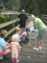
The MPCA is seeking volunteers
for its Citizen Stream and Citizen Lake Monitoring Programs. More than
1,200 Minnesotans participate in the Citizen Monitoring Programs, but in order
to reach all water bodies across Minnesota, more volunteers are
needed. Equipment and training are provided by the MPCA and no experience
is necessary.
Laurie Sovell, coordinator of the MPCA’s Citizen Stream
Monitoring Program, says “105,000 miles of rivers and streams, and 12,200
lakes is a lot of water to cover. We are looking for people curious about local
water bodies and passionate about protecting our state’s water
resources.”
For some lakes and streams, volunteer-collected data are the
only data available, making citizen involvement critical to ensuring the
lasting health of Minnesota’s waters. Find out if your favorite lake or
stream needs monitoring by using the MPCA’s interactive map. To
become a volunteer or learn more about the program, visit the program’s
website, or call 651-296-6300 (Twin Cities) or 800-657-3864 (Greater
Minnesota).
|
|