MPCA needs your data for lake and stream assessment
Minnesota Pollution Control Agency sent this bulletin at 10/05/2011 08:56 AM CDT
MPCA is interested in obtaining all available water quality data for these watersheds for use in the assessment effort. If you manage a water quality monitoring project in any of these areas, please note the data submission timeline below to ensure that your data is available for the assessment process. To be included in the assessment effort, data must be received by the MPCA and uploaded to the state’s water quality data management system (EQuIS) prior to data analysis. Steps involved in data storage for any project can span more than a month. Information on how to submit data is available on the MPCA website.
MPCA also welcomes data from other watersheds
While the MPCA’s 2012 assessment effort will involve the seven watersheds listed above, the agency is also interested in receiving data from monitoring efforts in other watersheds. The MPCA uses submitted data for:
In addition, the MPCA shares the data with local and state partners and interested parties via its data access web site and through the federal Environmental Protection Agency’s national water quality data warehouse. Therefore, the agency encourages anyone with monitoring data to provide that data to MPCA for inclusion in the EQuIS data system. Because of the watershed assessment timing, data from the identified watersheds will have first priority for processing into the system.
For additional information, contact:MPCA EQuIS TeamNancy Flandrick, 651-757-2361(St. Paul, Rochester, and Mankato Regional Offices)Jean Garvin at 651-757-2378(Willmar, Marshall, and Detroit Lakes Regional Offices)Lynda Nelson at 651-757-2601(Duluth and Brainerd Regional Offices)Miranda Nichols at 651-757-2614(Water Quality Data Coordinator) Background on using data to assess streams and lakes
The federal Clean Water Act requires states to monitor and assess their waters to determine if they are supporting beneficial uses, and publish a list of waters not fully supporting those uses (i.e. “impaired waters”) every two years.
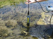
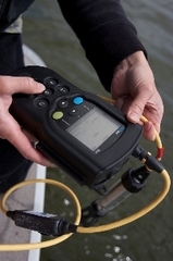
To accomplish this, the MPCA monitors waters and gathers water-quality data from state, local and federal agencies, as well as citizens. The MPCA then conducts a rigorous process (assessment) to compare the data against water quality standards to determine if water bodies are supporting their beneficial uses. Waters not fully supporting their beneficial uses are identified as impaired and included on Minnesota’s 303(d) list of impairments (also known as the TMDL List).
In recent years the MPCA has transitioned from a statewide approach to a major watershed framework for assessment. Data analysis/assessment by MPCA staff is primarily organized by major watershed, following intensive monitoring of each watershed. This watershed monitoring schedule follows a 10-year rotating timeline. The major watershed framework allows for a comprehensive approach to assessment that considers biological, chemical and physical data together. Some pollutants, namely toxics, are still assessed statewide, because the data collection and management activities are more statewide in nature.
While assessment and listing still occur on an individual stream reach/lake basis, information about the overall health of the watershed is also captured to further inform management activities. The monitoring and assessment efforts culminate in the completion of a comprehensive watershed condition report for each major watershed, which conveys the available information about the health of the major watershed, subwatersheds and individual water bodies within each watershed.
Watershed assessments occur each winter, following the completion of the watershed monitoring. Statewide assessments occur biennially. Every other year, the watershed statewide assessment results are packaged together into the draft biennial 303(d) list of impairments. The draft list is placed on public notice, adjustments are made as warranted by public comment, and the final draft list is submitted to the Environmental Protection Agency by April 1 of each even-numbered year.
Your role in collecting and managing the proper entry of these data into Minnesota EQuIS is important to Minnesota’s effort to identify impaired waters and waters in need of additional protection, and to work with local, state and federal partners to protect and restore Minnesota’s waters. Thank you for your attentiveness to the data management process and the assessment timeline.
| |

|
|
|
|
|
Unsubscribe • Preferences • Help • This email sent using GovDelivery (800-439-1420) |
||