 Welcome to the Spring 2025 edition of the Water Resources Update. This newsletter is sent to collaborators of the Metropolitan Council Environmental Services, including water resource professionals in the Twin Cities region and our stream and lake monitoring partners. The Environmental Services Water Resources department works to build strong partnerships dedicated to ensuring clean, healthy, and abundant water resources in the Twin Cities metropolitan area.
In February, the Met Council adopted the Regional Development Guide, Imagine 2050. It was developed with input from technical experts, local officials, advocates, and residents across the seven-county Twin Cities region. Imagine 2050 addresses critical issues that cross policy areas: climate, equity, natural systems, public health, safety, and well-being. The groundbreaking plan will guide growth and development across the Twin Cities metro region and includes a Water Policy Plan that kicks off a new cycle of long-range water planning in the region. Continue reading for more information about the Water Policy Plan and other work that Environmental Services Water Resources is doing to support clean water for future generations.
Water Policy Plan – a clear vision for sustainable waters in the region
The Water Policy Plan, adopted in February as part of Imagine 2050, has four objectives focused on climate, investments, health, and equity. These vital areas guide the region toward achieving our goal of sustainable waters by protecting, restoring, and enhancing regional waters and water services for public and ecosystem health. The plan’s policies recognize that water issues are connected across water sectors and require partnership. Regional water policies are intentionally crafted to apply across multiple water areas, wherever feasible, based on the Met Council’s roles and responsibilities and the roles of our many partners in the region.
Met Council staff are currently working on creating resources to assist metro communities in the development of their comprehensive plans, which includes the local wastewater plans, surface water, and water supply plans. In the coming months, these tools will become available along with technical assistance from staff to ensure alignment of policies and an end result of improved water resources.
 New coordinated approach to improve drinking water protection in the west metro
Part one of the first multi-community wellhead protection plan in Minnesota was recently approved for eight communities in the west metro. The plan showcases a new coordinated and collaborative approach to improving local drinking water protection in overlapping Drinking Water Supply Management Areas.
By consolidating staff time, engineering and consultation service, outreach communications, and interagency coordination this approach results in a much more efficient process for both the creation and review of wellhead protection plans. It has the added benefit of increasing mutual understanding of concerns and support of neighboring priorities and is an exciting step towards more efficient and integrated drinking water protection measures.
Funded by the Clean Water Fund in collaboration with Met Council, Minnesota Department of Health, and local communities, this project is now moving into part two – shared implementation planning.
For additional information, email Lanya Ross at lanya.ross@metc.state.mn.us.
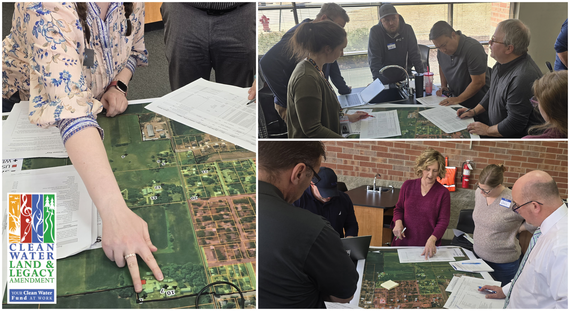 Scenes from a multi-community wellhead protection planning session
 Protecting recharge improves water sustainability
To help communities better consider groundwater protection in their land planning, resource management, and development decisions, the Met Council worked with Barr Engineering to identify and map areas for prioritizing the protection and enhancement of recharge in the region.
Recharge is the natural process where water moves from the surface into the ground to replenish groundwater. When land is developed and impervious land cover increases, stormwater is no longer able to easily infiltrate into the ground, and the presence of potential pollutants from human activities often grows. If not properly planned for and managed, these actions can lead to groundwater deficits or contamination, creating a costly and unsustainable scenario for communities.
This study, which can be accessed on the Met Council’s website, used publicly available datasets and accepted methodology to prioritize areas for recharge protection and enhancement activities in the metro. Datasets related to geology, surface water, groundwater, water quality, and wellhead protection were used to develop a holistic, qualitative, prioritized classification of land for recharge protection and enhancement activities. This information can help to build a shared understanding among regional water planning partners and service providers, inform Local Water Plans and Community Comprehensive Plans, and provide insight for regional and local approaches to groundwater protection.
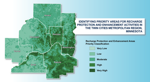 Study output map showing areas for recharge protection and enhancement in the metro region

Inviting water monitoring and data assessment professionals
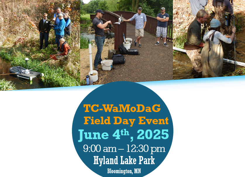
The Twin Cities Water Monitoring and Data Assessment Group (TC-WaMoDaG) is hosting a field day event focusing on demonstrations of water monitoring equipment and techniques. See demonstrations of equipment and connect with other local water resource professionals to discuss field challenges and share solutions.
TC-WaMoDaG is a community of practice for water resource monitoring and assessment in the Twin Cities Metropolitan Area. Its primary purpose is to serve as a forum for public sector water professionals to share information and learn from one another.
Location: Hyland Lake Park Reserve, Sunnyside Shelter (10145 Bush Lake Road, Bloomington)
Date: Wednesday, June 4
Time: 9:00 a.m. to 1:00 p.m.
For more information on this and other events, visit the TC-WaMoDaG website to learn more about the group and to sign up for the email list.
 Sacred Water, Shared Future campaign looking for support
The Mississippi River in the Twin Cities metropolitan area is nothing like it was 100 years ago – and that is a good thing. In 1926, the Minnesota and Wisconsin Boards of Health pronounced the river “unfit”, “a potential danger”, and declared fish “practically exterminated.” In response, the cities of Minneapolis and Saint Paul worked together to collect and treat sewage, leading to tremendous improvements to water quality, habitat, and biodiversity over the following decades. In 2026, the Sacred Water, Shared Future campaign will celebrate the Mississippi River, promoting the story of its amazing recovery and engaging regional commitment to ensure it continues to be a productive, functioning ecosystem and a popular recreation area.
Sacred Water, Shared Future is a collaborative planning effort among nearly 20 Twin Cities organizations that focus on the Mississippi River. This effort honors the Mississippi River’s deep history – its sacred significance, its strength, and the harm it has endured, from pollution to the displacement of Indigenous peoples. While decades of restoration have helped heal its waters, the journey of care and protection continues.
This campaign celebrates the power of community, storytelling, education, and conservation. Through collaboration and shared action, Sacred Water, Shared Future renews our collective commitment to a healthy river. The campaign is currently looking for organizations to plan, host, or fund themed events during 2026. If you would like to get involved, contact Cassie Champion at casandra.champion@metc.state.mn.us to request more information.
 |
Mississippi River Institute for educators in July
For 20 years, the Mississippi River Institute by the Center for Global Environmental Education (CGEE) at Hamline University has been a free professional development program to inspire, educate, and engage educators through experiential, inquiry-based science and engineering investigations around the Mississippi River in the Twin Cities. For example, the image on the right shows educators investigating macroinvertebrates (photo by CGEE).
In 2024, the Met Council collaborated with CGEE to develop wastewater treatment curriculum to incorporate into the program, which was attended by 40 teachers from across the region. The upcoming program, running from July 21-23, 2025, includes a day at the Met Council’s Metro Water Resource Recovery Facility in Saint Paul.
All K-12 formal and informal educators are welcome to apply. Please share this opportunity with educators in your community. Visit the Hamline University CGEE website to see more information and register for the program. Information about all CGEE's s free development workshops can also be found online.
|
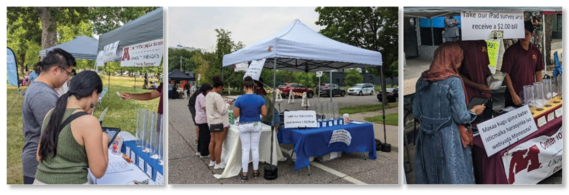
Water and art – connecting with residents from frozen lake to food hall
In the first few months of 2025, Water Resources staff and the Met Council’s Art+Policy team have been busy engaging with Twin Cities area residents. The Art+Policy team was formed as a way to bring our planning process alive and engage community in conversations about the roles of the Met Council, our shared future, and the ways in which our work connects to residents around the region.
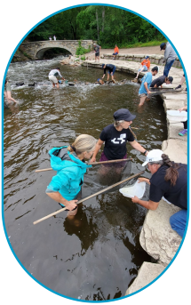
For four weekends in January and February, the Met Council’s Art+Policy team participated in the Art Shanty Projects on a frozen Lake Harriet in Minneapolis. Our shanty, “Government Game Night,” invited the public to play fun card games and yard games while learning about regional planning and the work of the Met Council. Each weekend, the Art+Policy team invited staff from different policy areas of the Council to work a shift and talk with residents about what they do at the Council. Several staff members from Environmental Services Water Resources came out for the final weekend!
 Water Resources staff bundled up for a day of public engagement at the Art Shanty Projects on Lake Harriet
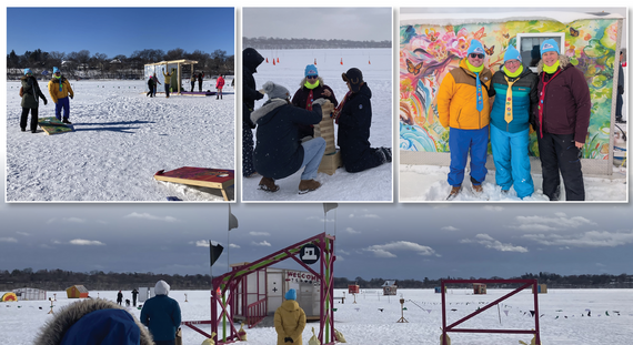
Just a few weeks ago, the Art+Policy team wrapped their calendar of events with the Earth Week Water Party at Malcolm Yards. More than 100 people came out for an evening to celebrate the importance of water and how it connects us all. Visitors to the event enjoyed a panel discussion, live art-making, light projections, sound baths, and tabling by organizations from around the region.
 Moments from the Earth Week Water Party including print making, projections on the United Crushers silos, and an insightful panel discussion
Keep an eye out for a forthcoming impact report to learn more about all the engagement work that’s happened over the past year and stay tuned for updates on future Art+Policy work. While activities related to the adoption of Imagine 2050 are winding down, our efforts to bring more art into the work of the Met Council are just getting started.
Diverse water perspectives inform regional water planning
The region’s residents enjoy water for recreation and drinking, participate in cultural practices that are centered around water, and pay for water utility services. However, resident voices, particularly those from poor and disadvantaged communities, are often underrepresented in water decision-making processes. Met Council staff worked on a four-year research project with experts at the University of Minnesota to identify resident values, through onsite and mail surveys, that can inform equitable water policy, planning, and management, and provide approaches for fair and just decision-making.
The second phase of this research, which included onsite surveys at 14 community events as well as a series of water policy co-development workshops, was completed in 2024. The Phase II report can be found on the project’s webpage.
This research provides guidance that can help the Met Council and its planning and water management partners to make just and equitable water decisions. The region’s residents generously shared their perspectives, offering an opportunity to incorporate those perspectives into regional policies, guide regional operations and engagement approaches, and provide support for local planning partners and utility customers. Perhaps most importantly, this study offers a framework for achieving equitable outcomes that include transparency, trust building, and culturally appropriate community-driven decisions.
 On-site surveys were conducted at various community events (photos by Meredith Keller)
Increasing monitoring to support wild rice research
Wild rice grows in numerous lakes and rivers in Minnesota, including the lakes connected to the Mississippi River as well as floodplain lakes along the Minnesota River. Excess levels of sulfate, which is a mineral that naturally occurs in water but can also come from industrial processes, has the potential to hinder the growth of wild rice.
Environmental Services Water Resources has increased monitoring to support the study of wild rice growth in our region. We started collecting sulfate samples in the rivers more often, to be able to develop more accurate trend and pollutant load calculations. We also started monitoring the water quality of several lakes in the Minnesota River floodplain with historical wild rice observations.
We have analyzed the sulfate data we have collected to gain a better understanding of sulfate concentrations in regional rivers and tributaries, changes in concentration over time, and relative contributions from a selection of sources. This information was shared with organizations in the region that have an interest in wild rice growth. If you would like to receive a copy of the technical memo summarizing this analysis, contact Steve Kloiber at Steve.Kloiber@metc.state.mn.us.
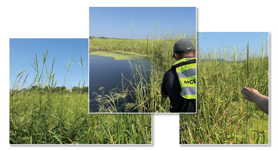 Met Council staff conduct surveys of wild rice
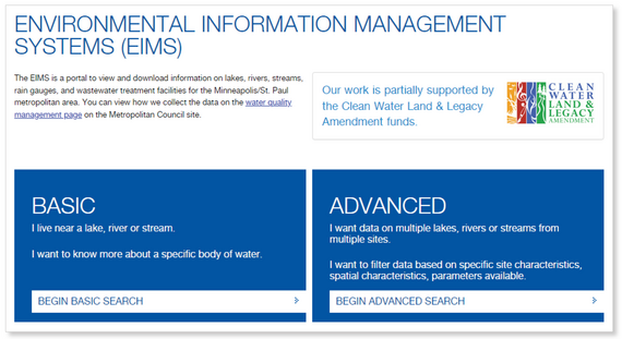
Accessing Met Council water quality data
Most of the river, stream, and lake water quality data collected by Environmental Services Water Resources is available to download from the Environmental Information Management System. However, some data is only available by request. Please contact Jen Keville at jennifer.keville@metc.state.mn.us to request staff-reviewed river and stream continuous data, biological river and stream data, a selection of pollutant load calculations since 2015, and field visit observation data.
Framework will guide long-term assessment plans
Environmental Services Water Resources has developed a conceptual framework to help plan, organize, and prioritize the assessment work that we do. This plan allows us to be more intentional about our assessments and when we do them. We hope this will improve how you as our partners can leverage our work with more clarity on when assessment products will be available and updated. It will also help us work towards the goals of the new Water Policy Plan and provide information that the Met Council and partners need to manage water resources.
The goals of our assessment work are to identify the status, trends, and drivers of the water quality, hydrology, and biology conditions of the various water resources in our region. Applying this framework has allowed us to see which assessments we already cover, and where there are gaps that can be filled in the coming years.
In addition to trying to be more comprehensive in our assessments, the Met Council also has a goal to improve how we deliver and communicate the results from our assessment work. We are exploring the use of interactive data dashboards for our partners to view and explore our assessment information. One of the first projects will be a dashboard to share lake water quality assessment information. More information will be communicated and partner feedback requested as we develop and roll out new tools.
|