|
January 6, 2020
January Weed of the Month: Using Drones to Combat Noxious Weeds
Eric Yu, Minnesota Department of Agriculture
Noxious weeds, characterized by their aggressive behavior, continue to be an increasing problem throughout the United States. Early detection is critical in order to contain and/or eradicate an infestation. Ground-based surveys for weeds require time and money to cover a relatively small area. The data collected from ground-based surveys may only provide a limited amount of information regarding the extent and spread of any target weed. Remote sensing, using an unmanned aerial vehicle (UAV), can provide a more efficient method to map and monitor an area for noxious weeds.
UAVs cover a large area in a relatively short amount of time while providing high spatial resolution, which can allow for the detection of small objects including weeds. Due to weight constraints, UAVs use light-weight sensors and especially four- to six-band multispectral cameras to take images in the visible and the near infra-red (NIR).
Timing of aerial flights is one of the most critical factors for distinguishing characteristics of noxious weeds from surrounding cover. For example, an Oriental bittersweet survey is done best once leaves have fallen, snow has covered the ground, and the fruits are bright red. The photo below shows an aerial image taken in December 2019, 200 feet above ground level in a forested area of southeastern Minnesota. The cluster of red berries in the photo stands out from its surroundings. The photo taken from the camera attached to the UAV is geo-tagged with a GPS coordinate, making it easy to locate and treat or remove Oriental bittersweet.
For more information about the collaborative work done by the Minnesota Department of Agriculture (MDA) and the University of Minnesota (U of MN) to combat Oriental bittersweet using UAVs, visit the MDA website.
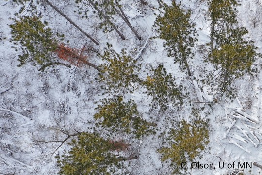 An aerial image shows the red berries of Oriental bittersweet, on the left side of the image, in a forested area. Photo courtesy of Curtis Olson, University of Minnesota. Click here to download the image.
Although aerial surveys offer a more efficient method of mapping infestations, there are many weeds that may not be good candidates for remote sensing. Weeds may not be distinguishable from their surroundings making it difficult to locate in an aerial image. Research is being done to overcome this obstacle by using multispectral cameras which work by imaging different wavelengths of light. Plants typically reflect a large amount of near-infrared (NIR) light, which is not visible to the human eye but is visible to multispectral cameras. These cameras have been utilized to identify areas of stress in a crop, and even provide a quantitative metric for the vigor of a plant. The MDA and U of MN are currently working together in hopes to develop an effective method to aerially monitor Palmer amaranth using a multispectral camera. Below is an aerial image of a Palmer amaranth infestation.
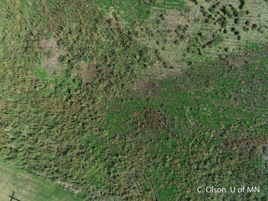 An aerial image of a Palmer amaranth infestation. Photo courtesy of Curtis Olson, University of Minnesota. Click here to download the image.
MEDIA: For more information on Weed of the Month, contact Allen Sommerfeld, MDA Communications, at allen.sommerfeld@state.mn.us or 651-201-6185
Having trouble viewing this email? View it as a Web page.
|