 September 2026
 📷: Blue Mounds State Park, photo courtesy Explore Minnesota Tourism
State Parks That Seriously Rock 🪨🤘
There’s more to Minnesota state parks and trails than meets the eye. Look a little closer and you’ll find stories written in stone — ancient lava, billion-year-old rock, glacial potholes, towering bluffs and underground caves. This month, we’re digging into the geology that shaped some of Minnesota’s most distinctive landscapes. Come explore what’s beneath your feet!
  📷: Interstate State Park
Glacial Potholes at Interstate State Park
Potholes you'll actually like!
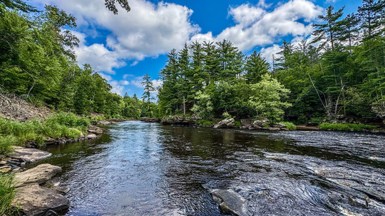
Some of Minnesota’s most impressive geology is hiding in plain sight at Interstate State Park. Smooth, rounded holes ranging from small depressions to cavernous pits are carved directly into the park’s dark basalt bedrock. Known as glacial potholes, these formations offer a glimpse into a time when the St. Croix River looked very different from the river today.
About 1.1 billion years ago, the Midcontinent Rift began pulling apart the Earth’s crust, sending lava across the region and shaping the bedrock. Much later (roughly 10,000 to 11,000 years ago), meltwater from receding glaciers created an over one-mile-wide river that cut through the landscape.
Where fast-moving water encountered the park’s uneven basalt riverbed, whirlpools called eddies formed. Sand, silt and stones caught in the currents scraped against the bedrock like sandpaper. Small depressions gradually became deeper as water and sediment continued to spin inside them. The result is today’s collection of remarkably large glacial potholes.
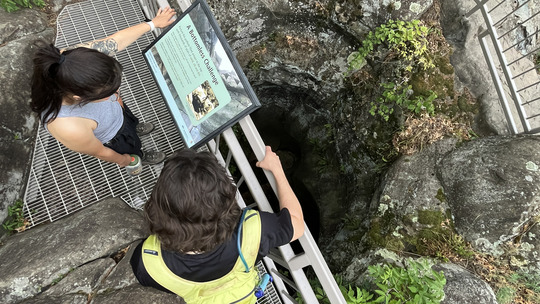
One of the most impressive potholes is the Bottomless Pit. Despite its name, it does have a bottom — nearly 60 feet below the surface. Early efforts to clear sediment from the pothole began in the late 1800s. Crews initially dug through 47 feet of debris without reaching bedrock, earning the formation its name. Several decades later, the pothole was fully excavated and the true depth was discovered.
See the geology for yourself this fall. Visit Interstate State Park’s Glacial Potholes Area and walk on top of ancient lava or join a naturalist-led pothole tour! Check out the park’s events calendar for upcoming programs and tours.
|
 |
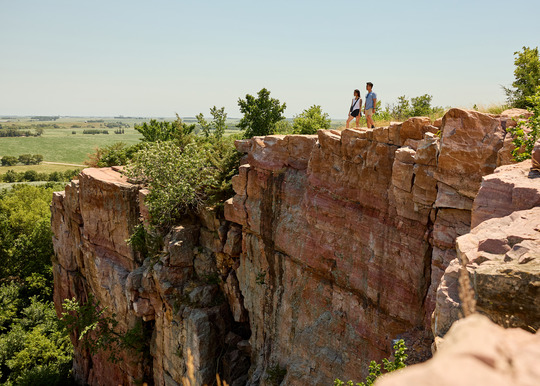
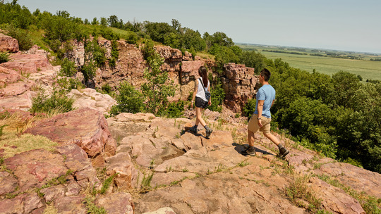 📷: Blue Mounds State Park, photo courtesy Explore Minnesota Tourism
Quartzite Cliffs at Blue Mounds State Park
Learn where the park's name comes from.
Rising above the grasslands of southwestern Minnesota are colorful cliffs made of Sioux Quartzite at Blue Mounds State Park — pink, red and purple rock that stands in sharp contrast to the surrounding prairie. From a distance, the mounds can take on a bluish appearance, which helped give the park its name.
About 1.68 billion years ago, rivers carried enormous amounts of quartz-rich sand across an ancient landscape. Layer after layer of sand accumulated until groundwater cemented the grains into sandstone. Over time, heat and pressure transformed that sandstone into the exceptionally hard Sioux Quartzite seen at the park today.
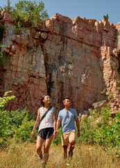
Some clues from that ancient landscape are still locked inside the rock. Look closely at exposed quartzite and you may find cross-bedding and ripple marks left behind by flowing water. In some places, even impressions made by raindrops have survived for more than a billion years.
Many years later, massive glaciers also moved across southwestern Minnesota. Rocks trapped beneath the ice scraped and polished the exposed bedrock as the glaciers passed, leaving scratches called glacial striations behind. Boulders were moved, rotated and deposited across the landscape. These glacial markings add a much more recent chapter to the story of the ancient rocks.
Today, the resilient Sioux Quartzite forms the high ridges and dramatic cliffline that make Blue Mounds State Park one of Minnesota's most distinctive landscapes. Some cliffs rise as much as 100 feet, while other exposures emerge only a few feet above the prairie.
|
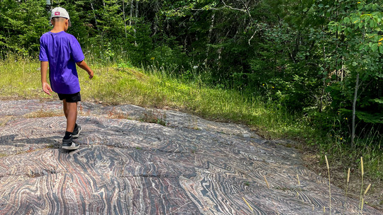 📷: Tess Johnson, Lake Vermilion-Soudan Underground Mine State Park
Banded Iron Formations Along the Iron Range
Hypnotizing patterns at Lake Vermilion-Soudan Underground Mine State Park.
At Lake Vermilion-Soudan Underground Mine State Park, you will find some of Minnesota’s oldest rocks. The park sits along northeastern Minnesota’s Vermilion Iron Range, where bands of red, white and dark minerals ripple through rock more than 2.7 billion years old. A spectacle of Minnesota’s Iron Range landscape, these banded iron formations were created long before dinosaurs, forests, or even complex animals existed.
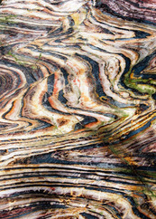
Banded iron formations began taking shape beneath an ancient sea. During quiet periods between volcanic activity, iron-rich material settled onto the seafloor along with silica. Over time, layer after layer accumulated. Today, those layers appear as bands of red jasper, pale chert and dark iron-bearing minerals, such as hematite and magnetite.
The result is one of the park’s most striking geological features. Some outcrops look almost painted, with thin bands twisting, folding and swirling through the stone. The rocks have been altered, folded and later polished by glaciers, leaving behind the patterns visitors see at the surface.
Today, you can encounter the unique formations by following the park’s Hiking Club Trail. This 2.4-mile loop passes an exposed section of the famous banded iron formation along with historic mine pits and old-growth forest. Look closely at the rock and see if you can pick out its contrasting layers. Each one began as material settling onto an ancient seafloor billions of years ago.
While you're at the park, you can also take a Soudan Underground Mine tour and descend nearly half a mile underground. The Soudan Mine was Minnesota's first iron mine and operated for 80 years before closing in 1962. Mine tours are offered seasonally, and reservations are recommended. Find the mine tour schedule on the state park’s webpage to plan your next visit.
|
|
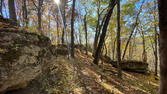 📷: Cara Koster, Beaver Creek Valley State Park
The Driftless Area of Southeast Minnesota
Rock outcrops and bluffs make for stunning scenery.
Southeastern Minnesota can look surprisingly different from the rest of the state. Rolling farmland gives way to steep, wooded bluffs. Cold streams wind through narrow valleys, while flowering goat prairies open to the sun on south-facing slopes. Layers of limestone and sandstone peek from the hillsides. The region’s distinctive geology helps explain why.
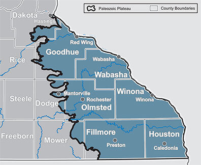
This is Minnesota’s Driftless Area, part of a larger region stretching into Wisconsin, Iowa and Illinois. The region gets its name from the relative lack of glacial sediment, or “drift,” that covers much of Minnesota. While some older glacial deposits remain, southeastern Minnesota was largely missed by the most recent glacial advances, leaving its rugged landscape exposed.
|
The Driftless Area stretches across several Minnesota state parks, including Frontenac, Carley, Whitewater, Great River Bluffs, Beaver Creek Valley and state trails including the Great River Ridge, Root River, and Goodhue Pioneer. While each park and trail has its own character, all offer opportunities to experience the bluffs, valleys, exposed bedrock and waterways that define southeastern Minnesota.
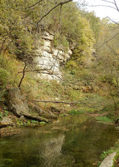
Get more familiar with the Driftless landscape by exploring Beaver Creek Valley State Park. East Beaver Creek flows in a stunning valley surrounded by 200-foot bluffs, with its cold, clear water winding along the bottom of the valley. Trails lead beside the creek and climb into the surrounding hills, offering expansive views of the valley.
The Beaver Creek Valley Trail, a 3-mile round-trip hike, can take you along the base of the bluffs and beside the trout-filled East Beaver Creek. For a broader view, take the steep Switch Back Trail toward the top of the valley, where overlooks reveal just how deeply water has carved into southeastern Minnesota’s ancient bedrock.
|
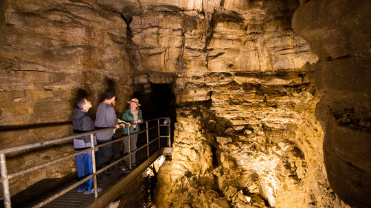 📷: Scenic tour at Forestville/Mystery Cave State Park.
The Making of Mystery Cave
Go underground at Forestville/Mystery Cave State Park.
Over the summer heat? Come chill with us underground! At Forestville/Mystery Cave State Park, Minnesota’s longest cave stays a cool 48 degrees year-round. Discovered in 1937, Mystery Cave has more than 13 miles of known underground passages filled with stalactites, stalagmites, flowstone, fossils and other fascinating formations.
Mystery Cave formed within southeastern Minnesota’s karst landscape, an area underlain by limestone and other rock that can slowly dissolve in water. As rainwater seeps through the soil, it becomes slightly acidic and works its way into cracks in the limestone. Over thousands of years, the water gradually widens those cracks into underground passages. The result at Mystery Cave is a maze of corridors extending through more than 13 miles of rock.
Want to see it for yourself? The popular scenic tour follows just under a mile of paved trails, bridges and lighted passages — and is accessible for wheelchairs and strollers. Along the way, you might even catch a glimpse of Turquoise Lake, an underground pool known for its vivid blue-green water.
Planning a September visit? Mystery Cave will soon transition from its summer tour schedule to a reduced fall schedule. Be sure to check the park website for the tour times and make a reservation before your visit.
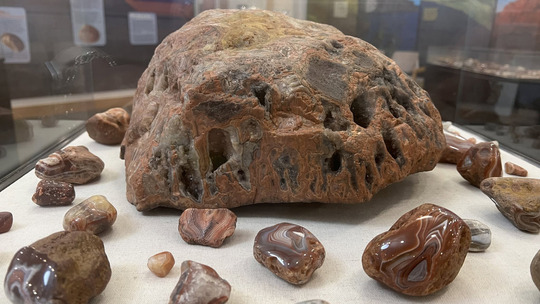 Moose Lake Agate and Geological Center
Learn more about the state gemstone.
Minnesota’s geologic story is on display at the Moose Lake Agate and Geological Center. Located at the entrance to Moose Lake State Park, the center showcases Minnesota’s state gemstone, the Lake Superior agate, alongside fascinating displays of rocks, minerals and geology from across the state. See impressive agate collections, learn how these colorful gemstones formed more than a billion years ago and discover how glaciers later carried them across Minnesota.
The center is open daily through Labor Day, Sept. 7. On Sept. 8, the center will transition to its fall schedule and will be open Thursday to Sunday through Oct. 18. Check the park website for current hours before your visit.
 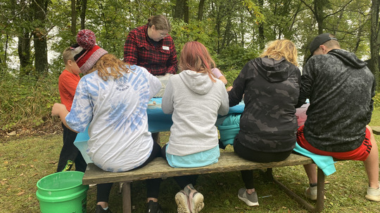 📷: Archaeology Day at Mille Lacs Kathio State Park in 2023. Photo courtesy Mandy Wintheiser (back middle).
Meet Mandy Wintheiser
DNR archaeologist with a knack for history.
A small piece of worked stone may not look as impressive as a complete arrowhead, but to archaeologist Mandy Wintheiser, some of the most exciting discoveries can be easy to overlook. Each one can add another clue to the story of a place. Stone flakes left behind from making or sharpening a tool, for example, can show that people once stopped, worked or lived nearby.
Mandy's interest in archaeology started when she was young. A childhood fascination with history eventually grew into a career in archaeology. For the past three years, she has worked with the Department of Natural Resources through the Minnesota Historical Society. Based at the DNR’s central office, Mandy works directly with projects to help identify, understand and protect cultural resources across the state.
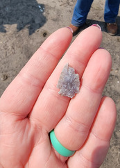
One of Mandy’s more unique recent opportunities came at Lake Bronson State Park. The DNR lowered Lake Bronson in September 2024 as part of a project to replace the park’s aging dam. With the water gone, land hidden beneath the lake became accessible for a rare archaeological survey. During summer 2025, Minnesota Historical Society archaeologists worked to document pieces of the area’s history exposed on the lakebed. Before the lake was created, the landscape included homes and other signs of human activity. For archaeologists, temporarily removing the water opened a window into that earlier landscape.
Education is another important part of her role, whether she is working with DNR staff, participating in archaeological organizations or helping others understand why cultural resources deserve protection. But archaeology is far from a solo endeavor.
“There are many different areas of expertise needed to research and protect cultural resources,” Mandy says. Archaeologists may help identify and interpret what is found, but researchers, historians, land managers and other specialists can all play a role in piecing together history.
That collaboration is especially important when archaeology intersects with projects on public lands. Mandy brings a cultural-resource perspective to projects while working alongside people with expertise in natural resources, engineering, land management and other fields. Together, that work helps protect archaeological sites that connect people to thousands of years of human history on the landscapes Minnesotans visit and enjoy today.
“It’s important to understand our cultural resources and history of people and the land,” Mandy says.
|
|