|
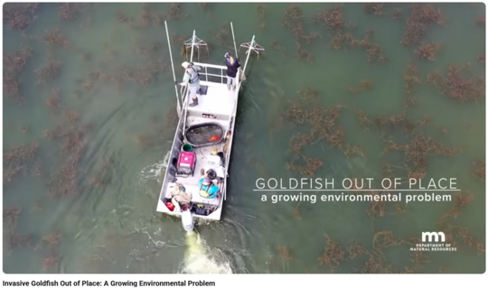
Many don't realize the impacts of former pet goldfish being released into our lakes, and some of our families may have contributed to the problem in the past. The DNR's Invasive Goldfish Out of Place: A Growing Environmental Problem video (less than five minutes) discussed the impacts.
Goldfish, often illegally introduced by well-meaning pet owners, are a growing environmental problem in Minnesota’s lakes and rivers that are difficult and expensive to manage and threaten our native ecosystems. Fortunately, there are steps we can take to prevent the spread of goldfish, protect our waters, and do the right thing by our pets by returning, rehoming, or surrendering your unwanted goldfish.
-
09/28/26 (Mon, 1-2 p.m.) Flood Inundation Real-time Mapping Register
-
10/05/26 (Mon, 1-2:30 p.m.) Floodplain Basics Register
-
10/19/26 (Mon, 1-2 p.m.) Floodplain Administration 101 Register
|
|
 |
-
11/09/26 (Mon, 1-2 p.m.) FEMA Map Basics Register
-
11/16/26 (Mon, 1-2:30 p.m.) Tools for Assessing Shoreland Bluffs Register
-
12/07/26 (Mon, 1-2 p.m.) Accessory Structures in the Floodplain Register
|
|
 |
-
01/11/27 (Mon, 1-2 p.m.) Dealing with Zone A Floodplains Register
-
01/20/27 (Wed, 9:30-10:30 a.m.) Flood Insurance Basics Register
-
02/01/27 (Mon, 1-2 p.m.) Better Culverts and Crossings Register
|
|
 |
-
02/16/27 (Tue, 1-2:30 p.m.) Floodplain Administration 201 Register
-
03/15/27 (Mon, 1-2 p.m.) Hydrology and Hydraulics for Non-Engineers Register
-
03/29/27 (Mon, 1-2 p.m.) Floodplain and Watershed Higher Standards Register
-
04/05/27 (Mon, 1-2 p.m.) Post Flood Responsibilities and Substantial Damage Register
|
|
 |
Remember: Recordings of past virtual training available
To see recordings of the one-hour virtual floodplain and other related trainings and presentations presented during 2026, and in recent years, go to the Shoreland and river-related training page, Floodplain training page or Other Land Use training page.
DNR's Floodplain and Floodplain Management information sheet gives high level summaries of key floodplain management concepts, including:
- What are floodplains?
- How are floodplains managed?
- Where do floodplain regulations apply?
- Flood insurance requirements
- Key Definitions
The 2006 version of this information sheet was recently updated. The content didn't change significantly, but it does have updated graphics and formatting.
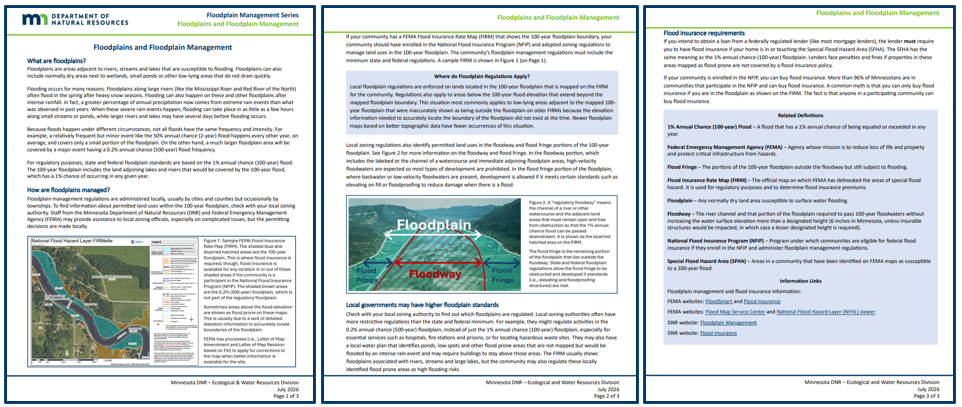
Pages from updated "Floodplains and Floodplain Management" information sheet
You are the local floodplain manager. A resident got the required local floodplain permit for work in the floodplain and placed fill around their foundation to help direct runoff away from the building. The building was constructed in 2012, and the area was first shown as floodplain on your 2015 maps.
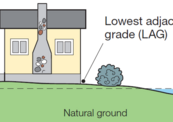
Now that resident has contacted you and says they are applying to FEMA for a Letter of Map Revision based on Fill (LOMR-F). They have a survey that shows the lowest adjacent grade (LAG) – or the lowest ground touching the building – is above the Base Flood Elevation (BFE), which is the 1% annual chance (or "100-year") flood elevation. To complete their LOMR-F application, they need to have someone from the city sign the “Community Acknowledgement Form.”
You check your records and see that house has a basement. You ask if they filled in the basement, and they say “no.”
What do you tell them?
See Zoning Challenge Answer later in this Water Talk newsletter.
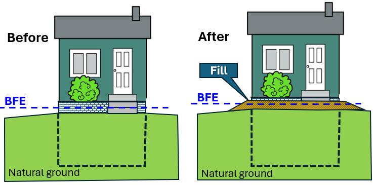
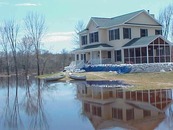
Before shows house with basement and Lowest Adjacent Grade (LAG) a bit below the Base Flood Elevation (BFE); After shows same house with fill to get LAG above the BFE
DNR staff recently completed and posted the first three videos in a series on finding Base Flood Elevations (BFEs).
What is the BFE?
The Base Flood Elevation (BFE) is the 1% annual chance flood elevation, or the 100-year flood elevation.
The BFE is a key elevation for meeting local floodplain regulations and for determining whether a building or lot is eligible to obtain a waiver to the mandatory flood insurance requirement. (Flood insurance is mandatory for federally backed loans when the building is in or touching the FEMA mapped floodplain.)
See the Floodplains and Floodplain Management information sheet (discussed in preceding article) for a high level discussion of the floodplain and regulations.
BFE video series
The first three videos in our Finding BFEs series:
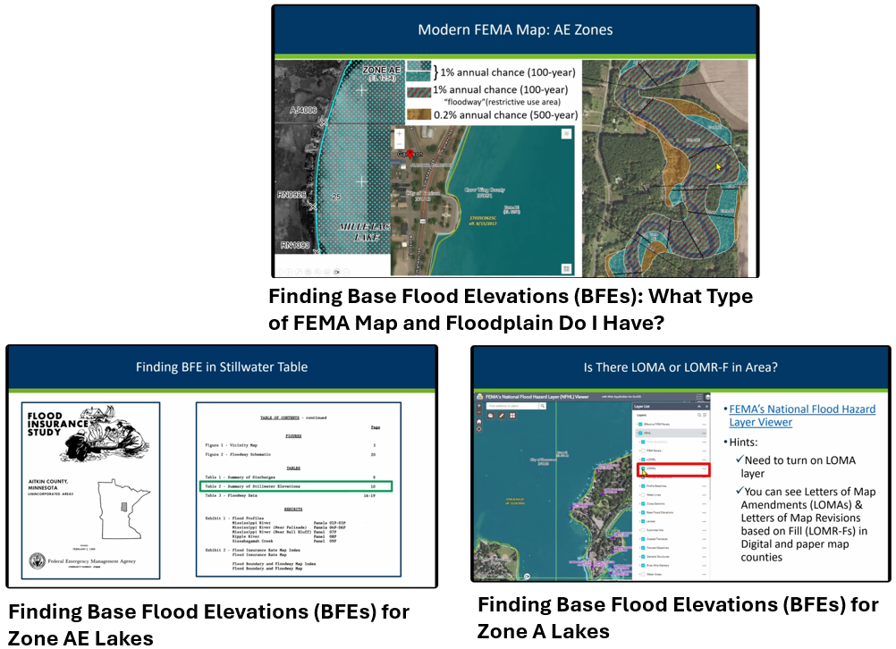
Videos: (1) Finding BFEs: What Type of FEMA Map and Floodplain Do I Have? (2) Finding BFEs for Zone AE Lakes (3) Finding BFEs for Zone A Lakes
Another two videos in the series are expected to be available later in 2026:
- Finding Base Flood Elevations (BFEs) for Zone AE Watercourses (detailed study watercourses)
- Finding Base Flood Elevations (BFEs) for Zone A Watercourses (approximate study watercourses)
FEMA floodplain maps issued before 2003 were paper, while those issued since are digital.
You will want to know how to find and print a paper FEMA map if your community's official maps are still paper, or if you want to look at the historical map (for example, if you want to see the map in effect at the time a building was constructed).
Does your community still have paper maps?
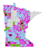
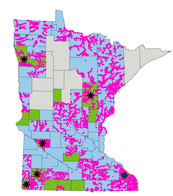
The current official FEMA floodplain maps for many Minnesota communities are still paper. In the map to the right:
- Light blue counties have digital Flood Insurance Rate Maps (DFIRMs)
- Green counties have older paper maps
- Light gray counties don't have FEMA floodplain maps.
The counties with current effective paper maps include: Aitkin, Chippewa, Faribault, Grant, Jackson, Kanabec, Martin, Murray, Polk, Rock, Sibley, Traverse, Wadena and Winona.
|
Video about Finding and Printing FEMA Paper Maps
If you want to view and print FEMA paper maps, see the new Finding and Printing Old FEMA Paper Maps video (less than 10 minutes).
The process to find and print a portion of the official Flood Insurance Rate Map (FIRM) - called a "FIRMette" - is much more complicated for the older paper maps than for the FEMA maps with the more modern Digital FIRMs (DFIRMS) for FEMA maps updated since about 2003.
Also, if you ever need to check the maps that were in place when a structure in your community was constructed, you probably will be looking at paper maps.
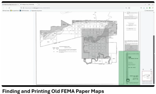
Video: Finding and Printing Old FEMA Maps
See "Is My House in the Floodplain?" video for finding newer maps
Note that our Is My House in the Floodplain video continues to be available for instructions on how to use the FEMA Map Service Center site to view and print digital FEMA maps. The video also includes brief discussions on why floodplain maps are important, finding the type of map in your county (for MN), how to document if there is not a FEMA map in that community, and a short intro to DNR's MNTOPO site (recently updated to MNTOPO 2).
That video has about a five-minute segment on finding and printing the paper maps, but FEMA changed the look of their site and how to do that. That is why the separate “Finding and Printing Old FEMA Paper Maps” video was done.
We hope to cut the paper map segment in our Is My House in the Floodplain and add a link to the new video in the “more” section below the video.
(See the Zoning Challenge question earlier in this Water Talk newsletter.)
Your response should be, "Sorry, but I can't sign this."
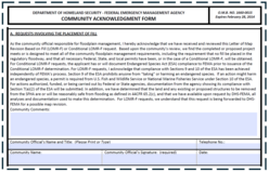
When you sign you are vouching that either:
- For houses built or substantially improved since this area was first shown in the mapped floodplain, you are ensuring the lowest floor meets your floodplain management ordinance and is at or above the Regulatory Flood Protection Elevation (RFPE). The RFPE is the Base Flood Elevation (BFE) plus one foot of freeboard plus any stage increase (up to 0.5 feet) from establishing the floodway, or a local more stringent requirement.
- For existing nonconforming structures (built before we had FEMA mapped floodplain in that area), federal regulations (44 CRF 65.5 (4) (i)) require that your community assures the lowest floor (which includes basements) is above the BFE.
In this Zoning Challenge, the house was built before the area was first shown on the mapped floodplain (making it an existing nonconforming structure), and the applicant informed you that the building still has a basement with a lowest floor clearly below the BFE and RFPE. In this example, you would not sign the Community Acknowledgement Form because the lowest floor is not above the BFE, as required by federal regulations.
|
Related reminders for communities when signing the Community Acknowledgement Form
-
Full or partial lot fill - If the applicant is applying for a full or partial lot LOMR-F, and the building has not yet been constructed, remember that you are also vouching that any future buildings will meet your floodplain management ordinance.
-
Possible violation? Let's say someone applies for a single structure LOMR-F, shows the lowest adjacent grade is above the BFE, but does not provide the lowest floor elevation of their building. The FEMA reviewer cannot ask for the lowest floor (since it is not one of the data requirements listed in the federal regulations (44 CFR 65.5 (a)). In this case, you should not sign the Community Acknowledgement Form until the applicant provides plans or other documentation showing the lowest floor elevation of their building being at or above the RFPE.
Note that if the application has the low floor elevation, and it is below the BFE, the case will be flagged by FEMA to review as a potential violation.
-
FEMA can ask for supporting documentation - If there is reason to believe there is a violation, the community can be asked for supporting information. The Community Acknowledgement Form the community official signs includes the statement "we have available upon request by DHS-FEMA, all analyses and documentation used to make this determination."
-
DNR staff routinely check LOMR-F cases - DNR receives monthly batches of the Minnesota Letters of Map Amendments (LOMAs) and LOMR-Fs. For LOMR-Fs (or conditional LOMR-Fs, for proposed filling) we check whether the application shows the "as-built" or proposed lowest floor and that it meets the minimum required elevation. If we don't see that documentation in the application materials, we reach out to communities and ask for that documentation.
Local officials often do not realize what they are signing. Many of our communities rarely have floodplain issues come up, and we have a lot of local staff turnover. So DNR will continue to provide occasional reminders like this to help local officials avoid inadvertently allowing something that is not allowed by their floodplain ordinance and/or by federal regulations.
Does a LOMR-F take the property out of the floodplain?
For flood insurance requirements:
Yes. The LOMR-F removes the mandatory flood insurance requirement. In FEMA’s eyes, the building is not in the special flood hazard area anymore. However, when the community signed the Community Acknowledgement Form they vouched that any existing or proposed structures meet the floodplain regulations. In Minnesota we often note that a LOMR-F is a mandatory flood insurance waiver.
For zoning:
Depending on state and local regulations, the structure may still be subject to the floodplain management regulations or other local regulations.
In Minnesota, there are several other steps required by state law before the property is removed from the floodplain for zoning. Minnesota Rules (6120.5800, subp. 2) require the area be filled above the Regulatory Flood Protection Elevation (RFPE), and contiguous to other lands lying outside the floodplain (or that flood control measures meeting Minnesota Rules 6120.5900 are constructed and operating). In addition, the community must adopt the LOMR-F by officially amending their floodplain management ordinance.
Also, if the site is within a shoreland district, the community's Shoreland Management regulations would still require minimum elevations.
During times of flooding our local officials can feel overwhelmed as they try to assist those living and working in the community with what can be done with damaged homes and businesses. DNR has two information sheets that we recently updated to aid our local officials and the landowners.
Repair or Rebuild after a Flood Flowchart
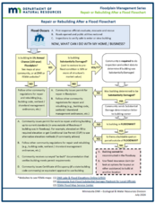
Use the Repair or Rebuild after a Flood Flowchart to triage which damaged buildings can immediately start repairs, which can get a local permit to do repairs after a quick review and which buildings that may be "substantially damaged" need a more in-depth review and may need more extensive updates.
The content of the flowchart has not significantly changed, but the format and accessibility have been updated.
|
After a Flood - FAQs on Building Requirements
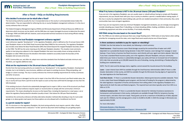
- What does the local floodplain ordinance regulate?
- What are the requirements in the 1% annual chance (100-year) floodplain?
- Is there assistance to help pay for repairs or rebuilding?
These and other common questions are covered in the After a Flood - FAQs on Building Requirements information sheet.
For more information
For more resources to assist local officials and residents, see DNR's Flood Preparation, response and recovery page. There are many links to helpful resources.
Some key resources for local officials include:
|

Have a tricky floodplain management situation? Want to get the latest timing for FEMA map updates?
Talk with FEMA and DNR Floodplain Program representatives during monthly virtual Minnesota Floodplain Management Office Hours. Hours are 10-11 a.m., typically on the fourth Thursday of the month (but a few are adjusted to avoid holidays, etc.).
Upcoming monthly hours (Note: all are 10 a.m. - 11 a.m. Central Time)
Where: Teams. No registration is required. Select a date to see a Teams meeting and join us.
These office hour dates and links are also available on the DNR Floodplain Training and Education page.
|
Important Dates to Note:
(since May 2026 Water Talk and upcoming in next couple months)
|
|
 |
Preliminary Maps
None
Local Officials Meetings and Open Houses
Note: Unless noted otherwise, these meetings are virtual
- Rock County Revised Prelims Flood Risk Review - September/October 2026
- Twin Cities HUC-8 Flood Risk Review (Capitol Region, Ramsey Washington, South Washington, and Vadnais Lakes) - October/November 2026
- Twin Cities HUC-8 Flood Risk Review (Coon Creek) - October/November 2026
- Twin Cities HUC-8 Flood Risk Review (Rice Creek) – November/December 2026
- Twin Cities HUC-8 Flood Risk Review (Mississippi and MWMO) - December 2026/January 2027
- Winona Countywide Flood Risk Review - Fall 2026
90-Day Appeal Periods
None
Letters of Final Determination (LFDs)
None
Effective (Six months after LFD date)
None
Additional Map Update Information:
|