What can I do to keep my shoreline from washing away?
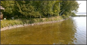
The DNR encourages natural alternatives to riprap to control shoreline erosion, such as natural vegetation planting, shoreline restoration, and leaving ice heaves in place. Over time, however, fluctuating water levels, increased wave action, ice heaving, and loss of natural vegetation can result in a demonstrated need to stop existing erosion or restore an eroded shoreline by installing natural rock riprap.
Riprap information
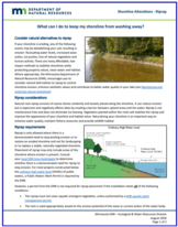
The DNR has updated its web resources, including a new riprap webpage and downloadable fact sheet on riprap. Highlights of the new resources include:
|
- A summary of how vegetation alternatives to riprap provide improved water quality, habitat and scenic character.
- A caution to property owners that riprap is not maintenance free and does not protect against ice heaves.
- Clarification that the DNR has authority for riprap installed below the ordinary high water level (OWHL) and local governments for work above the OHWL.
- An explanation of when there is a demonstrated need to stop existing erosion or to restore an eroded shoreline below the OHWL.
- A description of when riprap can be installed without a DNR permit if it complies with a comprehensive list of specific requirements. Riprap is not allowed for landscaping or aesthetic purposes and placement of riprap may only include areas of the shoreline where erosion is present.
- Riprap above the OWHL may be subject to local permit requirements, especially if more than 10 cubic yards of material are being disturbed for the project.
- For riprap installed below the OHWL and in a mapped floodplain, if a DNR permit is not required a local permit is required.
- Property owners and contractors must complete, sign, and submit a “Landowner Statement and Contractor Responsibility” notification form to the DNR before starting work.
|
Consult your local DNR Area Hydrologist to determine whether there is a demonstrated need for riprap to stop erosion and with questions on the requirements for installation of riprap without a DNR permit. Check with your zoning authority for local permit requirements and erosion control regulations.
Reminder: Any riprap project that is in a FEMA regulatory floodplain requires a permit. If the project meets the conditions where a DNR permit is not required, a permit is required from the local zoning authority (city if within city limits, or county if in unincorporated areas). However, if a DNR permit is required and most of the project is within DNR's jurisdiction (below the OHWL) the community may accept the DNR permit as the required permit.
-
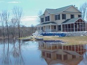
10/05/26 (Mon, 1-2:30 p.m.) Floodplain Basics Register
-
10/19/26 (Mon, 1-2 p.m.) Floodplain Administration 101 Register
|
|
 |
-
11/09/26 (Mon, 1-2 p.m.) FEMA Map Basics Register
-
11/16/26 (Mon, 1-2:30 p.m.) Tools for Assessing Shoreland Bluffs Register
-
12/07/26 (Mon, 1-2 p.m.) Accessory Structures in the Floodplain Register
|
|
 |
-
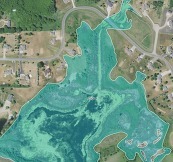
01/11/27 (Mon, 1-2 p.m.) Dealing with Zone A Floodplains Register
-
01/20/27 (Wed, 9:30-10:30 a.m.) Flood Insurance Basics Register
-
02/01/27 (Mon, 1-2 p.m.) Better Culverts and Crossings Register
|
|
 |
-
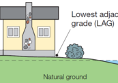
02/16/27 (Tue, 1-2:30 p.m.) Floodplain Administration 201 Register
-
03/15/27 (Mon, 1-2 p.m.) Hydrology and Hydraulics for Non-Engineers Register
-
03/29/27 (Mon, 1-2 p.m.) Floodplain and Watershed Higher Standards Register
-
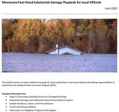
04/05/27 (Mon, 1-2 p.m.) Post Flood Responsibilities and Substantial Damage Register
|
|
 |
Remember: Recordings of past virtual training available
To see recordings of the one-hour virtual floodplain and other related trainings and presentations presented during 2026, and in recent years, go to the Shoreland and river-related training page, Floodplain training page or Other Land Use training page.

The Minnesota Association of Floodplain Managers (MNAFPM) annual conference will be held Nov. 4-6, 2026, in Rochester.
You don't want to miss all the great presentations, workshops and opportunities to learn from each other!
|
Schedule
- Nov. 4, 2026: Trainings, field tour, kickoff, and social
- Nov. 5, 2026: Main conference day
- Nov. 6, 2026:
- InfoWorks ICM Training
- Certified Floodplain Manager (CFM) exam (requires separate registration with Association of State Floodplain Managers at their CFM "Getting Certified" page)
Registration
Go to the MnAFPM conference registration page to register and see links to other conference details.
Register by Oct. 5 to take advantage of the Early Bird discount for the conference registration and field tour!
Note to Minnesota local government staff: You are encouraged to attend. See details about scholarships for the conference. Application deadline: October 2, 2026.
See MnAFPM website for more information.

Looking for ways to better protect natural shorelines and stem their loss to riprap and other shoreline alterations? If so, check out the new shoreland model ordinance. Incorporating ideas from many counties, the shoreland model ordinance has been updated with new voluntary higher standards to manage vegetation and shoreline alterations. This is the first model update since 2022 and the most significant since 2016.
Note: You can see the new model ordinance on the Shoreland Model Ordinance page. (The voluntary higher standards are shown in a blue bold font in the document that can be downloaded.)
Highlights of the updated model include:
|
Vegetation Management
Managing vegetation cutting, or restoration, is very difficult under the shoreland rules due to vague standards around what areas can be cut and by how much, as well as lack of a local vegetation permit providing oversight of vegetation management activities. Following are new higher standards that can help protect and restore shoreline vegetation:
- Requiring a local permit for most vegetation removal activities other than routine yard maintenance and vegetation pruning work.
- Requiring a 10-foot riparian buffer restoration as a condition for all vegetation and land alteration permits and shoreland variances.
- Defining and specifying specific areas where cutting is allowed and quantifying the amount of vegetation cutting allowed in these areas. Specific concepts or areas include structure screening, view corridors, recreational use areas, and access through the bluff and shore impact zones.
The loss of natural shorelines to riprap and other shoreline alterations is the biggest challenge in shorelands today. The model update offers many opportunities for local governments to help address this challenge.
Lake shoreline stabilization and riprap
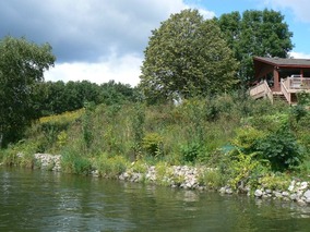
The model update includes standards that allow riprap only when a shoreline assessment determines that there is a demonstrated need to stabilize or restore a shoreline that cannot be controlled with suitable vegetation and bioengineering methods. A shoreline assessment evaluates the type and severity of erosion and determines the allowed stabilization practice that is reasonably capable of correcting or stabilizing the documented erosion. The DNR has developed a lakeshore shoreline assessment tool that local governments may use for assessing erosion and determining a suitable stabilization practice. (See separate article below on assessment tool).
The update also includes:
- Prohibiting riprap for aesthetic purposes and on wetlands; it cannot adversely affect adjacent properties and it must comply with DNR public water rules for work below the OHWL.
- Modifications to the riprap dimensional standards to limit the size and scale of riprap to that needed to address the demonstrated need.
- Requirement to use a rock or aggregate filter material unless it is not necessary due to tight soils and design. Design should allow for the voluntary establishment of vegetation within riprap.
|
Other Land Alteration Standards in the new model
- Standards for managing sand blankets and ice ridges above the OHWL.
- Standards for restoring a 10-foot riparian buffer as a condition for all vegetation and topographical alterations including specifications for restoration plans.
- New definitions to clarify and support these changes.
Townships Taking on Shoreland Zoning
The model also includes suggested language for counties to help clarify requirements and procedures for townships taking on shoreland zoning. The language borrows ideas from the shoreland rules for township adoption. While the DNR does not have authority to review and approve township shoreland ordinances, counties can assert oversight over townships taking on shoreland controls. Per Minn. statute 394.33, township ordinances must be consistent with and no less restrictive than county shoreland ordinances. Under this authority, counties can clarify the criteria and procedures in their ordinance to ensure township shoreland standards and approval procedures are consistent with those of the county.
The National Flood Insurance Program (NFIP) has now had over 30 extensions since the last five-year extension that expired Sept. 30, 2017. The last extension was set to expire Sept. 30, 2026. As of Sept. 2, 2026, the NFIP’s authorization has been extended to Dec. 11, 2026.
FEMA's Congressional Reauthorization for the NFIP page should have the latest updates. FEMA reports that they and Congress have never failed to honor the flood insurance contracts in place with NFIP policyholders. Should the NFIP’s authorization lapse, FEMA would still have authority to ensure the payment of valid flood claims with available funds.
Should the authorization lapse again, FEMA would stop selling and renewing policies for millions of properties in communities across the nation. Nationwide, the National Association of Realtors estimated in 2017 that a lapse might impact approximately 40,000 home sale closings per month.
|
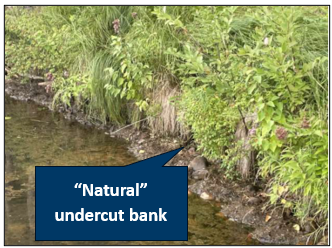
The installation of unnecessary riprap is widely recognized as causing the loss of much of Minnesota’s natural shorelines. This is because many property owners apparently choose a riprap aesthetic over a natural shoreline. Many contractors support this aesthetic and offer property owners riprap. Local governments can play an important role in changing this aesthetic through shoreline assessments and appropriate solutions that protect and/or restore natural shorelines and the habitat and water quality benefits they provide.
Problems with unstable shorelines
|
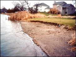
However, when the erosion is accelerated by a catastrophic natural or human disturbance, especially the removal of shoreline vegetation, the shoreline equilibrium is no longer balanced and the ecosystem becomes unstable, causing:
- Degraded fish and wildlife habitat,
- Release of excessive nutrients that stimulate undesirable algae growth, and
- Potential loss of valuable waterfront property.
|
DNR’s Lakeshore Stability Assessment Tool
A shoreline assessment looks at the natural and human causes of erosion including wave energy, slope, soil type, presence of aquatic and riparian buffer vegetation, and human activity along the shore. Using objective criteria, an assessment helps guide the implementation of solutions appropriate to the erosion cause. An assessment will also help determine the location and scale of the solutions. Often, erosion problems are isolated to a relatively small area of a shoreline.
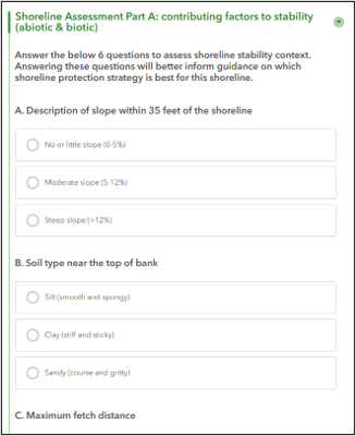
The DNR has developed a web-based assessment tool that local governments and other resource agencies such as soil and water conservation districts and watershed districts can use. The tool is especially useful for supporting local shoreline alteration regulations and permit decisions. The updated shoreland model ordinance contains optional shoreline alteration standards – the DNR assessment tool can be used to administer these standards.
The DNR assessment tool includes two parts:
- Part A (see figure) contains six questions that address contributing factors to stability (e.g., wave energy, slope, and soils).
- Part B contains two questions to determine if there is demonstrated need for installing riprap. Based on answers to the eight questions, the tool creates a recommended solution or stabilization practice.
The assessment tool is an ArcGIS Online (AGOL) web application from ESRI. The DNR uses AGOL to share geographical information within groups. The application uses Survey123 and Experience Builder to facilitate collaboration and data sharing. Many local governments also use AGOL and can be added to a DNR AGOL group. To be added to the DNR AGOL Lakeshore Stability Assessment group, ask your GIS staff to do the following:
- Update settings
-
user profile visibility set to public
-
user role privilege to allow user role to join external groups. Note, this requires a custom role with join external groups privilege turned on. This will allow group owners and managers to both find and add them to DNR created groups.
- Contact Paul Radomski with your AGOL account name or Username. Paul will then invite you to the group. An invitation will be added to the users ArcGIS Online Account Notifications, and you will need to accept. Once this is completed, you will be able to access all data, applications (the assessment tool), and content shared with the AGOL Lakeshore Stability Assessment Group.
|

Have a tricky floodplain management situation? Want to get the latest timing for FEMA map updates?
Talk with FEMA and DNR Floodplain Program representatives during monthly virtual Minnesota Floodplain Management Office Hours. Hours are 10-11 a.m., typically on the fourth Thursday of the month (but a few are adjusted to avoid holidays, etc.).
Upcoming monthly hours (Note: all are 10 a.m. - 11 a.m. Central Time)
Where: Teams. No registration is required. Select a date to see a Teams meeting and join us.
These office hour dates and links are also available on the DNR Floodplain Training and Education page.
|
Important Dates to Note:
(since August 2026 Water Talk and upcoming in next couple months)
|
|
 |
Preliminary Maps
- Chippewa Countywide: Revised Prelims - December 2026
Local Officials Meetings and Open Houses
Note: Many of these meetings were postponed due to the federal partial shutdowns and the inability of FEMA representatives to attend.
- Rock County Revised Prelims Flood Risk Review - November 2026
- Twin Cities HUC-8 Flood Risk Review (Capitol Region, Ramsey Washington, South Washington, and Vadnais Lakes) - November 2026
- Twin Cities HUC-8 Flood Risk Review (Coon Creek) - December 2026
- Twin Cities HUC-8 Flood Risk Review (Rice Creek) – January 2027
90-Day Appeal Periods
None
Letters of Final Determination (LFDs)
None
Effective (Six months after LFD date)
None
Additional Map Update Information:
|