|
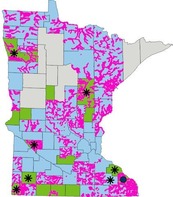
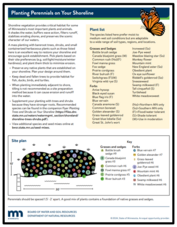
It's spring and many of us are thinking about planting projects in our yards. Have you been thinking about converting a portion of your lawn to a rain garden, native garden area, or bee-friendly lawn? Do you have shoreline where you could restore a more natural buffer?
How do I choose plants that will work in my location?
Several organizations and agencies have great overall sites that cover selecting plants, planting hints, and much more:
DNR resources for shoreline areas
|
|
 |
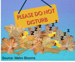
Remember: Don't "Clean Up" too early in the season
 |
|
If you are planning to garden this spring, please note that many pollinators overwinter by taking shelter in dead plant material in your yard. For this reason, don’t rake or otherwise disturb dead leaves and other plant matter until temperatures consistently reach 50 degrees, or until you start seeing dandelions!
|
FEMA is part of the Department of Homeland Security, so the current partial federal shutdown is impacting FEMA. FEMA staff and their contractors are key partners for many aspects of floodplain management at the state and local level.
Following are current updates based on the knowledge of DNR staff:
FEMA staff - During the shutdown some FEMA staff have been furloughed, but many have different funding sources and have been able to continue working. The number of staff have been greatly reduced over the past year, so those FEMA staff who are still working during the shutdown are focused on time sensitive priority projects. Note that many FEMA web pages are not being updated during the shutdown, and some separate FEMA websites are not being updated.
In addition, during the shutdown FEMA staff are extremely limited in their ability to communicate with state and local partners, or the general public. Minnesota's state staff in the floodplain program have not been able to communicate with FEMA's regional or headquarter staff since soon after the partial shutdown began.
FEMA Grants - FEMA has many grants that support efforts at state and local levels with identifying higher flood risk areas, preventing flood risk by following more resilient regulations and building standards, and helping communities to do a range of different flood reduction projects. Unfortunately, many of those grants have been impacted over the past year or specifically due to the federal partial shutdown.
FEMA grants support the state's Dam Safety Program, Floodplain Management Program and Floodplain Mapping and Modeling Program (through a Cooperating Technical Partners - CTP - grant).
- The CTP grant was not offered in 2025. Congress allocated funds for years 2025 and 2026 of the CTP program, so the states receiving the CTP grants are hopeful the grant will be available in 2026. While Minnesota has some multi-year grants for map updates that are ongoing, no new update efforts will be started until new CTP grants are awarded.
- The grants that support the state Floodplain Management and Dam Safety programs were awarded in 2025, however due - in part - to the partial federal shutdown, no reimbursements to any of the states have been received for work done since July 1, 2025.
FEMA's Building Resilient Infrastructure and Communities (BRIC) grant program had been on hold the past year, but FEMA recently opened the funding opportunity. The application period opened March 25, 2026 and will run for 120 days. See more on FEMA's Fiscal Years 2024/2025 Funding Opportunity web page. For status of Minnesota grants through the BRIC program, check with the state Homeland Security and Emergency Management (HSEM) division staff and see updates on their Hazard Mitigation webpage.
FEMA Contracts - Much of the FEMA work is actually done by FEMA contractors, including working on different aspects of the FEMA flood risk analysis and map updates, supporting key FEMA websites, reviewing requests for FEMA map zone and official map updates, supporting the Community Rating System, etc.
Fortunately, a key contract supporting flood risk analysis and FEMA map updates just got extended for a year. However, some contracts have not been extended, and several are set to expire soon.
FEMA Review Council - The FEMA Review Council had their term extended again - to May 29, 2026.
Future Updates - DNR and HSEM staff will continue monitoring FEMA status and programs for any changes that impact communities in the state.
By Tony Dingmann, Minnesota Pollution Control Agency (MPCA)
Spring is slowly arriving across Minnesota and there is a busy field work season ahead for the Watershed Pollutant Load Monitoring Network where Minnesota Pollution Control Agency (MPCA) staff and partners sample for pollutants at 197 river and stream stations.
Early March Observations
Up north, with the rivers still under the cover of ice, staff continue to take samples drilling through feet of ice. From the North Shore to Grand Forks, this portion of Minnesota is still weeks away from seeing open and flowing rivers.
In the central portion of Minnesota, a transition is occurring where signs of spring are more apparent. From Mille Lacs Lake to Alexandria, many rivers have opened while still others remain frozen. Water samples are collected more frequently during this transition.
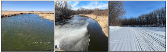
From left to right: Pipestone Creek in Southwest MN, Sauk River in central MN and Mississippi River in Aitkin, MN. All pictures taken on March 9, 2026.
Further south, from Rochester to Marshall, the rivers are ice free, even with the 10-20 inches of snow they received in mid-March. Staff are out collecting samples in response to the snow melt and rain events.
Between north and south, transitioning from winter to spring can take 6 to 8 weeks. Along with this comes changes in water levels, flow, water quality and pollutant concentrations. One constant is that MPCA staff and partners will be monitoring these changes and gathering sufficient water quality data to accurately show daily and yearly pollutant concentrations as well as long term trends.
More Information
To learn more about MPCA's work and to see pollutant concentrations, please visit the MPCA website: Watershed pollutant load monitoring | Minnesota Pollution Control Agency
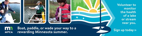
Spring is here and the Minnesota Pollution Control Agency’s Volunteer Water Monitoring Program is gearing up for another great season of lake and stream water clarity monitoring across the state. With more than 92,000 miles of streams and over 12,000 lakes in Minnesota, more volunteer monitors are needed to help track the health of our waters.
How does it work?
Volunteers conduct a simple water clarity test in a body of water at least twice a month during the summer. We provide all the equipment and training for free, so no experience is needed. Lake monitors boat or paddle to a designated spot in the lake to check the clarity, while stream monitors record data from the streambank or a bridge crossing.
The MPCA uses the volunteer-collected data to help determine whether lakes and streams are meeting water quality standards, designed to protect aquatic life and recreational activities (like fishing and swimming). In some cases, the information gathered by volunteers is the only monitoring done on a particular lake or stream, making volunteer gather data critical to our work to protect Minnesota waters.
Volunteer Story: Ahead-of-her-time Battle Creek researcher returns as water monitor
Julia Dady has fond memories of growing up along Battle Creek in Saint Paul. Dady was never afraid to get dirty and play in the mud, and she liked that the creek always had something for the kids to explore, even in the winter. Yet, during her years of playing in Battle Creek, Dady noticed pollution in the creek.
In May 1972, Dady’s seventh-grade teacher gave the class an assignment to develop a project that had some sort of community significance. Dady wanted to make her project about the creek because, to her, the creek was a big part of her community. There weren’t any books specifically about the creek and no internet at the time, so Dady embarked on her own investigative journey to document the pollution she saw. After collecting her photos and writing down her observations, Dady presented her project, titled Pollution of Battle Creek, to her seventh-grade class.
After completing her project, Dady remained interested in water quality. In high school, she decided to sign up for the volunteer water monitoring program. At that time it was run by the University of Minnesota and lake monitoring was the only option, yet she signed up and monitored a nearby lake.
Fast forward to 2022. Battle Creek looked much better, thanks to a 1982 flood and erosion control project. The University of Minnesota had transferred the volunteer water monitoring program to the MPCA, and the program started recruiting monitors for rivers and streams as well as lakes. Dady, who started searching for new volunteer opportunities decided to venture back out to the creek again.
As she filled out her application for a second time, she felt a very full-circle moment when she saw a monitoring location at Battle Creek was open. Now, as a volunteer, Dady loves to go out to her monitoring spot and talk to the people who walk by and ask what she is doing on the bank of the same creek she loved so much as a child.
“I feel a sense of connection to my community and to my neighborhood and the environment,” she said. “I feel like I’m doing a small part to help. I feel like I’m contributing something.”
Gain experience
This is the perfect opportunity for outdoor enthusiasts and those interested in protecting our state’s natural resources!
We’d be happy to provide a certificate, letter and/or resume/cover letter language at the end of each monitoring season you participate in to verify your participation in the program.
Interested?
Head to www.mn.gov/volunteerwater to locate open volunteer sites near you and learn more about this important program. Please let us know if you have any questions or would like further information on the program at watervolunteers.mpca@state.mn.us.
The National Flood Insurance Program (NFIP) has now had over 30 extensions since the last five-year extension that expired Sept. 30, 2017. The latest extension expired Jan. 30, 2026, and was extended just after our January 2026 Water Talk was issued. The NFIP’s authorization has now been extended to Sept. 30, 2026.
FEMA's Congressional Reauthorization for the NFIP page should have the latest updates. FEMA reports that they and Congress have never failed to honor the flood insurance contracts in place with NFIP policyholders. Should the NFIP’s authorization lapse, FEMA would still have authority to ensure the payment of valid flood claims with available funds.
Should the authorization lapse again, FEMA would stop selling and renewing policies for millions of properties in communities across the nation. Nationwide, the National Association of Realtors estimated in 2017 that a lapse might impact approximately 40,000 home sale closings per month.
|

The Association of State Floodplain Managers (ASFPM) is the premiere national association for all topics related to floodplain management, flood risk identification/mapping, flood risk reduction and community resilience.
The ASFPM annual conference will be relatively nearby in neighboring Wisconsin in spring 2026, so we hope to see many attendees from Minnesota.
The conference will be on the shores of Lake Michigan in Milwaukee, Wisconsin for a landmark event—ASFPM’s 50th Annual National Conference, themed: “The Fresh Coast Legacy: 50 Years of Floodplain Management.” Taking place May 31 – June 4, 2026, this milestone event celebrates five decades of progress in flood risk reduction and community resilience across the nation.
For more information
See the ASFPM 2026 conference website for more details and to watch for updates.
Registration is open. Register by April 15, 2026 to save $100 on registration.
|

Have a tricky floodplain management situation? Want to get the latest timing for FEMA map updates?
Talk with FEMA and DNR Floodplain Program representatives during monthly virtual Minnesota Floodplain Management Office Hours. Hours are 10-11 a.m., typically on the fourth Thursday of the month (but a few are adjusted to avoid holidays, etc.).
Upcoming monthly hours (Note: all are 10 a.m. - 11 a.m. Central Time)
Where: Teams. No registration is required. Select a date to see a Teams meeting and join us.
These office hour dates and links are also available on the DNR Floodplain Training and Education page.
|
Important Dates to Note:
(since January 2026 Water Talk and upcoming in next couple months)
|
|
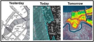 |
Preliminary Maps
None
Local Officials Meetings and Open Houses
Note: Many of these meetings are being postponed due to the federal partial shutdowns and the inability of FEMA representatives to attend.
- Anoka Countywide (outside Mississippi HUC8) Kickoff - May/June 2026
- Rock County Revised Prelims Flood Risk Review - May/June 2026
- Dodge County Better Data LOMR Flood Risk Review - May/June 2026
- Twin Cities HUC-8 Flood Risk Review (Capitol Region, Ramsey Washington, South Washington, and Vadnais Lakes) - May/June 2026
- Twin Cities HUC-8 Flood Risk Review (Coon Creek) - May/June 2026
- Twin Cities HUC-8 Flood Risk Review (Rice Creek) – May/June 2026
90-Day Appeal Periods
None
Letters of Final Determination (LFDs)
- Olmsted Countywide (Rochester Levee) - Dec. 10, 2025
- Wabasha Countywide - Jan. 21, 2026
Effective (Six months after LFD date)
- Olmsted Countywide (Rochester Levee) - June 10, 2026
- Wabasha Countywide - July 21, 2026
Additional Map Update Information:
|