|
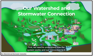
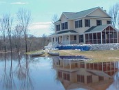
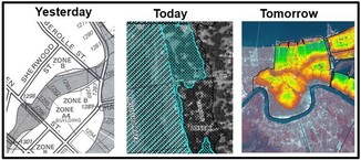
The Anoka Conservation District has two new videos on connections with stormwater. They are both excellent resources for the general public, helping us to understand connections to the watershed and the role of stormwater ponds.
 |
|
"Our Watershed and Stormwater Connection" educates us on what watersheds are, why they are important, and some of the challenges local officials face while trying to prevent flooding and improve water quality. (Posted May 2025; < 10 minutes) |
 |
|
"Our Stormwater Pond Connection" explains how stormwater ponds help keep our lakes and rivers clean, and includes practical advice on what to do to enhance stormwater ponds. (Posted May 2025; < 6 minutes) |
For more information
 |
|
Videos were funded in part by the Clean Water Fund of the Clean Water, Land, and Legacy Amendment. |
Editor's note: Know of videos or other educational resources on land use or water management of likely interest to the general public - especially those produced by our Minnesota local communities or organizations? Please share ideas for articles like this at floodplain.dnr@state.mn.us or with Ceil Strauss.
Public comment period open for first four counties
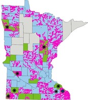
An important milestone is happening in Minnesota’s Public Waters Inventory (PWI) Update Project. The DNR has initiated the 60-day public comment period for PWI updates proposed in Aitkin, Benton, Blue Earth and Clay counties, the first updates in this important statewide initiative.
For these four counties, a preliminary map and list of corrections as well as details about the 60-day public comment period are available on the recently updated project webpage.
The project website includes the PWI Update Project - County Status and Public Comment tool (image of home page shown below).
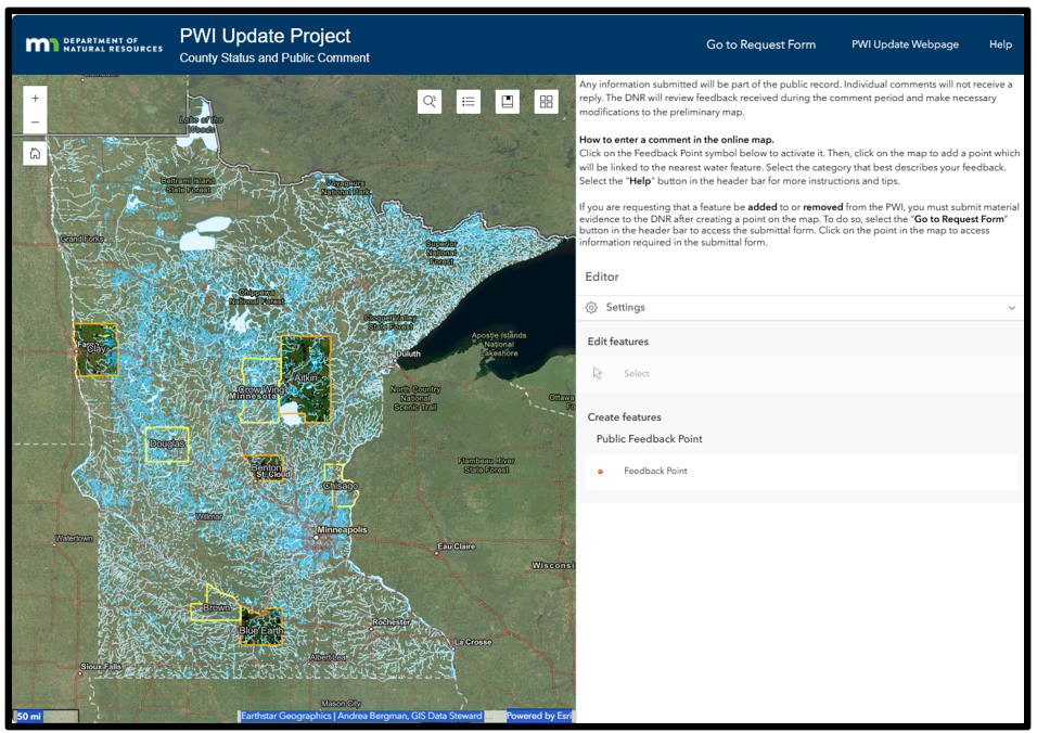 The PWI Update Project - County Status and Public Comment viewer that can be accessed on the PWI Update page
The DNR has notified officials in Brown, Chisago, Crow Wing and Douglas counties that it is starting PWI updates in those areas. Altogether, the DNR aims to update an average of 12 counties per year, wrapping up the project by 2032.
Background
In 2024, the DNR launched an eight-year effort to update the Public Waters Inventory (PWI) —a critical tool for identifying lakes, wetlands and streams that meet Minnesota’s legal definition of public waters. The PWI was first created in the 1980s, and this multi-year project is a significant step forward in improving water resource protection and regulatory clarity.
Questions about the revised webpage or the PWI Update Project can be sent to pwi.update.dnr@state.mn.us.

Back by popular demand!
A series of FREE one-hour virtual trainings on floodplain and shoreland management topics are being offered through March 2026. The timing will be similar to those offered in recent years, with most trainings offered 1-2 p.m. on Mondays and 9:30-10:30 a.m. on Wednesdays.
Use the "Register" link next to each training to sign up.
Note that each training is worth one Continuing Education Credit for Certified Floodplain Managers (CFMs).
You'll also be able to find the registration links and more details about each training on the DNR October 2025 to March 2026 Shoreland and Floodplain Upcoming Live Trainings page, or via the link at the top of the DNR Shoreland and Floodplain Education and Training Center.
|
Upcoming dates and topics:
-
1/7/2026 (Wed), 9:30-10:30 a.m.: FEMA Map Basics (including Letters of Map Change highlights) Register
-
1/14/2026 (Wed), 9:30-10:30 a.m.: Dealing with Zone A Floodplains Register
-
1/26/2026 (Mon), 1-2 p.m.: Shoreland and Floodplain Variances Register
|
|
 |
-
1/28/2026 (Wed), 9:30-10:30 a.m.: Accessory Structures in the Floodplain Register
-
2/4/2026 (Wed), 9:30-10:30 a.m.: Grading and Non-structural Development in the Floodplain Register
|
|
 |
-
2/11/2026 (Wed), 9:30-10:30 a.m.: FEMA Letters of Map Change (LOMCs) Register
-
2/23/2026 (Mon), 1-2 p.m.: Floodplain and Watershed Higher Standards Register
|
|
 |
-
3/4/2026 (Wed), 9:30-10:30 a.m.: Substantial Damage and Post-flood Responsibilities Register
-
3/11/2026 (Wed), 9:30-10:30 a.m.: Wells and SSTS Regulations in the Floodplain Register
-
3/23/2026 (Mon), 1-2 p.m.: Floodplain Violations and Enforcement Register
|
|
 |
Remember: Recordings of past virtual training available
To see recordings of the one-hour virtual trainings presented in recent years, and other newer on-demand virtual trainings, go to the Shoreland and river-related training page or Floodplain training page.
Come learn in person and interact with other local officials and professionals involved in aspects of floodplain management (i.e., surveyors, consulting engineers/planners, Realtors, lenders/agents).
We plan to cover floodplain management basics and FEMA map basics, including a map reading and interpretation exercise. Other topics include floodplain administration basics, utilizing web-based flood maps and tools, dealing with nonconformities, making Substantial Improvement (SI)/Substantial Damage (SD) determinations, and community post-disaster responsibilities.
|
|
These trainings are free.
|
Registration information for both the virtual trainings and the one day in-person trainings is at our Shoreland and Floodplain Training registration page (or via a link at the top of our shoreland and floodplain training page.)
You may also use the direct registration links for the dates/locations below.
-
Mankato: Feb. 3, 2026, (Tue); 9 a.m. – 4 p.m. (8:30 registration): MnDOT District 7 Office, 2151 Bassett Drive, Mankato | Register
-
Blaine: Feb. 5, 2026 (Thu); 9 a.m. – 4 p.m. (8:30 registration): MN DPS - Homeland Security and Emergency Management, 3925 Pheasant Ridge Dr. NE, Blaine | Register
-
Waite Park: March 10, 2026 (Tue); 9 a.m. – 4 p.m. (8:30 registration): Stearns County Services Center, 3301 County Road 138, Waite Park | Register
-
Rochester: March 12, 2026 (Thu); 9 a.m. – 4 p.m. (8:30 registration): Rochester Fire Station #2, 2185 Wheelock Dr. NE, Rochester | Register
These trainings are in-person only. (There will not be a virtual option.)
Continuing Education Credits (CECs) may be obtained by Certified Floodplain Managers (CFM).

The Association of State Floodplain Managers (ASFPM) is the premiere national association for all topics related to floodplain management, flood risk identification/mapping, flood risk reduction and community resilience.
The ASFPM annual conference will be relatively nearby in neighboring Wisconsin in spring 2026, so we hope to see many attendees from Minnesota.
The conference will be on the shores of Lake Michigan in Milwaukee, Wisconsin for a landmark event—ASFPM’s 50th Annual National Conference, themed: “The Fresh Coast Legacy: 50 Years of Floodplain Management.” Taking place May 31 – June 4, 2026, this milestone event celebrates five decades of progress in flood risk reduction and community resilience across the nation.
For more information
See the ASFPM 2026 conference website for more details and to watch for updates.
Local Scholarships
Local floodplain administrators can apply for scholarships offered by the Minnesota Association of Floodplain Managers (MnAFPM) to help offset the costs to attend the ASFPM conference - watch for updates on the scholarships anticipated to be available in January 2026 at MnAFPM.org.
|

Have a tricky floodplain management situation? Want to get the latest timing for FEMA map updates?
Talk with FEMA and DNR Floodplain Program representatives during monthly virtual Minnesota Floodplain Management Office Hours. Hours are 10-11 a.m., typically on the fourth Thursday of the month (but a few are adjusted to avoid holidays, etc.).
Upcoming monthly hours (Note: all are 10 a.m. - 11 a.m. Central Time)
Where: Teams. No registration is required. Select a date to see a Teams meeting and join us.
These office hour dates and links are also available on the DNR Floodplain Training and Education page.
|
Important Dates to Note:
(since November 2025 Water Talk and upcoming in next couple months)
|
|
 |
Preliminary Maps
None
Local Officials Meetings and Open Houses
- Wadena Countywide Discovery Kickoff @ Wadena - January 2026
- Anoka Countywide (outside Mississippi HUC8) Kickoff - Feb./March 2026
- Rock County Revised Prelims Flood Risk Review - March/April 2026
- Dodge County Better Data LOMR Flood Risk Review - Feb./March 2026
- Twin Cities HUC-8 Flood Risk Review (Capitol Region, Ramsey Washington, South Washington, and Vadnais Lakes) - Feb./March 2026
- Twin Cities HUC-8 Flood Risk Review (Coon Creek) - March/April 2026
- Twin Cities HUC-8 Flood Risk Review (Rice Creek) – March/April. 2026
90-Day Appeal Periods
None
Letters of Final Determination (LFDs)
- Olmsted Countywide (Rochester Levee) - Dec. 10, 2025
- Wabasha Countywide - Jan. 21, 2026 (anticipated)
Effective (Six months after LFD date)
- Olmsted Countywide (Rochester Levee) - June 10, 2026
- Wabasha Countywide - July 21, 2026 (anticipated)
Additional Map Update Information:
|