 July
Sunshine and shadow play amid the trees
In bosky groves, while from the vivid sky
The sun’s gold arrows fleck the fields at noon,
Where weary cattle to their slumber hie.
How sweet the music of the purling rill,
Trickling adown the grassy hill!
While dreamy fancies come to give repose
When the first star of evening glows.
By Henrietta Cordelia Ray
 Summertime
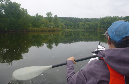
Floating on the water, being lulled by the gentle current, and watching the scenery change as you move down river is one of those quintessential summertime experiences. With 35 state water trails to choose from, you have options to experience it yourself right here in Minnesota. In this Trailblazer issue we feature three of the six designated Wild and Scenic Rivers in Minnesota, a designation that preserves and protects outstanding scenic, recreational, natural, historic and scientific values of a river.
Whether you’re looking to discover a new water trail or want to travel downriver for the first time, check out our route recommendations and make the most of summertime.

Join us for a 90-minute virtual focus group to share your thoughts on outdoor recreation and Minnesota state parks. We want to hear about your views and experiences in the outdoors to help us improve park visitors experiences. You’ll receive $40 for your participation.
Sign up to be considered. Your voice matters!
|

Bookmark mndnr.gov/river_levels to check river levels before your trip.
The MN Department of Natural Resources interprets the flow readings for paddling with ratings from "scrapable" (so low that paddlers may have to get out of their watercraft to avoid rocks) to "very high" (where paddling is considered dangerous and not recommended). When in doubt, contact a local state park, outfitter or bait shop to get the most-up-to date river conditions.
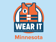
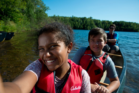
Everyone on the boat should wear their life jacket. Wearing a life jacket is the best way to ensure an unexpected fall into the water doesn’t turn tragic. Replace your life jacket if you can no longer read the label.
The new performance classification system on personal floatation devices (PFDs) is a numbered scale with buoyancy aids at the lower range and life jackets at the upper end. Choose your life jacket based on your boating activity and your weight.
|

The Cannon flows for about 83 miles (134 km) from Tetonka Lake into the Mississippi River. Bounded by rolling hills, high bluffs, farmland and woods in its upper reaches, this water trail provides a variety of wildlife and sightseeing opportunities.
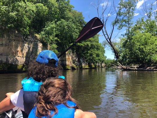 The river cut through sedimentary rocks creating a valley with dramatic dolomite and sandstone rock outcrops.
Around 1000 CE, the mouth of the Cannon River was a major center of the Mississippian culture. This culture was heavily dependent upon agriculture, resulting in population concentration along the river. Indigenous people and traders frequently hid their canoes near the river’s mouth. For this reason, French fur traders called it La Riviere aux Canots, or "the river of canoes." The name was later mispronounced by English-speaking newcomers, and that’s how the current moniker came to be.
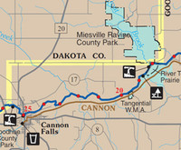
ROUTE: From Riverside Park in Cannon Falls to Miesville Ravine County Park
7 miles (11 km); 2-3 hours for the average paddler. For a longer day, continue to Welch, Minn. for 5 miles (8 km).
This family-friendly route has easy class I rapids, and is very scenic. On quiet days paddlers may see wildlife including bald eagles, herons and painted turtles. Since the Cannon flows into the Mississippi, its waters harbor a wide variety of fish species, including walleyes, northern pike and catfish.
|
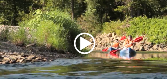 Find more route descriptions and videos on the virtual tour webpage.
Named Aandego-ziibi by the Ojibwe for the bird they called the “marauder of newly planted corn,” the Crow River has two forks that flow southeast into the Mississippi River.
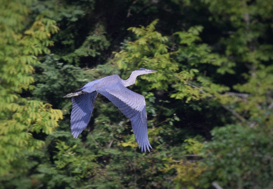 Chances to see wildlife along the Crow River are plenty. Sightings of great blue herons, white-tailed deer and bald eagles are common. PHOTO: Doug Easthouse.
The North Fork of the Crow River starts its 175-mile journey (282 km) toward the Mississippi River at Lake Koronis, on the border between Stearns and Meeker counties. Prairie and hardwood vegetation border this river, which deepens and widens downstream from Kingston, meandering through a floodplain that is sometimes more than a mile wide. Rapids are few and easy. The river is even broader and deeper as the North and South forks join near Rockford, making this section ideal for day trips. At river miles 18 and 10.5, mills still stand where dams were located in the past.
ROUTE: From Crow-Hassan Park Reserve to the confluence with the Mississippi River
10 miles (16 km); 3-4 hours for the average paddler. For a longer trip, put in at Riverside County Park.
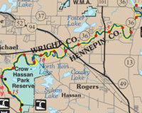
The Crow River leads paddlers through rural landscapes just outside of the Twin Cities metro area. River banks, forested with maple, basswood and elm trees, are occasionally interrupted by gently rolling farmlands.
|
The Rum River begins its journey at Mille Lacs Lake and continues 154 miles (248 km) to its confluence with the Mississippi River. Along the way, it meanders through glacial outwash plains.
The Rum River passes extensive backwaters and marshes, sandy upland plains, farmland and a thick canopy of maple, oak and ash trees. Several county and regional parks along the river provide opportunities to stop, stretch your legs, enjoy a picnic or even spend the night at a watercraft campsite.
ROUTE: From Martin’s Landing Public Water Access near Isanti to the Rum River North County Park
11.1 miles (17.8 km); 3.5-5 hours for the average paddler.
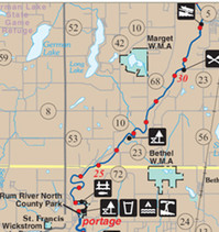
This stretch of the Rum River offers paddlers an opportunity to encounter an abundance of wildlife, including white-tailed deer, beavers, song birds and bald eagles. The Rum is also a favorite among anglers because of its strong populations of smallmouth bass, northern pike and walleyes.
|

Growing up, I always looked forward to our annual camping trip — it brought the whole family together for a weekend full of hiking, fishing and nights around the campfire.
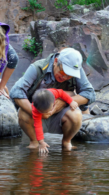
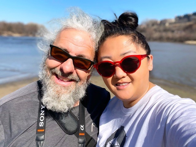 Bdote, the confluence of the Minnesota and Mississippi rivers, represents a spiritual and physical place of creation for Dakota people. When taking a break from their work creating visual media, Jim and Hlee enjoy visiting this special place, thinking of those who came before us. BELOW, Hlee’s dad with one of his 12 grandkids, passing his love for the outdoors to the next generation.
The great thing about Minnesota is that we have a lot of public land for recreation. The variety and abundance of accessible public lands is unique. As a small business owner, being able to immerse myself in the calm of nature is crucial for my mental wellbeing, and gives me the opportunity to unwind and unplug from my hectic life. I love that I’m able to take day trips to several state, regional and county parks, or plan a weeklong getaway just a few hours from home, yet feel like a world away.
Growing up as a child of refugees, we capitalized on the benefits of Minnesota’s public lands. Some of my best childhood memories are of our family hikes and camping trips. We didn’t see much of my dad during the week, as he worked third shift in manufacturing, but weekends with him were special, as he took us fishing and hiking. In their home country of Laos, my parents farmed, fished, and spent most of their time outdoors as part of their livelihood. After coming to Minnesota following the Secret War, these activities became hobbies.
My parents instilled in me the love for the outdoors. Now, my husband and I spend weekends outside, hiking at Nerstrand Big Woods State Park, fly fishing at Whitewater State Park, or camping at Voyageurs National Park. Cruising up and down the Mississippi River, we can fish, ride the locks and dams, beach the boat to go swimming with our pup, and see our hometown from a different vantage point. You’re in the middle of the city, but connected to nature. You’re both alone with your family but surrounded by community.
Black, Indigenous, Women of Color (BIWOC) can make the most of Minnesota’s public lands with confidence. Public lands are here for all of us to use and enjoy. No matter what your cultural or racial background is, no matter your gear or experience, you too can take a space that can bring you peace.
|
|