Get to know Andra Mathews
DNR Division of Fish and Wildlife, Section of Wildlife welcomes Andra Mathews as GIS Data Steward!
What titles or positions do you hold professionally or personally?
Personally, I am grateful to be called mom, wife, daughter, sister, aunt, friend, colleague, employee, mentee, and mentor. My credentials include a B.Sc. in Earth Sciences - Physical Geography, a M.Sc. in GIS & Cartography - Web Map Development, and certification as a GISP. I am a resigned non-profit representative member of the Minnesota Geospatial Advisory Council (GAC), and I am still involved with inter-agency and cross-sector GIS efforts through the GAC. I am a big fan of Minnesota's great GIS network and try to recruit others to join the industry and our collaborative efforts whenever the opportunity presents itself.
What is your favorite part of the job?
Shout out to Bruce Anderson and the Wildlife GIS support team, thanks for being awesome to work with! 😊 I am thrilled to have a variety of responsibilities that I enjoy related to GIS data stewardship: database design, spatial analysis & modeling, developing and implementing standards, and writing technical documentation! My favorite is when I have time to create complex cartographic hierarchies and layouts for map illustrations, or any opportunities to apply my web map development skills to UI/UX elements.
How do you use GIS in your position?
As a new employee at MNIT partnering with MnDNR, I have a lot to learn about this role and its function in the Division. In general terms, I use GIS to collect, manage, create, share, document, and enable spatial data for wildlife biologists, researchers, operations staff, and the variety of public stakeholders that we support. I am also responsible for helping to maintain and develop the maps and interactive web map applications that are used to collect and illustrate wildlife data for internal and public use.
Can you share any important projects that have needed GIS to complete?
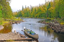
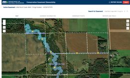
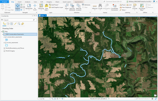
Some of the primary projects I will be supporting include the use of Survey123 for the Wildlife Health Team for their Chronic Wasting Disease work tracking the expansion of CWD throughout the state each year, and assisting the Area Wildlife Managers to record water control structures data needed for the enhancement of waterfowl habitat. I am also excited to be onboarding at this time while the Wildlife and Aquatic Habitat Management Application (WAHMA) is beginning to be modernized from its current platform.
Any parting thoughts?
An inspirational and famous quote from Mary Oliver that I learned from one of my greatest mentors, Gary Tabor (VMD, MES, and Chair IUCN WCPA Connectivity Conservation Specialist):
“What is it you plan to do with your one wild and precious life?” ~ Mary Oliver
|