|
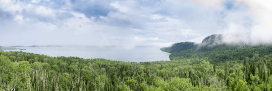
Minnesota's northshore and Lake Superior
It's all downhill from here
|
Have you ever tipped that beverage on your desk? The liquid marches toward your keyboard, you try in vain to stop the flow as it cascades over and between the keys. That is a very local example of water pulled along the path of least resistance.
Everywhere on the earth's surface, water is following along an inevitable downhill path. The smallest rivulets flow around barriers, join together and create streams that create rivers.
|
|
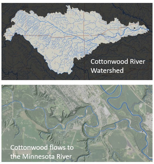 |
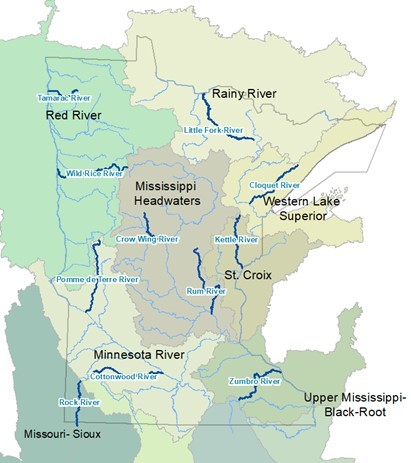
Most of our major watersheds are named for the river that collects that flow. Big Fork, Cannon, Kettle, Pine, Cottonwood; their names might evoke a childhood adventure or recent canoe trip when we too were pulled downhill to the river and followed the flow.
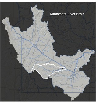
Each of these rivers flows into a 'big river' basin. These basin names are also familiar; the Red, the Miss, the Minnesota, the Rainy, the St. Croix.
Do you know what River Basin holds your favorite river? You can use the WHAF to explore river geography. There are many ways our rivers connect to the history of the land, the history of people, and the role of water in 'Mni' * sota.
*The Dakota word for 'water' at the root of our Minnesota vocabulary.
Want to explore our River Basins? Open the WHAF River Basin Map.
USE TIPS: Expand the width of your browser window if the map does not load. Click another part of Minnesota to display each River Basin Boundary.
|
Think you know your Minnesota river geography?
Take the Basin Challenge to test your water geography knowledge
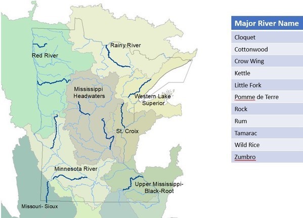 Do you know which river name matches each dark blue line on the map? Scroll down to reveal the answers.
 |
|
Did you ace the test?
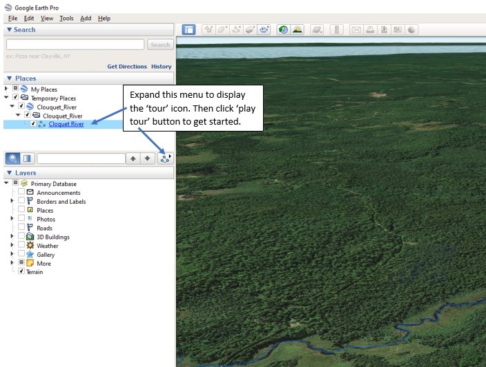
Do you want to know more about these rivers? You can fly-over each one in Google Earth by clicking a link below:
|
Here are detailed instructions to help you get started. You will need to download Google Earth for Desktop if you don't already have it installed. Enjoy your flight!
Try visiting a few rivers and compare the different landscapes that make Minnesota such a diverse place to live. Think about the ways that our land use influences our river systems, and how water has influenced the shape of our human and natural communities.
We live at the headwaters of several major rivers. Major systems like the Minnesota, Mississippi, Rainy, Red, St. Croix all start within or along our borders. That means the flow starts here, making our stewardship decisions are even more impactful downstream. Now that's the river geography that matters!
|