 May 2021
Give me daylight broken and scattered
across your fluid transparent face,
come meet me with the moon and the stars
running and tumbling along your sides.
~Hai-Dang Phan
Excerpt from River to River, Copyright © 2019
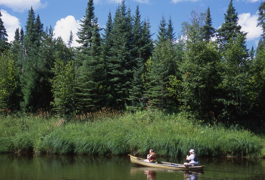
Minnesota has the largest water trail system in the United States, with a wide network of public water accesses, campsites and rest areas on state water trails on 33 rivers and Lake Superior. Water trails are assets for physical and mental well-being, providing awe-inspiring and meditative experiences to those navigating them or enjoying the surrounding environment.
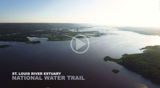
In this issue we celebrate the second national water trail designation in Minnesota. The Mississippi National River and Recreation Area Water Trail was one of the first in the nation in 2012, and the St. Louis River Estuary was added last October.
We also celebrate Asian American and Pacific Islander Heritage Month with a bit of art (do read Phan’s full poem!), paddling photos and stories of outdoors women who inspire others to connect with nature.

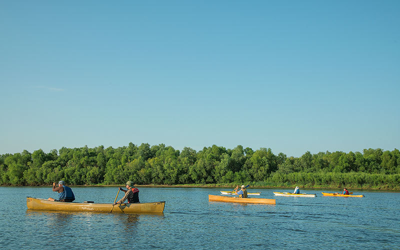
St. Louis River estuary on Lake Superior, the largest freshwater estuary in the United States, designated national water trail.
 Known as Gichi-gamiwi ziibi (river to the great lake) in Ojibwe, the St. Louis River connected trading posts on the Mississippi River, Lake Superior and Lake Vermilion.
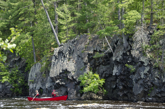
The St. Louis River State Water Trail flows southwest from Seven Beaver Lake in the Superior National Forest and turns southeast at Floodwood, Minn., to end at Lake Superior. The lower section of the river offers the only whitewater rafting opportunities in Minnesota, with rapids ranging from Class I to Class III between Floodwood and Cloquet.
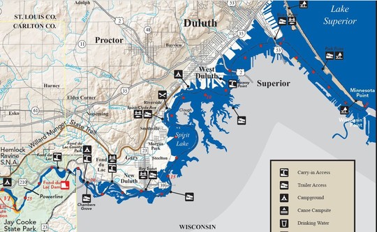 The St. Louis River Estuary National Water Trail includes 16.5 miles (26.6 km) of the river from the Fond du Lac Dam to Lake Superior. Click image for more information and to get the full maps for the St. Louis River State Water Trail.
The 12,000-acre estuary, where the St. Louis River enters Lake Superior, has been an important area for indigenous people, including the Fond du Lac Band of Lake Superior Chippewa. Once teeming with wild rice, fish, waterfowl and other wildlife, the estuary's ecosystem was nearly destroyed by unregulated industrial waste disposal. Restoration efforts have been underway to improve water quality and wildlife habitat. More
The St. Louis River Estuary National Water Trail project was a direct result of a cleaner river.
 The National Water Trails System connects people to nature by allowing public access for recreation and conservation activities along routes on waterways.
The designation drives tourism, contributes to public health and quality of life, and improves recreational accessibility to all people regardless of skill level, ability or financial means.

11 designated loop trails for over 73 miles (117 km) of paddling and other recreation options for all skill levels and abilities.
 Many landings along the St. Louis River Estuary National Water Trail provide access to parks, food and drinking water. Year-round recreation opportunities such as fishing, birding, camping, skijoring and biking are great ways to connect people to natural spaces and foster new relationships with the river.
 Two Novice Paddling Routes:
Boy Scout Shuttle
(3-4 miles or 4.8-6.4 km)
Access: Boy Scout Landing public water access, Perch Lake carry-in access. This trip can be done entirely on the water, or as a relay with some members of a party travelling the first leg of the relay on a multi-use trail.
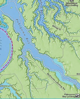
Pokegama Bay Paddle
(5-9 miles or 80-14.5 km; map on right)
Access: Woodstock Bay Landing, Billings Park access. Explore the immersive natural environment of the Little Pokegama River delta. Surrounded by public land, this loop is ideal for exploring natural habitat and wildlife diversity from the water or by land. NOTE: Difficulty level will depend on seasonal water flow and level of the Little Pokegama River.
|
Maps for all 11 loop trails.
Maps for the St. Louis River State Water Trail.
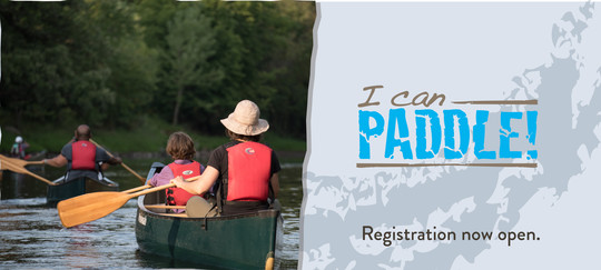 Learn to paddle with an I Can Paddle! program — instruction and equipment provided. Paddling equipment rental is available at some state parks and outfitters throughout the state. (Call ahead for availability as operations may be modified due to COVID-19.)

A successful river trip is a safe trip: Plan your route, leave a float plan with someone, check water levels and have the right gear. Paddling safety; boating safety.
 Cold Water Kills
Even if air temperatures feel like summer, water temps can still be dangerously cold. Always dress for immersion.
Rapids
Rivers and rapids are rated from Class I (easiest) to Class VI (dangerous) based on observations at low or moderate water levels or on secondhand reports.
The Best Life Jacket is One You'll Wear
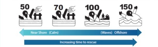
Nearly 90 percent of boating-related drowning victims were not wearing a life jacket. Replace your life jacket if you can no longer read the label.
The new performance classification system on personal floatation devices (PFDs) is a numbered scale with buoyancy aids at the lower range and life jackets at the upper end. Choose your life jacket based upon your boating activity and your weight.
|
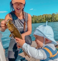
 The faces and stories of our visitors and staff.
"Black, Indigenous, people of color (BIPOC) can find adventure, connection, and healing in the Minnesota outdoors."
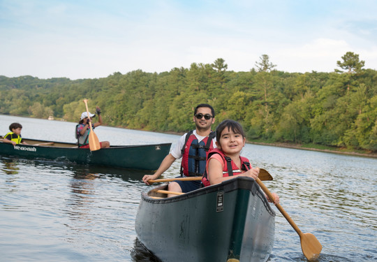
Swimming in natural spaces with the underwater views of land and sky feels deeply immersive and special. I enjoy extended time on the water canoeing. Navigating while paddling is a state of mediation and communication with the environment. I’m reminded of the power of nature with the movement of water in our rivers and lakes.
I value having access to undeveloped natural spaces. It’s in these spaces that I refresh and restore myself. I’m deeply grateful for all the public green spaces in Minnesota while acknowledging that these lands were stolen from Indigenous people.
As a second generation Asian American woman, the mainstream Minnesotan “outdoors person” portrayal doesn’t fit me. Learning more stories and history of all BIPOC people’s connection and proficiency in nature has helped remind me that I belong here.
Kym coaches outdoor endurance athletes to pursue goals that bring more meaning to their lives. Her honeymoon? A 19-day Boundary Waters Canoe Area Wilderness adventure! More about Kym @zest_ed_athletics
|
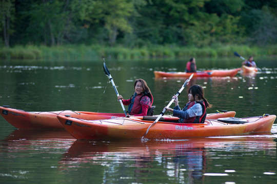
"My hope is that all Asian Americans and BIPOC, including my children, can feel safe and welcome in public land, so they too can reap the benefits from outdoor recreation."
Canoeing is what made me fall in love with the outdoors. It made the lakes and rivers accessible for me. The St. Croix River is one of my favorites. I love being able to stop in different towns for a quick picnic or explore a new hiking trail.
Public lands provide year-round recreation opportunities I wouldn’t otherwise have: cross-country skiing, hiking, foraging, hunting, fishing, paddling. There’s something to do no matter the season. Not everyone is a landowner but everyone has access to public land, and I think that’s a beautiful thing!
Outdoor recreation wasn't part of my life growing up, as it wasn't something my family did. Access and equity within the outdoors seem like a given, but many BIPOC have felt unsafe, unwelcome and judged for spending time on public lands and nature.
Jenny is an outdoor content creator, blogger, and wife and mom. Her goal is to evoke inspiration and wonder through the beauty of the great outdoors. More about Jenny @girlof10000lakes.
|
|