 March 2021
Cure yourself, with the light of the sun and the rays of the moon.
With the sound of the river and the waterfall.
~María Sabina, Mexican curandera and poet
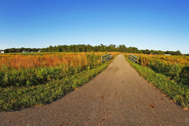
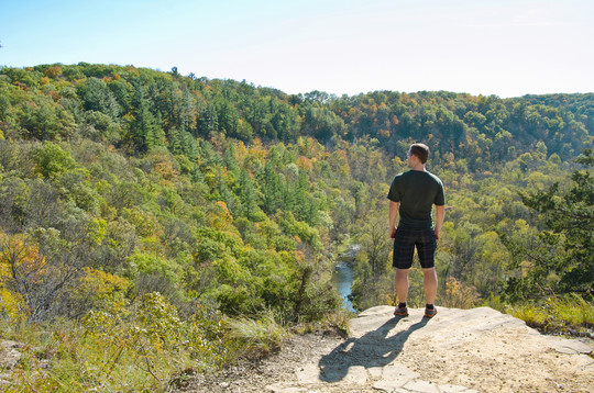 Take in the view from the top of Chimney Rock Overlook at Whitewater State Park. (The lush greenery will be there soon.)
2021 is the International Year of Caves and Karst. What better way to celebrate than to geek out on the science of karst, caves and the magical Driftless Area?
The landscape of southeast Minnesota offers many unique outdoor recreation opportunities including caving, fossil hunting and some of the best trout fishing in the United States. The hiking is spectacular, albeit challenging, with the elevation changes characteristic of the region. Many paved state trails offer opportunities for rolling along.
Join us for a mini geology lesson and armchair tour of the Driftless Area so you can make plans to visit soon and get your dose of healing nature.

Driftless Area (aka Paleozoic Plateau)
The last glaciers retreated before covering all of Minnesota, Wisconsin, Iowa and Illinois, leaving the area "driftless" or without glacial drift. Glacial drift is the material left behind by retreating continental glaciers.
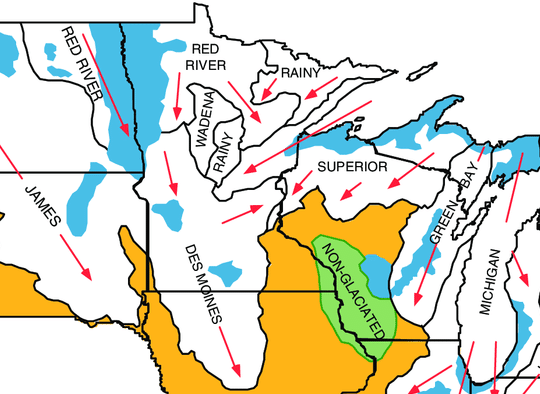 Generalized glacial geologic map of the upper Midwestern United States and names of major glacial lobes that were used to modify the glacial aquifer framework. SOURCE: U.S. Geological Survey
The Driftless Area is known for its deeply carved river valleys, caves and elevations ranging from 603 to 1,719 feet. Due to its unique characteristics, this area is home to many rare species of plants and animals.
Without the thick layers of glacial sediment or drift (up to 600 feet deep in parts of Minnesota), this area is more susceptible to the forces of water. Enter karst!
Karst
Karst is a special type of landscape that is formed as water dissolves rocks — mainly limestone — creating underground passageways.
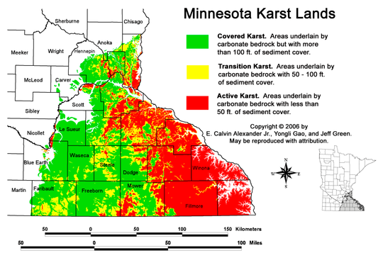 With little sediment cover, surface water quickly travels underground through the cracks and crevices of this "Swiss Cheese" rock, also the reason you won't see many natural lakes in the area. The cheesy moniker describes bedrock with sinkholes, caves, springs, blind valleys and disappearing streams.
Disappearing streams sink through fractured bedrock, either joining an aquifer or becoming an underground stream. A blind valley is where a stream ends abruptly in a depression or sinkhole.
Learn more from the Minnesota Pollution Control Agency website: Karst in Minnesota explanation and virtual tour; Karst Outreach and Education.
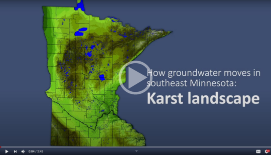 This video is part of a series that highlights the geology and complex movement of groundwater in southeast Minnesota. This animation complements a 3D poster and additional videos that can be found on the Minnesota Department of Agriculture website at www.mda.state.mn.us/segwresources

- It takes thousands of years for cave formations to develop, yet they're very fragile and could break in seconds if touched.
- Oils on human skin can change the way water moves across the walls of a cave impacting the growth of flowstone and other cave formations.
- Too much heat from lights in caves can cause algae to grow on the walls and ceilings altering the natural environment.
- The close connection between groundwater and surface water creates challenges in protecting water quality. Chemicals and bacteria can travel underground through sinkholes and resurface in nearby springs, potentially contaminating drinking water and area streams.
- Trout and other coldwater species need cold clean water to survive and thrive and are highly susceptible to temperature changes and pollution in the streams.

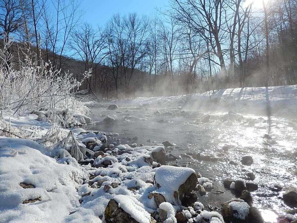 Beaver Spring does not freeze because it’s spring-fed from Big Spring.
The water in the spring-fed streams of the Driftless Area stays at a fairly consistent temperature of 48 degrees Fahrenheit. In the summer, the water feels cold but in winter it's much warmer than the stream's surroundings, making angling possible year-round.
Virtual tour
 This park is the premier karst destination in southeast Minnesota, with Mystery Cave and Big Spring being two of the major highlights. Follow the Big Spring trail alongside Canfield Creek to its source, the Big Spring. The limestone escarpment above the spring is habitat for boreal plants like balsam fir and other cold-loving species.
Big Spring originates at Goliath, an unspoiled sanctuary cave in Cherry Grove Blind Valley Scientific Natural Area (SNA).
Virtual tour
 Lake Louise State Park has more sinkholes than any other state park in Minnesota. Sinkholes are closed depressions caused by a collapse of soil or overlying formation above fractured or cavernous bedrock.
Virtual tour
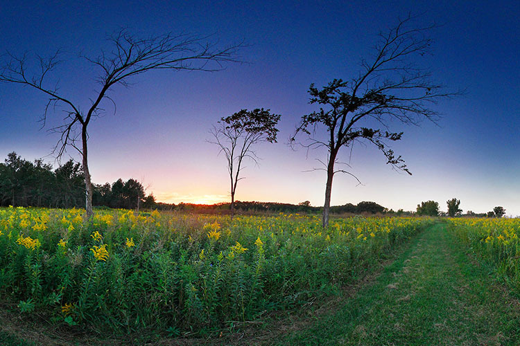
 This 29-mile paved trail bisects Lake Louise State Park and is perfect for seeing wildflowers in bloom and wildlife from the seat of a bike, from a wheelchair, on skates or on foot. It also offers a great birding experience with rarities such as grasshopper sparrows and dickcissels.
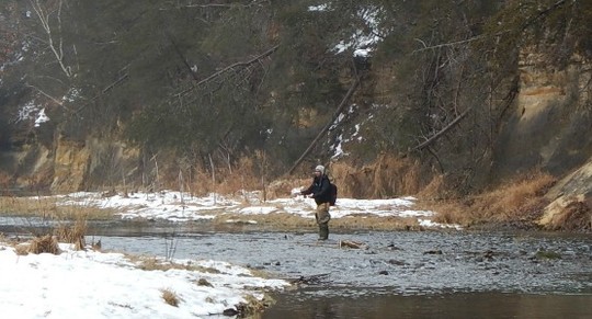 Fly fishing is popular along the middle fork of the Whitewater River, one of the top 100 trout streams in the United States.
Trout depend on cold, clean water for survival and the spring-fed streams of the Driftless Area provide ideal trout habitat (and fishing.)
The rock layer that makes up the cliff faces at Whitewater State Park, known as Oneota Dolomite, acts as a water conduit and is susceptible to cave formation. Timber rattlesnakes and peregrine falcons make their homes in small caves on the bluffs along the Whitewater River valley.
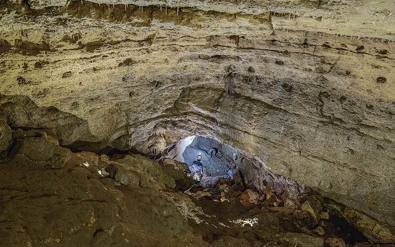
 Joe Petty discovered Mystery Cave in 1937 hoping to make a business out of it. The cave was named by local kids hired to help dig mud and debris from passageways. Legend has it one of the boys said, “We should call this place Mystery Cave ‘cause it’s a mystery why we’re working down here!”
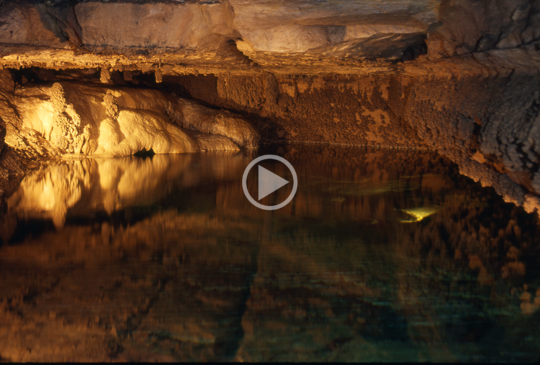
With 13 miles of passageways, Mystery Cave is the longest cave in Minnesota and ranks near 200th in the world for length. Other unique features that make this cave famous include raft cones, folia, botryoides and keyhole passages.
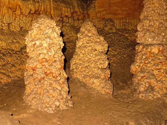 Raft cones look like underwater stalagmites. They're formed from calcite on the cones, which rise from the lake bottom and take millennia to form. (Click photo to read Adventure Underground, from the MCV.)
Cave formations grow very slowly. Factors that affect growth rate include the amount of water penetrating from the surface, the water's acidity, and the minerals in the soil and rock above.
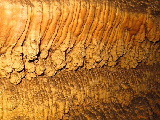 Flowstone forms slowly from a seeping flow of calcite-rich water. While much of Mystery Cave's massive flowstones are 12,000 years old or less, the oldest are more than 350,000 years old.
Mystery Cave is divided into three sections:
-
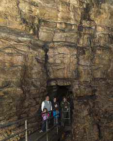
Mystery I is the section first discovered. It is now accessible and is where most tours (*) take place.
- On the Lantern tour, visitors explore Mystery II.
-
Mystery III is the section discovered most recently. Only caving clubs and researchers can access this section. They enter through a very small tunnel that leads to Dragon’s Jaw Lake, a narrow pool they cross using a small raft.
(*) Tours were suspended in 2020 due to needed COVID-19 social distance protocols. They will re-start when it is safe again to host visitors underground.
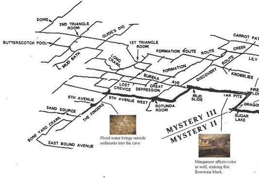  The above images show only snippets of the complex passageways of Mystery Cave.
Mystery Cave formed as the Root River began sinking underground through fractured bedrock of its streambed. It is estimated that the process began between 500,000 and 1 million years ago.
The cave continues to grow and change, especially when much of the tour route is flooded. Each drip of rain water that percolates through the cave leaves behind a minute crystal structure as it drops from the ceiling, forming a stalactite.
Caves provide critical habitat for bats, springtails and uncommon creatures such as blind, colorless insects and fish.
Mystery Cave serves as a laboratory for various agencies and researchers to study the connections between land-use, surface pollution and groundwater contamination. Expert cavers have the opportunity to explore the unique passages and help with the ongoing 3D cave mapping survey.
|
Read about the caves of Frontenac State Park from the Minnesota Conservation Volunteer magazine.
 Celebrating female adventurers on National Women's Month.
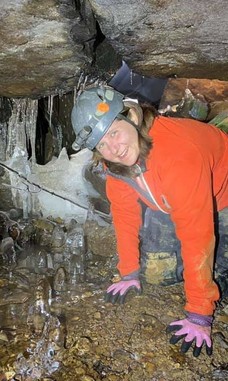
I have been drawn to tunnels, caves and small cozy places for as long as I can remember. As soon as I could, I started planning vacations around places that had commercial caves to visit. I have been caving regularly for the past eight years and cannot get enough.
I love caving for the sense of adventure and the opportunity to explore the unknown. I go in wondering what is on the other side of the small hole, only to discover new territory that nobody has set foot on before. I am always in awe of the formations that took thousands of years to grow. I like seeing the cave when it's alive with drips, streams and other water features. I love the shape of the walls, layers of rock and the unique things you find in caves, such as fossils.
The friendship and camaraderie in the caving community are yet another plus of the adventures.
|
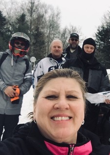
I have lived in Mahnomen County my whole life. I snowmobiled as a youth. My husband and I got back into the sport about 30 years ago and have been involved with the Sno-Drifters Snowmobile Club, and serve as director and secretary, respectively.
The White Earth State Forest trails are my favorite trails to ride — they are beautiful and well-maintained. Itasca State Park has a special spot in my heart, as it brings back childhood memories. Whitewater State Park is another favorite.
I like cross-county skiing, winter festivals, ice fishing tournaments and being outside all four seasons!
I highly encourage snowmobilers to get involved with their local clubs: It's a great way to meet others with the same interest and help ensure the growth and future of our sport.
|
|