|
|
|
May 13, 2020
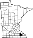
Geologic Atlas of Olmsted County (Part A)
Published 2020
The Geologic Atlas of Olmsted County was recently published by the Minnesota Geological Survey at the University of Minnesota. This is Part A of County Atlas Series C-49.
See the Press Release for the full story and links.
|
|
|

Groundwater Atlas of Olmsted County (Part B)
The DNR will use the geologic information to complete Part B of the series: the Groundwater Atlas of Olmsted County. Approximately 90 groundwater samples were collected for preparation of the atlas in 2019 and publication is expected in 2022.
The next counties to be sampled for preparation of a groundwater atlas will be Kandiyohi, Rock, and Nobles.
The atlas is a valuable tool for resource managers at all levels of government, as well as for industry, agriculture, and research. It can be used to help identify viable water sources, evaluate water supply, identify recharge sources and flow, manage sustainability, guide decisions for water well and septic system construction, assist in well-head protection for public water supply, and assess pollution sensitivity and likely paths of contamination migration.
|
|
|
County Atlas Program
Geology (Part A): Minnesota Geological Survey
Barbara Lusardi, Associate Director, 612-626-5119
Groundwater (Part B): Minnesota Department of Natural Resources
Paul Putzier, Supervisor, 651-259-5692
Partial funding for this project was provided by the Minnesota Environment and Natural Resources Trust Fund the Clean Water Fund.
|
|
