|
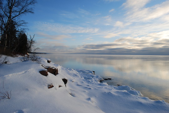
photo credit: MN DNR Beth Knudsen
The Power of Sharing
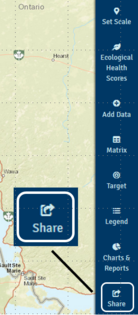
Even though we have moved past the holiday season of sharing, the WHAF team has a gift for you - a shiny new SHARE tool in the WHAF map!
|
This tool creates a unique URL link (web address) that you can save and use to re-open the same map at another time. You can also send the link to someone else so they can see your map in their own browser.
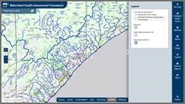
To learn about using the WHAF map, you can use the Map Guide for 'how-to' instructions for all the map tools; or you can jump directly to the page with information on using the Share tool.
|
|
 |
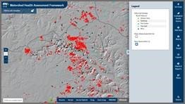
Examples of using Map Share:
One way to use the Map Share is to create a statewide map with your most commonly used data and health scores. Click on the 'Share' button to create the URL link to your map. You can embed the URL into a descriptive name like the link below:
Use Tip: Allow time for the data layers to draw before asking the map to do more. It is working to find everything you need to get started.
Next steps:
- Click on the map to display a major river basin mask.
- Zoom in on your area of interest.
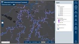
- Use the Share button to create a new URL Link for your local map
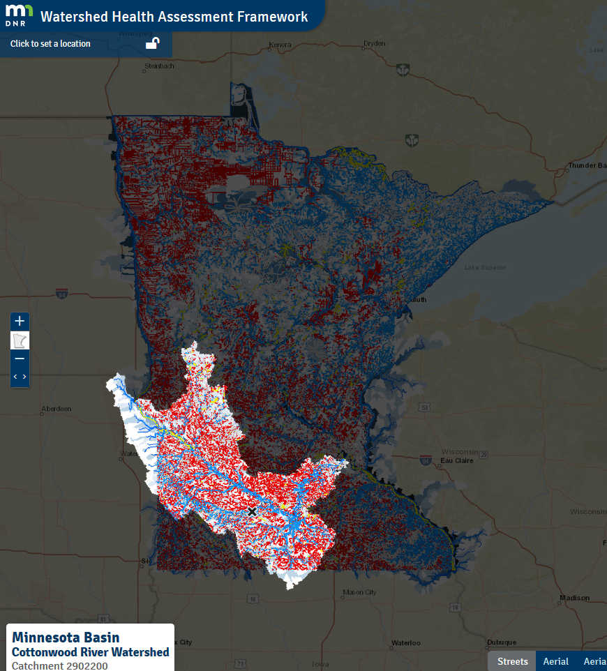
- Embed the link in a descriptive name, to build your own list of maps. Here is an example: Cottonwood altered streams and hydrologic position
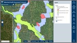
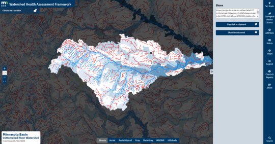 Cottonwood River major watershed, displaying altered streams and the hydrologic position of catchments data layer.
Now you know how; but why do we share maps?
Maps tell a visual story and help us:
- Interpret the data and build our understanding of watershed health.
- Discuss what we see with others.
- Compare and contrast different parts of Minnesota.
- Think about scale; how big is this issue, problem, or opportunity that you need to address?
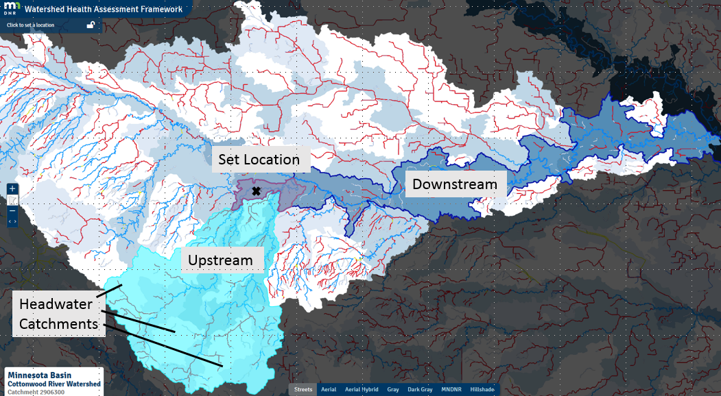
What does this map tell us about the Cottonwood River Watershed?
A red streamline indicates an altered stream. This map shows that streams in the flatter, northern part of the watershed have been altered. While the Cottonwood River is naturally meandering, it must accommodate the increase in water and sediment coming from the altered tributaries.
The background layer (graduated shades of blue) shows the Hydrologic Position of each catchment. You can trace the downstream path of a stream by following each progressively darker blue catchment.
Use the Set Scale tool to explore these upstream and downstream relationships further.
 Dutch Charlie and Highwater Creek flowing into the Cottonwood River.
Keep on Sharing:
The Share tool includes a button to 'share link via email'; click to email your map to a colleague for their review of something you found during an exploration.
You can also build a library of WHAF maps links. Bring along your list of links so you can easily pull up a map from anywhere with an internet connection. This is an efficient way to share information with a technical team or at a public meeting.
Here are some examples of regional management concerns you might be interested in exploring or sharing with a colleague:
Right click the links above to 'save as' and begin building your own library of links.
So map on... and remember the Power of Sharing!
Key Concept Review: Complexity
Complexity can seem overwhelming to discuss, but by defining the concept it becomes more approachable. Let's start by comparing complicated to complex.
Complicated:
If a system is complicated, it has many connected parts and processes. You might remember the instructions for 'build-it-yourself' furniture or building a model rocket. A car is another example of a complicated system with a finite number of parts and a finished product or state that works or acts in known and predictable ways. I expect to turn the key and drive my new car away from the dealership.
Complex:
If a system is complex, it has many connected parts and processes, but the parts and processes react and respond to each other in novel ways. It also has external inputs (such as energy) and outputs (such as waste), that travel through the system and influence the responses.
The human body is a complex system with inputs and outputs; think about the act of breathing or eating. Stuff comes in and stuff comes out. Each time that happens it changes something about the system and each minute the system is aging (sorry, but it's true!).
A wetland is also a complex system with nutrients, water, plants, animals, energy all interacting. Some elements stay within the wetland, and some flow in and out over time. And the system responds; too much input of phosphorus or sediment, and the system tips out of balance, shifting to a new, less healthy condition.
Shared Understanding:
Resource issues in your watershed will always require managing a complex system. Exploring and sharing maps is a great way to communicate different parts of the story and discuss the options. Working together, we can grow our understanding of how to improve watershed health in Minnesota.
|