Media contact: John Pepin, 906-226-1352
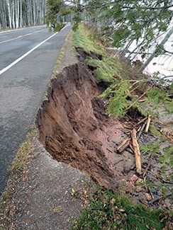
An emergency shoreline project will get underway Monday, Aug. 5 to protect the main entry road on the east end of Porcupine Mountains Wilderness Park from erosion aggravated by high Lake Superior water levels and storm damage.
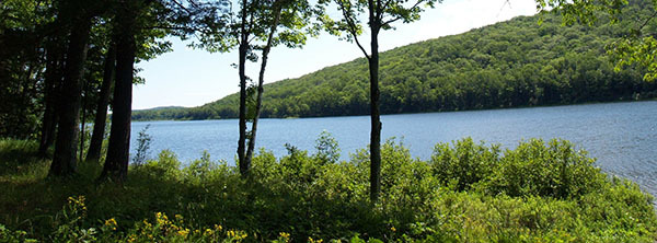
The Michigan Department of Natural Resources and the Ontonagon County Road Commission have teamed up to protect County Road 107 to ensure continued east access to the 60,000-acre park and its signature attractions.
The DNR is not typically involved in county road projects, but is in this case because of the road’s importance to the park.
“Without this main accessway, should a road washout or undermining occur, visitors to the park’s east end may be required to take an 80-mile detour, via west end entry, or be prevented altogether from reaching numerous points of interest,” said Eric Cadeau, DNR regional field planner.
Damage control
The estimated $550,000 project is focused at protecting critical roadway assets along the 107th Engineer Memorial Highway (Ontonagon County Road 107), including the Union River Bridge and shoreline along the road west of the bridge.
“This shoreline protection project is an immediate response effort intended to keep wave action and storms from further eroding or undermining the bridge or roadway that collectively serves as the eastern gateway to the park,” Cadeau said. “The DNR Parks and Recreation Division and the Ontonagon County Road Commission have also begun a public engagement and planning process which will help us determine long-term solutions for protecting this invaluable resource.”
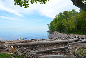
For now, large angular riprap stone will be placed 250 feet east and west from the concrete bridge deck at the Union River. Shoreline armoring will continue west of the bridge, protecting sections of the county road immediately vulnerable to damage in seasonal Lake Superior storm events.
The work is expected to continue through October, affecting traffic along County Road 107, from a half-mile east of the Union River Bridge to a half-mile west of South Boundary Road. Motorists should expect single-lane closures and one-way traffic controlled by temporary traffic signals.
“The public will be able access the beach and Lake Superior along significant lengths of the county road, but access will not be permitted within the work zone, including at beach areas,” said Mike Maloney, Ontonagon County Road Commission engineer.
Over the past several years, Lake Superior has been experiencing high water levels. In 2014, the lake level rose above the long-term annual average where it has remained. Currently, the Lake Superior water level is 2 feet above that mark. Lake Superior’s water levels are forecasted to be at, or near, record high levels through April 2020.
“In addition to the high-water levels, County Road 107 is affected by wind and waves traveling from up to 170 miles away, which increases wave energy and heightens erosive impacts on the shoreline and the undermining of the road,” Cadeau said.
Looking down the road
Meanwhile, the DNR, road commission and the Michigan Department of Transportation have been working over the past several months to develop multiple options for a long-term solution, identify funding sources and create a planning timeline.
A report outlining long-term options and cost estimates can be found at Michigan.gov/DNRPublicInput.
“We want the public to review these long-term options and let us know what solutions, natural features and impacts are important to them,” Maloney said. “The road commission and the DNR have also scheduled two public sessions to discuss the various long-term solution options with the public.”
Public input
First, the Ontonagon County Road Commission will hold a public hearing at 10 a.m. EDT Wednesday, Aug. 14 at Ontonagon Public Schools cafeteria, 701 Parker Avenue in Ontonagon. Comments will be limited to 3 minutes. Written comments may also be submitted. Groups planning to comment on the options are asked to designate a spokesperson to speak on behalf of the group.
A second session is set for the same day and location. This meeting is being organized by the DNR to discuss the park's draft general management plan that will include a breakout session at 6:45 p.m. on the erosion of County Road 107.
“We encourage the public to attend for an opportunity to review planning materials and provide feedback,” Maloney said. “Public input is a critical part of this planning process.”
For those unable to attend, comments on the long-term options for County Road 107 may be sent through Aug. 31 via email to CadeauE@Michigan.gov.
Questions? Contact Mike Maloney, (Ontonagon County Road Commission) 906-884-2332, Eric Cadeau (DNR regional field planner) at 906-353-6651 or Michael Knack (Porcupine Mountains Wilderness State Park acting supervisor) at 906-885-5275.
|