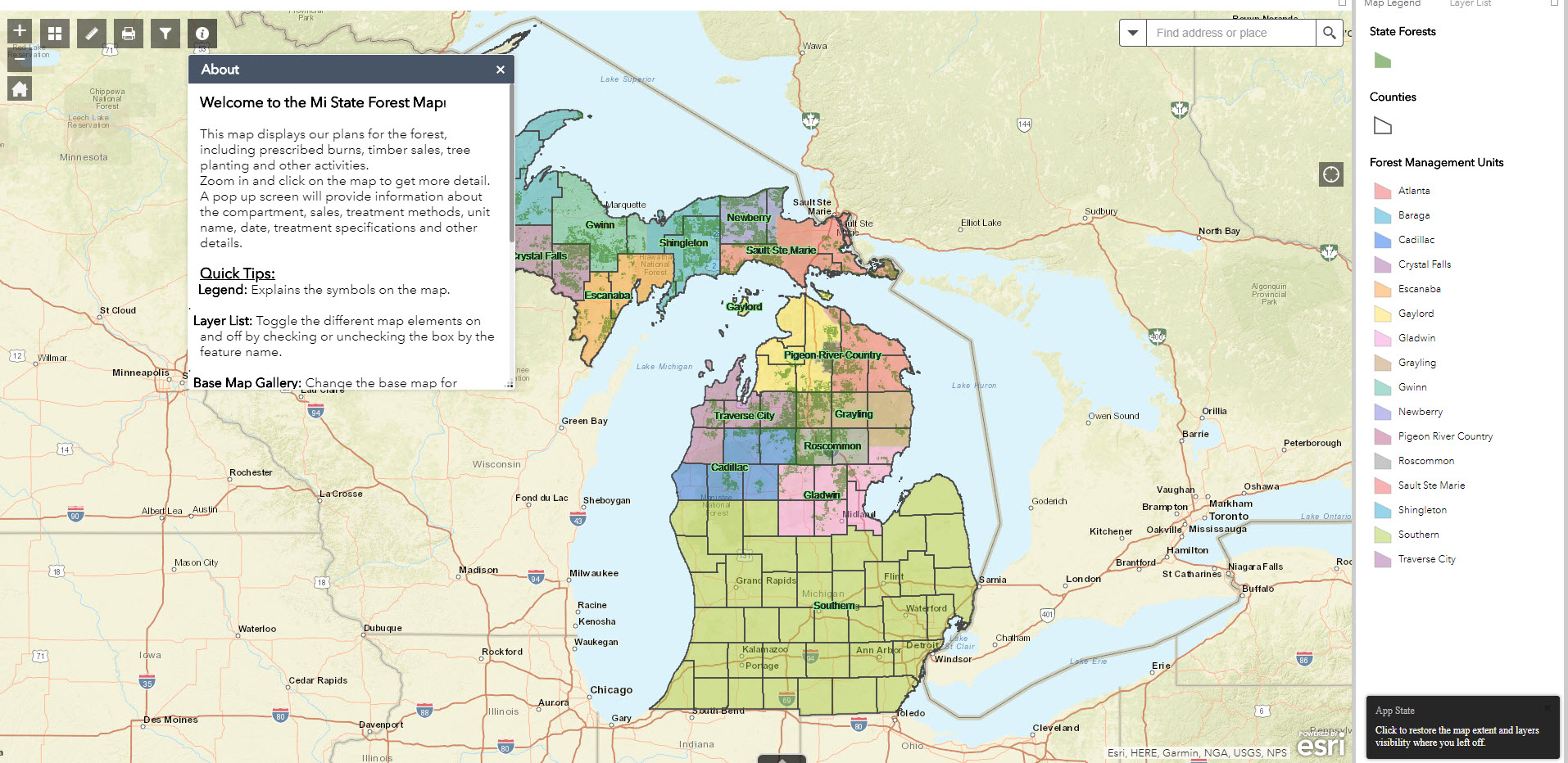
 The Michigan Department of Natural Resources has launched a new interactive online map to help the public better understand plans for different areas of Michigan’s state forests.
The map makes it easier to find information on timber sales, prescribed burns and other management activities. You can navigate on the map or simply type in an address to find out what activities are being planned or getting started in your area of interest. The current map highlights planned activities that will occur in 2020, the current “year of entry” – which means the department right now is discussing and planning for actions that will take place in 2020. Next year, in 2019, forestry staff will work on actions for the next year of entry, 2021.
“This really makes it easier for people to learn well in advance about what we’re doing to manage the forest for timber production, creation of wildlife habitat, or removal of invasive species – actions that will keep our forest healthy,” said Brian Maki, the DNR’s geographic information systems support manager.
The map is part of the DNR Forest Resources Division’s commitment to involving the public in proposed state forest management activities. People also may offer public comment at open houses at each of the 15 management units in the northern Lower Peninsula and Upper Peninsula. View the schedule.
Find the map under "Public Input" on the www.michigan.gov/forestry webpage. The DNR welcomes feedback to improve user experience, so if you have suggestions for improving interaction with the map, please email dnr-gis@michigan.gov.
The DNR manages 4 million acres of state forest and houses a crew of geographers and data managers who provide up-to-date information on forest health, wildlife populations and more. To explore the DNR’s maps and data that are available to you, visit www.michigan.gov/dnrmaps.
| 