Southeast Michigan’s St. Clair River is one of the world’s
busiest waterways. Its waters flow from Lake Huron into Lake St. Clair through
the largest delta in the Great Lakes, intersecting shipping lanes, abundant
natural areas, and one of the state’s top water trail destinations.
Historically, the St. Clair River suffered from the impacts
of pollution, but today transformative, award-winning
work to restore the river has reinvented its waterfront. Investments in environmental
restoration, economic development, and recreation projects have reconnected
the community to its river.
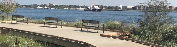
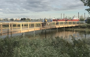
Recently, Michigan’s Coastal Management Program in the
Office of the Great Lakes partnered with St. Clair County to enhance this
connection by building a new interpretive boardwalk over a restored coastal
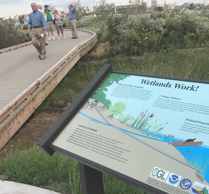
wetland on the river. The natural cedarwood boardwalk is wheelchair-accessible.
Interpretive signage posted throughout the site provides opportunities for
environmental education and citizen science, focusing on the area’s natural and
cultural history.
The public access project brings people closer to nature, getting
them up close to turtles, butterflies, frogs, wetland plants, and recovering
species like lake sturgeon and mudpuppies. It is a prime birding location; the
St. Clair River is known as a globally-important migratory flyway.
“This project has improved waterfront access for our local citizens and
visitors of all abilities to enjoy the tremendous shoreline assets in St. Clair
County,” said Lori Eschenburg of the St. Clair County Planning
Commission.
|