|
Share or view as a webpage | Update preferences
Q1 and Q2 2024 Maps and Data Updates

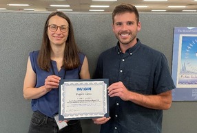
John Esch, who retired from EGLE earlier this year, was featured as the 2024 IMAGIN Geospatial Achievement Winner in recognition of his successes, leadership, and unwavering passion for advancing the field of geospatial and geologic technology in Michigan. If you’ve had the opportunity to cross paths with John, you know this is a very well-deserved award. Congratulations to John!
|
📰 EGLE GIS In the News
-
Drawing together the data on Michigan groundwater (March 11, 2024)
-
Esri: Michigan's map of environmental remediation projects (March 20, 2024)
-
EGLE story map details the life of woman who researched the effects of carbon dioxide on the atmosphere (March 22, 2024)
-
New story map looks at Air Quality Division's 2023 Year in Review (March 28, 2024)
-
New video series educates applicants and the public on EGLE's State Revolving Fund programs (April 1, 2024)
-
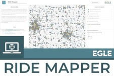
RIDE Mapper released as a replacement to Environmental Mapper (April 19, 2024)
-
It’s spring cleaning season. Don’t forget your medicine cabinet (April 22, 2024)
-
Michigan Green Schools program grows again in 2024 (April 24, 2024)
-
Career Series: Meet Art Ostaszewski, EGLE's drone pilot program coordinator (April 26, 2024)
🗺️ Maps and Dashboard Updates
In Q1 and Q2, we published three new apps. Visit EGLE’s “All Maps & Apps” page to explore similar content.
-
RIDE Mapper
Published: April 22, 2024. RIDE Mapper replaced the long-standing Environmental Mapper as the Remediation and Redevelopment Division’s (RRD) interactive map viewer displaying sites of environmental contamination regulated under Part 201, leaking underground storage tank sites regulated under Part 213, and underground storage tank facilities regulated under Part 211.
|
-
Regulated Areas for the Municipal Separate Storm Sewer System (MS4) Program
Published: June 12, 2024. This app shows the statewide expansion of the “Urbanized Area” for the Municipal Separate Storm Sewer System (MS4) program. The urbanized area is the regulated area for municipalities that are regulated under the MS4 program, including but not limited to cities, township, and villages.
-
Procedure 51 Site Classification Map
Published: June 18, 2024. Rapid, qualitative biological and habitat surveys for wadeable streams and rivers are conducted using the Great Lakes Watersheds Assessment, Restoration, and Management (GLWARM) section Procedure 51. Procedure 51 consists of separate qualitative evaluations of the macroinvertebrate community, fish community, and habitat quality. These protocols can be used to assess the existing condition of Michigan's wadeable streams and rivers as well as detect spatial and temporal trends. EGLE's Water Resources Division developed this map to illustrate their new Procedure 51 Site Classification system.
📖 Story Map Updates
In Q1 and Q2, we published three new story maps. Visit EGLE’s “Story Maps” page to explore similar content.
-
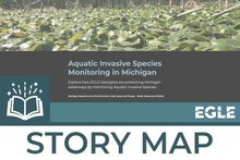
Aquatic Invasive Species Monitoring in Michigan
Published: March 5, 2024. This story map describes how Michigan's Department of Environment, Great Lakes and Energy (EGLE) monitors and manages aquatic invasive species (AIS) throughout the state.
|
|
 |
-
EGLE's Air Quality Division Releases 2023 Year in Review
Published: March 26, 2024. Metrics are an important part of the Air Quality Division (AQD)'s story, but the numbers alone don't tell the whole story. Read this story to deep dive into more details about the information found in the AQD 2023 Year in Review.
-
RIDE Mapper How-To Guide
Published: April 22, 2024. A guide for using the new RIDE Mapper, an online application that allows users to view sites of environmental contamination.
☁️ Open Data Updates
In Q1 and Q2, we published 17 new open data items and updated three open data item. Visit EGLE’s to explore similar content.
-
Aquatic Invasive Species Monitoring Locations
Published: March 5, 2024. A summary of aquatic invasive species monitoring location information and management actions for species of concern across the state. This layer provides information and photos of sites where specific species have been found and are being monitored. This data features several invasive species efforts, including Yellow Floating Heart, Water Lettuce, Water Hyacinth, Parrot Feather, New Zealand Mudsnail, European Water Clover, and Water Primrose.
|
-
Part 31 Rule 98 Outstanding International Resource Waters
Published: March 5, 2024. All surface waters of the Lake Superior basin that are not identified as Outstanding State Resource Waters (OSRWs) are designated as Lake Superior Basin - Outstanding International Resource Waters (LSBOIRW). Under the LSB-OIRW designation, new or increased loadings from point sources to the surface waters of the Lake Superior basin are prohibited unless the new or increased loading is consistent with the requirements of Part 31, Water Resources Protection, of the Natural Resources and Environmental Protection Act (NREPA)1994 PA 451, and specifically Rule 98 of Part 4, Water Quality Standards (WQS), promulgated under Part 31 of the NREPA.
-
Part 31 Rule 98 Outstanding State Resource Waters
Published: March 5, 2024. Rule 98(R 323.1098) of the Part 4 "Water Quality Standards" designated certain waters (contained in this layer) as protected from degradation. These waters include those that pass through National Parks or Shorelines, and designated Wild Rivers.
-
Gelman Site of 1,4-Dioxane Contamination
-
Published March 22, 2024.
-
Depth to Dioxane (2023 Data): Data from the Gelman Site of 1,4-Dioxane Contamination. This layer contains the estimated depth to 1,4-dioxane.
-
All Bore Locations Layer Group (2023 Data): Data from the Gelman Site of 1,4-Dioxane Contamination. This layer contains all bore locations in the current RockWorks project database.
-
Dioxane Plume (2023 Data): Data from the Gelman Site of 1,4-Dioxane Contamination. This layer contains the modeled 1,4-dioxane groundwater plume related to the Gelman Site using maximum concentrations at each location from 2023.
-
Fish Contaminant Monitoring Sampling Sites and Select Results (Consolidated Version)
-
Certified Michigan Green Schools (2023-2024)
-
Published April 19, 2024. The Michigan Green Schools program certifies schools in Michigan that have completed environmental stewardship activities. This data includes all the certified Green Schools in Michigan for the 2023-2024 year.
-
Assessment Units 2024
-
Published May 3, 2024. The Clean Water Act (CWA) requires Michigan to prepare a biennial report on the quality of its water resources as the principal means of conveying water quality protection/monitoring information to the United States Environmental Protection Agency (USEPA) and the United States Congress. These layers represent hydrologic features described in the report:
-
Michigan Green Ribbon Schools
-
Published May 6, 2024. The U.S. Department of Education Green Ribbon Schools (ED-GRS) recognizes schools, districts, and Institutes of Higher Education (IHEs) that: reduce environmental impact and costs; improve the health and wellness of schools, students, and staff; and provide effective environmental and sustainability education. The Michigan Department of Education (MDE) coordinates ED-GRS and nominates candidates based on an annual application process. This layer includes the Michigan schools that have been certified through this process.
-
Municipal Separate Storm Sewer System (MS4) Existing Urbanized Areas 2010
-
Published June 12, 2024. Urbanized areas from the 2010 census used in the EGLE Municipal Separate Storm Sewer System (MS4) Program.
-
Municipal Separate Storm Sewer System (MS4) Urbanized Areas Expanded from 2010
-
Published June 12, 2024. Urbanized areas expanded since the 2010 census used in the EGLE Municipal Separate Storm Sewer System (MS4) Program. The data is from the 2020 census and was compared with existing urbanized areas from the 2010 census.
-
Procedure 51 Site Classifications
-
Published June 18, 2024. EGLE's Water Resources Division developed this layer to illustrate their new Procedure 51 Site Classification scoring process for monitoring sites.
Recently Updated
-
Gelman Site of 1,4-Dioxane Contamination
-
Last Updated March 22, 2024. Previously published data was renamed (and metadata updated) to show the data’s vintage with the addition of the new 2023 published data.
Note: Many of EGLE’s open data layers are updated on a daily, weekly, monthly, or regular basis through live data integrations and these changes are not reflected in this newsletter or in the “Data Updated” details. Individual data layers will have update frequency detailed in their metadata. The information provided here reflects updates through manual static data pulls.
📅 Mark Your Calendars!
-
Statewide GIS User Group Meetings: quarterly networking and educational opportunities for GIS professionals across Michigan. The meetings are open to everyone from students through seasoned professionals and feature a range of technical and non-technical topics. You can join virtually or in person in Lansing.
- Upcoming GIS Conferences:
-
GIS Day 2024: November 20
Questions? Concerns?
Send an email to EGLE-Maps@Michigan.gov.
Visit our Open Data Portal for more information.
|