|
Share or view as a webpage I Update preferences
 EGLE Public comment opportunity and updates to the Pollution and Solution Mapper
 Public Comment Opportunity: 2022 Integrated Report and TMDL Addenda
The Michigan Department of Environment, Great Lakes, and Energy (EGLE) is accepting written comments between February 22 and March 25, 2022, on the draft Water Quality and Pollution Control in Michigan, 2022 Sections 303(d), 305(b), and 314 Integrated Report (2022 IR). The 2022 IR describes the status of water quality in Michigan and includes a list of water bodies that are not attaining Michigan’s Water Quality Standards and require the establishment of pollutant Total Maximum Daily Loads (TMDL). The draft 2022 IR is available on the Integrated Report Web site.
Concurrent with the 2022 IR Public Comment period is the Public Comment period for the Draft Addenda to the Statewide E. coli, PCB, and Mercury TMDLs and several other E. coli TMDLs (Bean Creek, River Raisin, South Branch River Raisin, and Luna Pier). The draft 2022 Addenda provide details on the rivers, beaches, and lakes that are newly proposed impaired waters assessed during the 2022 IR process. Water bodies in the Draft Addenda are intended to be covered by the respective TMDLs when the Addenda are approved by the United States Environmental Protection Agency.
Integrated Report- Written comments regarding the draft 2022 IR may be submitted to Kevin Goodwin at GoodwinK@Michigan.gov. Information Contact: Kevin Goodwin at GoodwinK@Michigan.gov or 517‑290-4198.
E. coli - The Draft 2022 Addenda are available on Michigan.gov/EcoliTMDL, along with supplemental information. The proposed newly impaired waters and Draft TMDL watersheds can be viewed on the interactive Pollution and Solution Map. Comments and questions should be directed to Molly Rippke at RippkeM@Michigan.gov or 517-342-4419.
Mercury and PCB - The Draft 2022 Addendum to the Statewide Mercury TMDL, and other information, is available on the Mercury TMDL Web Site. Similarly, the Draft 2022 Addendum to the Statewide PCB TMDL, and other information, is available on the PCB TMDL Web Site. Comments and questions for either should be directed to Gary Kohlhepp at KohlheppG@Michigan.gov or 517-230-7548.
Written comments regarding any of the above documents may be submitted to the Michigan Department of Environment, Great Lakes, and Energy, Water Resources Division, P.O. Box 30458, Lansing, Michigan 48909-7958.
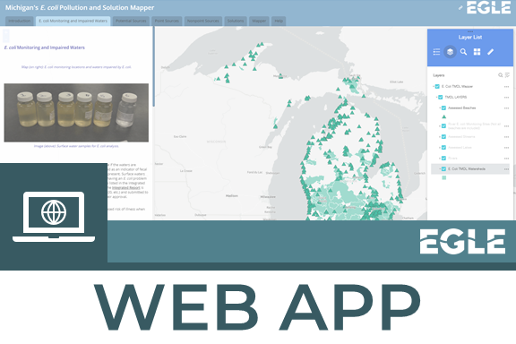 Updates to the Pollution and Solution Mapper
Several layers in EGLE’s E. coli Pollution and Solution Mapper have been updated in order to provide the most relevant information and details for the review of the Draft 2022 Addendum to the Statewide E. coli TMDL and the Draft 2022 Integrated Report. The purpose of this series of interactive maps is to provide the public with access to important public health information including E. coli monitoring locations, data summaries, and information on potential point and nonpoint sources of bacterial pollution.
For the public comment and review of the 2022 draft Addendum to the Statewide E. coli TMDL:
- In the E. coli Monitoring and Mapper tabs:
- The assessment unit layers (beaches, rivers, and lakes) have been updated to reflect newly proposed impaired waters for inclusion in the statewide E. coli TMDL, as well as the addition of newly monitored water bodies that are fully attaining the E. coli water quality standards.
- The E. coli TMDL Watersheds layer has been updated with the draft TMDL watersheds, which are drawn based on the proposed newly impaired waters (assessment units).
-
E. coli monitoring sites and data summaries were updated with 2021 data collected by EGLE and data submitted to EGLE by outside partners.
- In the Point Source and Mapper tabs, the following information was updated:
- The Combined Sewer Overflow (CSO) layer was updated to reflect the completion of the CSO control project in the city of Port Huron, with positive impacts to the Black and St. Clair Rivers.
- The National Pollutant Discharge Elimination System (NPDES) layer and the Groundwater Permit layer were updated to reflect current facility locations.
- Concentrated Animal Feeding Operations were removed from the general NPDES layer and are now included in their own layer with more information about livestock number, types, and amount of water produced.
- The Municipal Separate Storm Sewer System layer was updated to include villages and some metroparks in urbanized areas (based on 2010 census information).
|
