|
Share or view as a webpage I Update preferences

Announcing the public launch of EGLE's TMDL Watersheds Screening Tool and the availability of portal layers
The Department of Environment, Great Lakes, and Energy (EGLE) Water Resources Division (WRD) is announcing the availability of the Total Maximum Daily Load (TMDL) Watersheds Screening Tool. The purpose of this interactive map is to allow the public to view United States Environmental Protect Agency-approved TMDL watersheds in Michigan, which will assist National Pollutant Discharge Elimination System permittees in determining which TMDLs may be applicable. The WRD’s monitoring watersheds are identified, as well as a buffer screening tool that allows the user to produce a report of TMDLs near their location.
The development of a TMDL, or another approved alternative, is required when a designated use is not being met and the impairment is caused by a pollutant. Simply put, TMDLs are a regulatory basis for restoration of water quality. TMDLs address the following goals:
- Improve macroinvertebrate and fish communities by reducing sediment loads and increasing dissolved oxygen.
- Decrease nutrient loads to address nuisance algae and biological impairments.
- Reduce PCBs in the water column and in fish tissue for human consumption.
- Improve the safety of water recreation (swimming, wading, paddling, etc.) by decreasing pathogens.
- Address toxic substances, such as copper.
To increase data accessibility, these layers are now available on EGLE Open Data Portal (search for “TMDL”). Assessment units for the Great Lakes, beaches, rivers, and inland lakes can also be found on the Open Data Portal. These GIS files represent the spatial extent of water bodies, or portions of water bodies, which correspond with assessment units described in the 2020 Integrated Report (Clean Water Act Sections 303(d), 305(b), and 314).
Please direct any questions to Molly Rippke at rippkem@michigan.gov.
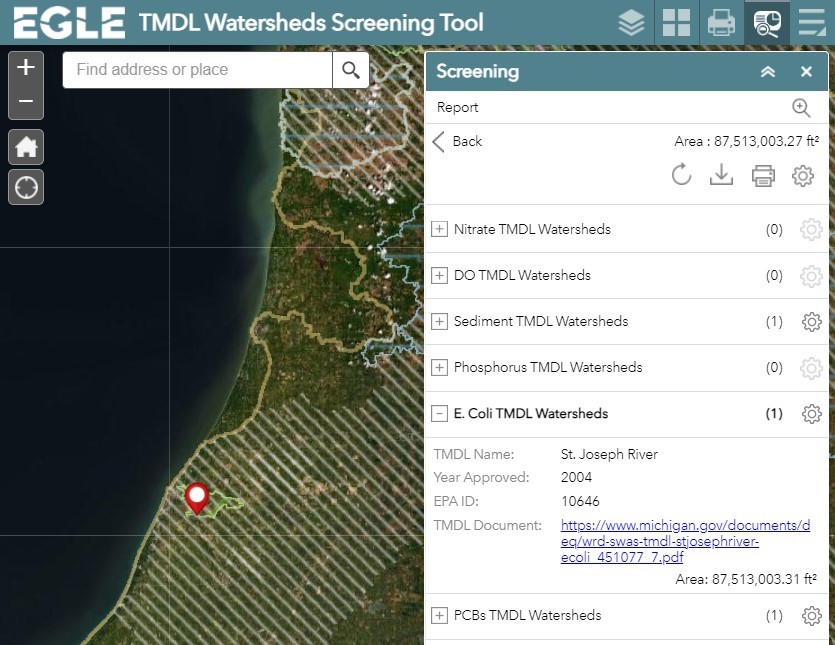
Screenshot from EGLE's TMDL Watersheds Screening Tool
|
