|
The Maine Geological Survey (MGS) recently released a Nearshore Survey System (NSS) Bathymetric Data Viewer. The viewer displays data collected with the MGS NSS as point elevation data and interpolated elevation raster datasets. This data is being released to provide bathymetric data to aid decision-makers in research and management related to dredging, beach nourishment efforts, or other planning efforts.
MGS collected bathymetric data at numerous locations using a Nearshore Survey System. The current NSS consists of a jet-boat pontoon platform, an RTK-GPS, and single-beam shallow-water fathometer, while a previous version of the NSS utilized a jet-ski platform. Specialized surveying software is used for mission planning, data capture and analysis. MGS scientists have collected data on a roughly annual basis at several locations where dredging, beach nourishment, and nearshore placement of dredged sediments occurred. These areas include:
- Nearshore placement or beach nourishment
- Wells Beach, Wells (2018-2022)
- Saco beaches, Saco (2016-2022, 2025)
- Little River Rock, Old Orchard Beach (2018, 2019, 2022, 2023, 2025)
- Dredging of a river channel and associated beach nourishment
- Scarborough River and Pine Point, Ferry and Western beaches (2016-2025)
MGS has also been tasked with conducting bathymetric surveys at other locations for other special purposes, including:
- Eelgrass mapping efforts
- Spring Point and Willard Beach, South Portland; Fore River and East End Beach, Portland; Mackworth Island, Falmouth; Lanes Island, Yarmouth (2018)
- Ground-truthing of new NOAA topo-bathy LIDAR data
- Blue Hill Bay, Blue Hill (2017)
- Bathymetric surveys in the vicinity of hydroelectric dams
- Leonard Lake, Ellsworth (2020)
- Kennebec River region, including Waterville, Winslow, Fairfield, Benton, Clinton, Skowhegan, Norridgewock (2020)
- Filling gaps in topo-bathy LIDAR data to support marsh-migration modeling
- Scarborough marsh, select areas (2025)
For more information about how and why data was collected, view the NSS Bathymetric Data Viewer’s frequently asked questions (FAQ).
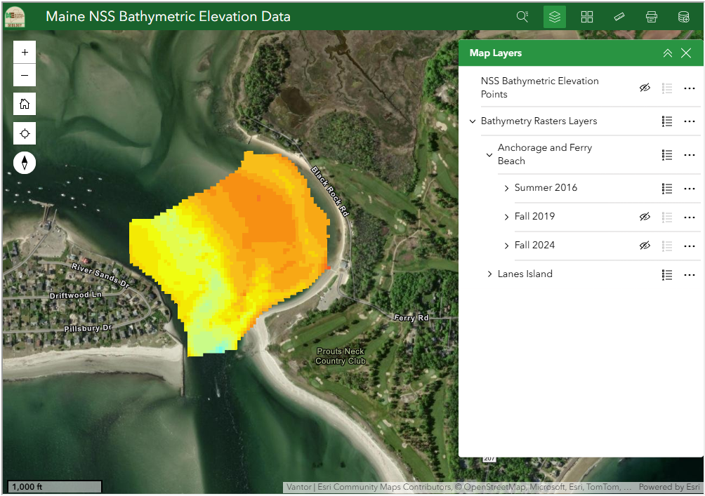 Screenshot of the new NSS web map viewer available on the MGS website showing water depths using a color coded raster.
|


