Regional Bedrock Map of the Lincoln 1:100,000 Quadrangle Released
The Maine Geological Survey (MGS) is pleased to announce the release of a regional bedrock geologic map in the east-central Maine area, Bedrock Geology of the Lincoln 1:100,000 quadrangle, Maine. Geographically, it covers the Penobscot River/I-95 corridor north of Old Town and south of Millinocket, including the Lincoln-Howland region, extending northwestward to Seboeis Lake and southeastward to Nicatous Lake, an area of 1600 square miles. Geologically, this region is where several major groups of Silurian slate and sandstone formations come together, defined previously in neighboring areas of Maine to the north, southwest, and south. This map represents a significant advance in understanding the geologic relationships among these various rock units. The map is authored by Allan Ludman, professor emeritus of Queens College of the City University of New York, who has spent over 50 summers mapping in Maine. He is the authority on the bedrock geology of this region.
Among the recent advances displayed on the map are a geochronology table (ages of rock units) for Ordovician volcanic activity in the Miramichi terrane, a correlation table of stratigraphic units, and regional distribution of fault systems of Paleozoic age. The map sheet includes explanations of all the intrusive igneous rock units as well as stratified rock units, representative field photographs, and references to relevant literature.
This map is part of the ongoing mapping program of the MGS, supported in part by cooperative grants from the National Geologic Mapping Program of the U.S. Geological Survey.
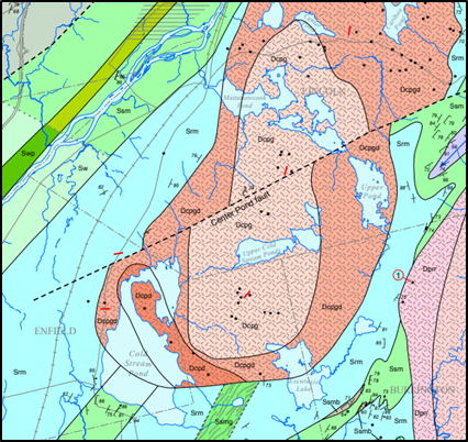
An example of the level of detail from the central part of the new map, Bedrock Geology of the Lincoln 1:100,000 Quadrangle, Maine.
|