New Bedrock Geologic Map Released
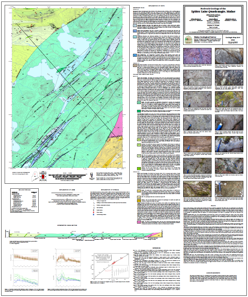
The Maine Geological Survey is pleased to announce the publication of a new bedrock geologic map of the Spider Lake quadrangle, by Dr. Chunzeng Wang, professor at the University of Maine at Presque Isle. It is the latest map to be published in a multi-year effort to map the Munsungun–Winterville belt, one of the geologically and economically important lithotectonic belts in Maine. The belt consists of Ordovician-Silurian volcanic and sedimentary rocks surrounded by younger Devonian sedimentary cover rocks.
Click map to view full size image
The Spider Lake quadrangle is located in the North Maine Woods, in the area east of Churchill Lake and around Spider Lake, Pleasant Lake, and Cliff Lake. Geologically it is part of the Munsungun inlier of the Munsungun-Winterville belt. Bedrock in the quadrangle is dominated mainly by basalt lava flows and other submarine volcanic rocks. In addition to the long-known Spider Lake Formation of predominantly basalt, the map shows two new volcanic formations identified recently, the Ordovician Ragged Mountain Formation (457 million years old) and the Silurian Churchill Ridge Formation (425 million years old). Their ages are determined by using zircon U-Pb radiometric dating technology. The Spider Lake Formation is confirmed to be Silurian in age (424 million years old) by using the same method as well as fossil identification. Another unique volcanic formation in the area is the Bluffer Pond Formation; it is composed entirely of beautiful basalt pillows. The most remarkable geological feature in the area, however, is the imbricated fault system made of numerous southwest-striking reverse-thrust faults and fault blocks/slivers that can stretch miles or even tens of miles. The sandstone, slate, and fossiliferous limestone of the Early Devonian Seboomook Group were entrained in the faults and became long and narrow fault slivers sandwiched between the older volcanic rocks in the Munsungun inlier.
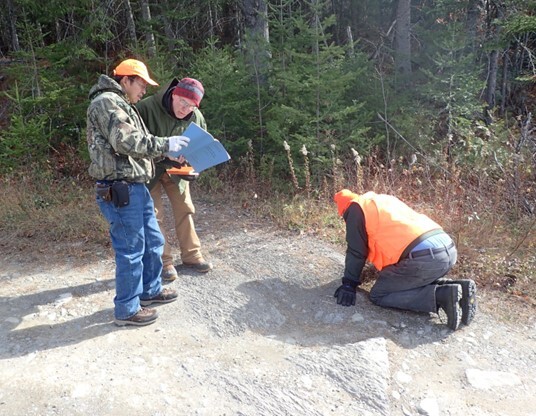 |
Chunzeng Wang (left) discussing mapping of Seboomook Group fault slivers in the Spider Lake quadrangle with former State Geologist Robert Marvinney (center) and geologist Steve Pollock (right) in 2018. Photo by David Putnam.
Bedrock maps provide a basic information source that can contribute to understanding groundwater quality, groundwater flow and contaminant transport, soil chemistry, distribution of mineral resources, engineering properties relevant to construction projects, and the geological history of Maine.
|