Digital Historical Maine Aerial Photographs Released
The Maine Geological Survey (MGS) is pleased to announce the formal, digital release of the MGS Historical Aerial Photograph Collection. For decades MGS has been a repository for air photo collections donated by businesses and other organizations. These photos were collected between 1930 and 2009 covering all parts of Maine. The collection almost doubled in size to 76,000 photos when the Maine Department of Transportation transferred their collection in 2022. To make this important resource more widely available, MGS embarked on an 18-month project to inventory, catalog, and scan all the photos. Now, the photos are available for download free of charge from the Digital Maine Repository. There is an interactive web map available to make finding photos by geographic location quick and easy. A video tutorial for efficiently using the map is also available.
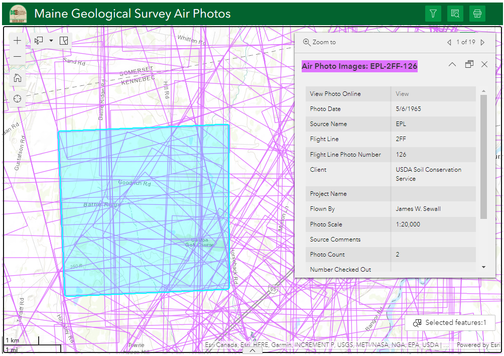 Screenshot of MGS Air Photo interactive web map showing a selected photo footprint.
These historical air photos are incredibly useful to landowners, government regulators, lawyers, engineers, planners, surveyors, and realtors. Basically, anyone who needs to understand past land uses or research evidence of former infrastructure will find this collection helpful. Additionally, it is just fun to see what your neighborhood looked like in the 1950's, for instance. As you explore this collection, you'll also find some unique (odd?) images and some beautiful, almost artistic, images.
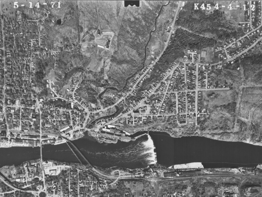 A portion of a 1971 air photo of Augusta showing the now removed Edwards Dam and Edwards Manufacturing buildings on the west (upper, in this photo) side of the river. The former, now removed, Statler Tissue Paper mill can be seen on the east (lower, in this photo) side of the river. Notice the boom of pulpwood floating in the river next to the mill waiting to be processed. This is something that won't be seen again in Maine rivers.
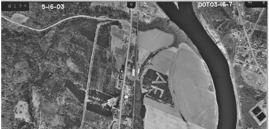 A portion of an air photo from 2003 showing a tree farm that was planted to reveal the letters 'AF'. Possibly the landowner's initials??
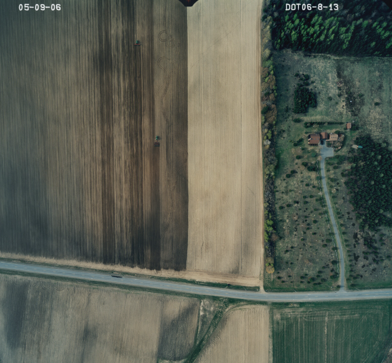 A beautiful air photo from 2006 showing the incredible detail and contrast in color and land use between agriculture, forestry, and residential. The tractor tiling the field is even visible.
|


