New Bedrock Geologic Map Released
The Maine Geological Survey is pleased to announce the publication of a new bedrock geologic map, Bedrock geology of the Lewiston quadrangle, Maine, by Amber Whittaker, Senior Geologist at the Maine Geological Survey, and the late Professor Arthur Hussey (Bowdoin College, emeritus). This is the latest map to be published in association with a multi-year effort to map the bedrock geology in the Lewiston area of south-central Maine.
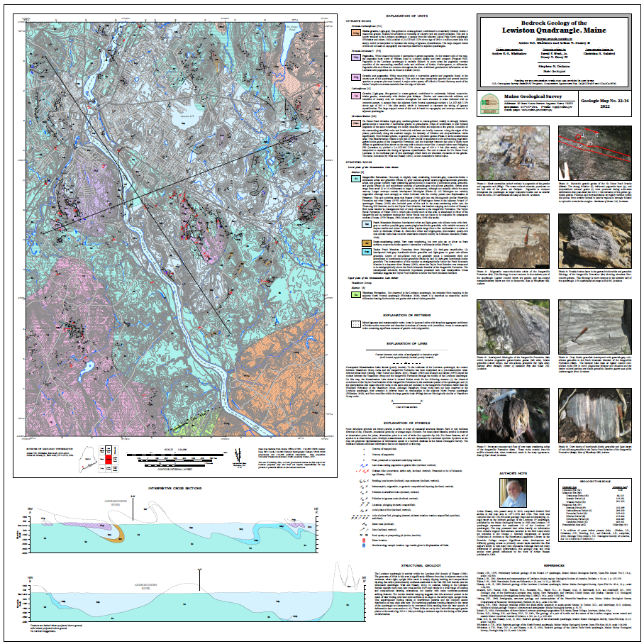 |
The Lewiston quadrangle, adjacent to the recently published Monmouth and Lisbon Falls North bedrock maps to the northeast and east, is underlain by the Sangerville Formation sedimentary rock sequences that were deposited in an ancient ocean basin, the Central Maine Basin, in Silurian time (approximately 420 to 430 million years ago). The northeastern part of the quadrangle hosts a variably deformed Late Silurian-Early Devonian (420 ± 3 Ma) granitic intrusion in Sangerville Formation rocks. Multiple generations of folding have combined to produce the complex distribution of rock types on this map, in contrast to the fairly linear northeast-southwest pattern commonly observed to the east of this area. Two Late Carboniferous-Early Permian (298 ± 2 Ma and 303 ± 1 Ma) granitic intrusions cut the conceptual Messalonskee Lake thrust in the southern part of the quadrangle. Additionally, many granitic pegmatite intrusions, as yet undated, can be found throughout the quadrangle. The map contains unit descriptions, photos of the different rock types, two interpretive cross sections, and a summary of the complex structural pattern found in the area.
Bedrock maps provide a basic information source that can contribute to understanding groundwater quality, groundwater flow and contaminant transport, soil chemistry, distribution of mineral resources, engineering properties relevant to construction projects, and the history of the earth.
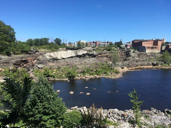 Great Falls on the Androscoggin River, viewed from the Auburn side, showing Sangerville Formation rocks (brownish gray) and a pegmatite sill (light colored).
|


