New Bedrock Geologic Maps Released
The Maine Geological Survey is pleased to announce the publication of three new bedrock geologic maps of the Boothbay Harbor, Bristol, and Pemaquid Point quadrangles. All three maps are co-authored by Professor David West of Middlebury College in Vermont, and Emeritus Professor Arthur Hussey (deceased) of Bowdoin College and represent on-going efforts to provide detailed bedrock geologic maps of the mid-coast region. Each of the published maps reflect an integration of new field work by Professor West and the compilation of information gleaned from thousands of field station entries recorded by Professor Hussey during his decades of work in the area.
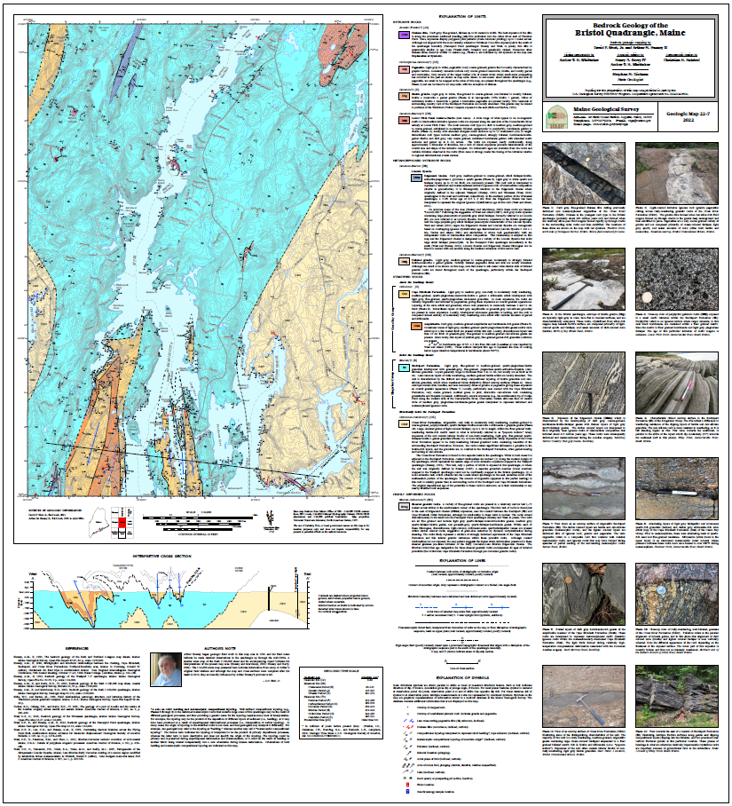 |
The three adjoining quadrangles are centered on the scenic north-south trending peninsulas and adjacent islands that comprise the lower Sheepscot and Damariscotta River estuaries. The bedrock geology is dominated by three sequences of polydeformed amphibolite facies metamorphic rocks: (1) Ordovician arc-related rocks of the Cape Elizabeth Formation (Casco Bay Group), and several other thin units that may correlate with other formations in the Casco Bay Group; (2) Silurian calcareous flysch of the Bucksport Formation of the Kingsclear Group (Fredericton trough); and (3) the Cross River Formation, a sequence of poorly understood, migmatitic, rusty-weathering pelitic gneisses of probable Cambrian-Ordovician age. Rocks of the Casco Bay Group and the Bucksport Formation are juxtaposed along the complexly folded Boothbay thrust. The Cross River Formation and adjacent rocks of the Bucksport Formation are also presumed to be in fault contact, although details are lacking. The structural geology is dominated by Acadian-aged, tight, north-northeast trending, shallow plunging folds and associated steeply dipping foliation that is superimposed on the Boothbay thrust and earlier recumbent folds.
The stratified rocks are intruded by a wide variety of pre-, syn-, and post-tectonic igneous rocks that range in age from Late Silurian to Early Jurassic. These include deformed and metamorphosed alkalic rocks of the Lincoln Syenite, several small composite mafic plutons of uncertain age, numerous granitic plutons of presumed Devonian age, and numerous diabase dikes of Late Triassic-Early Jurassic age, including the Christmas Cove Dike.
The publication of these maps represents an on-going tribute to Professor Arthur Hussey’s 60 years of geologic study along the Maine coast. It is hoped these maps, in an area that includes high levels of visitation and outdoor recreation, and numerous land trusts, will add to Professor Hussey’s legacy of outreach to geologists and non-geologists alike.
Bedrock maps provide a basic information source that can contribute to understanding groundwater quality, groundwater flow and contaminant transport, soil chemistry, distribution of mineral resources, and engineering properties relevant to construction projects. Additionally, in that these maps provide information on the history of the earth, they are important educational tools for both geologists and non-geologists.
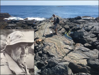
David West examining deformed metamorphosed Ordovician volcanic rocks on Outer Heron Island in the Pemaquid Point quadrangle (photo taken by Amber Whittaker). Inset photo of Professor Arthur Hussey.
|