New Surficial Geologic Maps Released
The Maine Geological Survey (MGS) is pleased to announce the publication of four new surficial geologic maps by Lindsay Spigel, MGS surficial geologist.
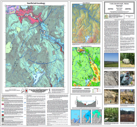 |
The Unity and Unity Pond quadrangles in central Maine have a wide range of interesting surficial geology deposits and landforms. Glacially-sculpted and till-coated uplands have made excellent farmland and can now be traversed on the Hills To Sea Trail network. Major eskers such as the Kanokolus and Halfmoon systems show former glacial meltwater networks and are significant local aggregate resources. Temporary proglacial lakes likely existed in the Unity quadrangle as drainage from the modern Sandy and Halfmoon Stream valleys was blocked by the retreating ice sheet. Lowlands, especially in the Unity Pond quadrangle, were once at the bottom of a late-glacial sea that covered much of the area, resulting in glaciomarine mud and sand deposits (some with fossil shells) and remnant shorelines that are now hundreds of feet above modern sea level.
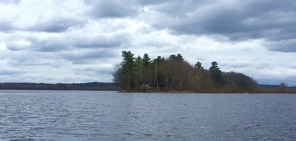 View of the Kanokolus Esker ridge from Unity Pond.
|


