|
Having trouble viewing this email? View it as a Web page. 
|
|
News and Information
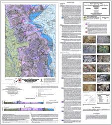
The Maine Geological Survey is pleased to announce the publication of a new bedrock map, Bedrock geology of the Greenlaw Pond quadrangle, Maine, by Chunzeng Wang, a professor at the University of Maine at Presque Isle. Mapping in this quadrangle in 2019 was part of a multi-year effort to map the region, known as the Munsungun Anticlinorium, in detail, replacing old reconnaissance mapping. The quadrangle hosts the largest volcanogenic massive sulfide deposit in the eastern U.S at Bald Mountain, which is yet unmined, and the region has the potential for further undiscovered resources.
The Greenlaw Pond quadrangle comprises a suite of Ordovician volcanic rocks and related sedimentary rocks that are unconformably overlain by Devonian sedimentary rocks. Of note, mapping in the region has demonstrated that the Bald Mountain deposit is hosted by the Munsungun Lake Formation, not the Winterville Formation as previously mapped. All units are cut by numerous late faults. Dr. Wang has continued mapping in 2020 in the adjacent Big Machias Lake quadrangle.
|
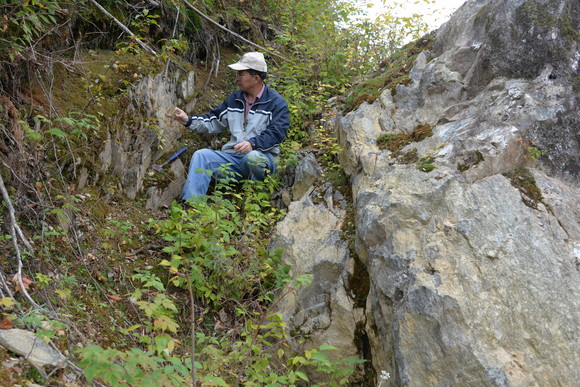 Dr. Wang examining volcanic rocks of the Munsungun Lake Formation in northern Maine.
|
|