News and Information
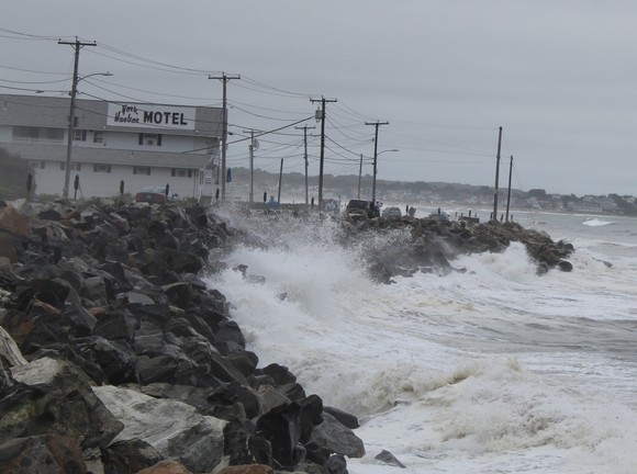
The Maine Geological Survey (MGS) is pleased to announce the release of a new web map viewer titled Coastal Structure and Dune Crest Inventory and Overtopping Potential. This viewer maps the extent of coastal engineering structures (e.g., seawalls, bulkheads, jetties, etc.) and coastal sand dune crests along the coastlines of communities in Cumberland and York Counties, from South Portland through Kittery.
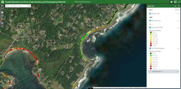 The viewer also provides an analysis of the vulnerability of coastal engineering structures and coastal sand dunes to overtopping by potential storm events by displaying the relationship between the elevations of existing coastal engineering structures and protective sand dunes in reference to the 100-year (1% water level) base flood elevations (BFEs) from preliminary FEMA Flood Insurance Rate Maps. Understanding this relationship may help guide adaptive management of coastal infrastructure and the pursuit of green infrastructure approaches, such as dune restoration, in response to storms and sea level rise.
|